


From the email of a correspondent this morning. The quote is from a speech made by Teddy Roosevelt. The remainder, my correspondent’s response to it.
**********
“In the first place, we should insist that if the immigrant who comes here in good faith becomes an American and assimilates himself to us, he shall be treated on an exact equality with everyone else, for it is an outrage to discriminate against any such man because of creed, or birthplace, or origin. But this is predicated upon the person's becoming in every facet an American, and nothing but an American...There can be no divided allegiance here. Any man who says he is an American, but something else also, isn't an American at all. We have room for but one flag, the American flag... We have room for but one language here, and that is the English language... and we have room for but one sole loyalty and that is a loyalty to the American people.”
I dunno...
Roosevelt sounded good up until the linguistic chauvinism and issues of loyalty.
But then I come from a country with two official languages. It is possible to be a good Canadian without knowing one or the other of them, not a word. For that matter, I don't think anyone takes issue with your bone fides if you speak neither of them. You could be an Inuit for instance. A lot of older people who immigrated to Canada from Italy or elsewhere have never managed to master English. Conceivably a younger person from abroad might never be comfortable outside of Cantonese or Portuguese, though he would clearly be at a disadvantage outside his neighborhood. I think in our country we make few demands on you until the second generation -- your children should certainly fit in.
Loyalty. What is loyalty anyway? If I moved to the U.S. would I have to pretend to dispise hockey and love basketball? (Even if the later sport was invented by a Canadian?) Where do you go to have an uncritical love of the Stars and Stripes pharmaceutically installed if you weren't born with the instinct. To me, the Canadian flag is a piece of cloth I have no especial love for. The values it is supposed to stand for are my values, but I have those values to love and don't need the cloth. How could an American flag mean any more to me if I stepped over a dotted line on a map and began hanging up my hat there? Loyalty to freedom, democracy, equalitarian principles? Unquestionably... whether I find them in America, Canada, France, India, or South Korea. Loyalty to a man in a public office? That's monarchy. Loyalty to a crown or a flag? Fetishism.
Loyalty to a "way of life", that is the minutae and detail of our day to day life? I certainly have a fondness the particular theme music of our news stations, that Fox or CNN doesn't evoke. I like streets of the city I live in, the brands of candy bars in our 7-11's, the observance of "Victoria Day", the tragedy of Dieppe and victory at Vimy Ridge, the Canadian National Exhibition every fall, the huge Caribbean festival in the summer, pictures of the old British lady on our pennies instead of the guant bearded man, etc, etc, etc. These are not momentous things, just the tiny details of my life that I am more fond of than the strange manners and customs of a place I never lived. Had I lived some of my life in Turkey or the United States, I would have a place in my heart for them, because they would be a part of me. In fact, I have spent enough time in the U.S. to be fond of it in my way.
I suppose, though, what Teddy Roosevelt meant was to put your way of life, your institutions, your nation ahead of all others. You cannot be a good German or Mexican and be a good American at the same time. Your country may need you to go and kick German ass someday, and won't tolerate your ambivalence. You are with us or against us. A very American attitude. Here in Canada, we prefer not to think about it... Maybe we won't need you to kick anybody's ass, or at least not the ass of your folks back in the old country. When push came to shove, as it has on ocassion, Canadians have not generally held back. They went to Germany and kicked ass. And French Canadians, who you might expect to suffer from split loyalties, were in fact reluctant to rush off to Europe to save France. When the chips were down, it seemed Canadians did put Canada first in important matters. So we let them celebrate their Hindu holidays and wear their turbans and speak Somali at home and don't question their loyalties. Better we should not try to tear people's hearts in two.
But I suppose Teddy Roosevelt was from another time and another place. If some of his words smack to me of simple Jingoism, its because I prefer not to think in blacks and whites, and recognize we live in a more flawed world, with difficult issues and complicated cases, than the one priveleged men in the late 19th. century believed they inhabited.
Friday, September 29, 2006
Jaw-dropping chutzpah
From The Globe and Mail this morning:
Dearth of doctors threatens to close emergency rooms
At least 21 hospitals in Ontario are struggling with a severe shortage of doctors, leaving many of them bracing for a temporary shutdown of their emergency departments…
…Elizabeth Witmer, a Progressive Conservative MPP for Kitchener-Waterloo who served as health minister under the previous Tory government, accused the Liberals of mismanaging the health-care system. "There is a crisis situation," she said during Question Period yesterday.
For Elizabeth Witmer, of all people, to stand up barefaced in front of this province and lecture anyone about the state of its health care system is stunning effrontery. Something must be done, she tells us. Well, yeah, Liz, we agree; that’s why we dumped your government in 2003, after all. Maybe you’ll recall it was your own Tory administration that fired all those nurses and closed all those hospitals and got rid of all those beds in the name of the “Common Sense Revolution”, so-called?
This is like being told by the cop who batons your tail light “you really ought to fix that”.
Wednesday, September 27, 2006
What's that smell?
You mean it isn't familiar yet?
There's a new spin in town south of the border, and its name is bullshit. Check it out.
Seems that in 1998, when Clinton bombed Osama's camps, the Republicans charged that he was doing it to distract Americans from the Monica Lewinsky scandal.
Now, in 2006, when real questions are being raised about how 9/11 happened and with Americans getting more and more tired of Afghanistan and Iraq, these same Republicans are — get this, this is really, really good — telling us that Clinton used the Monica Lewinsky scandal to distract the American people from the issue of Osama (remember, he was by then wanted for the attack on the USS Cole).
Isn't that incredible? Bill Clinton got an intern to blow him, made sure the prudes in the Republican Party got wind of it and then saw to it they began years of pointless, expensive, idiotic impeachment proceedings, all so that the country wouldn't notice he hadn't caught a terrorist (does it bear mentioning here that George Bush hasn't caught him either, after five years of trying?).
What a fucking genius Bill Clinton must be! I stand in awe of a man who can deftly orchestrate what the Republican are suggesting here! Dance, puppets, dance! What fools Americans are for not recognizing this and appointing President-for-Life this man who apparently can think into the fourth dimension, whose planning and perception are evidently on the next order of magnitude relative to the rest of us. Because clearly, anyone that stratospherically intelligent would never have waved off a report about how this same Osama was planning to attack and instead pissed the day away hunting armadillos on his ranch with Barney.
The word for the day, folks, is hogwash.
Monday, September 25, 2006
All the King's horses and all the King's men
I've always had an ear she could bend. That above all else.
This evening was a different kind of evening in my experience. A friend of mine — a very long-term friend; we've known one another since high school — is going through a very rough spot in her marriage. The reasons are myriad, complex, and delicate; there's nothing TV-cliche or simple about what's going on. They are on the verge of separating, and what's astonishing is that the ball is essentially in her husband's court as to what will happen. As she chillingly outlined the realitives of the situation, I was struck by how much it was like a moment in a game of chess when you know you've made a mistake that will end the game, unless your opponent chooses — knowingly chooses — a move that prolongs things. There is nothing my friend can do but wait and see what the move will be.
She asked me out to dinner this evening, I think because our history has always featured me as someone she can talk to. We had a brief, inexpensive meal, and then sat in the car in a parking lot across from her home in the pouring rain. Her composure was admirable; the sky did her crying for her. There are hopeful signs, and there are discouraging signs. It's impossible to guess what will happen. The next weeks will be long, tense ones for her.
Even though I'm only on the sidelines, I found that song took on new meaning for me. Stepping into the men's room at the restaurant, I heard the speakers playing If You Leave Me Now by Peter Cetera. When I was a teenager, the song was pretty-sounding mush. This evening it really gelled. The lyrics came into sharp focus, and every one of them suddenly made sense. I was hoping she wasn't listening in the women's room. Luckily she'd made her way to the front door by then.
On my way home, the Depeche Mode song Personal Jesus. I first heard the song driving to another friend's house in summer 2000. I always liked it because it sounded cool and powerful. But this evening, again, suddenly the lyrics just dropped on me and made sudden, personal sense. Coming back from such an evening, I finally got what the song's about in a way I never really did.
I don't know how things will work out for them. I only know she's scared, feeling powerless, but hopeful. She wants things to work out. I think she's tried hard, and I hope she gets her wish.
Wednesday, September 20, 2006
London's brain is falling down, falling down, falling down...
Primate New Service
LONDON — In chorus with the State of Michigan, the City of London, Ontario, announced today that it doesn't want Toronto to put its garbage in a big hole in the ground near London.
"Who the hell is Toronto to use my hole in the ground?" whined London. "It's not my fault 2.5 million people make garbage and have 'no place to put it'. Why don't they store it in the garage, or in the back yard? Frankly, I wish Toronto would just go away someplace. Disappear. It's nothing but a big pushy nuisance, and everyone would be better off without it if it just vanished off the face of the Earth."
Even as London warmed to the idea of the elimination of Toronto, it suggested Toronto should "keep sending the money, though."
Wednesday, September 13, 2006
SPACE: 2006
Incidentally, today marks the 7th anniversary of the moon being blasted out of orbit, in keeping with the now-alternate "history" of the 1970s TV series SPACE: 1999. Just thought you'd like to know that. :)
Evil deeds and good intentions
I had the following exchange with an email correspondent. I sent out some results I saw from The Globe and Mail that surprised me, got the response below in blue, and then replied to this morning. I post it here because it's the clearest I've ever stated my impressions on the matter.
------------------------
------------------------
While of course these results aren't scientific, given that they're indicative of the views of readers of The Globe and Mail — what I'd consider to be a moderately conservative bunch — I have to say they're not what I expected to see when I clicked on the results link...
Monday, Stephen Harper stressed the link between Canada's military presence in Afghanistan and the 9/11 attacks. Do you think those events five years ago continue to justify the NATO mission in the war-torn country?
No: (71%) 11618 votes
Yes: (29%) 4833 votes
Total votes: 16451
------------------------
The question is too limiting. If the question asked whether there is still value to the mission, I'm sure the answer would be different. There IS still value in freeing people from the oppression of the Taliban. School teachers able to teach (willing) young female students for the first time in decades. There is some real value to THAT.
To balk as the going is a bit tough now is ever so Liberal/NDP, isn't it?
------------------------
Well, if the question's limiting, it's also honest. Our troops didn't invade Afghanistan to overthrow its government. The reason, in October of 2001, was to capture Osama bin Laden and those responsible for the 9/11 attacks, without the burden of presenting the extradition evidence demanded by both the Afghan government and international law. We also didn't believe them when they said they didn't know where Osama was... I guess after five years of not being able to find the guy ourselves, that might sound a little more plausible to Western ears. Too bad it's taken the deaths of hundreds of soldiers and thousands of civilians to get right back where we started. To play the shell-game with the question of our intentions now is ever so neo-con; a fine new tradition here and elsewhere.
As to balking, it's certainly not a characteristic of the Grits. One prime minister sent in the troops; another kept them there. As for the NDP, I don't recall myself what position they took in 2001, in the immediate aftermath of 9/11 when emotions were running high and the US had a million people in the streets in Tehran demonstrating in support of them. Speaking only for myself, it's not balking if you never agreed with the idea in the first place.
As a Westerner, I naturally laud the idea of equality, political liberty, education... all the things we value in our own society. But it's wrong to imagine they can imposed from without. Wherever they've been successful, they've had to grow from native soil. They had to be what the people wanted. Where they didn't exist, it was because the urgency to acquire them didn't exist either. It was no easy road here... the American Revolution, the French Revolution, the British voting riots, the Revolutions of 1848 in Europe, the Rebellions of 1837... These are all examples of moments when various peoples rose up and instituted the new values that really, finally reflected where those societies were at. The point is, they were never imposed from without; they blossomed from within. The moment had come; the people wanted it. It seems manifestly obvious to me that Afghanistan is not yet such a nation. Perhaps it never will be. It's not required to be, either.
We do ourselves and our values no favour in associating them, in the minds of Afghanis, with invasion, destruction, incivility, and foreign occupation. Like planting a palm tree in Timmins, the transplant will endure only so long as it's artificially tended. The moment the troops leave, Afghanistan will, naturally, revert to whatever its societal norms designate it to be. If the people want to be rid of the Taliban — and to be honest with you, I don't see much evidence of that — then they'll be rid of them, sooner or later, just as we were with the Family Compact and the French were with the Bourbon monarchy. But we can't do it for them. We can't change minds with guns, only by setting examples. If the change doesn't come from within their own society, it will never stick. The lives of our soldiers are being lost to apply band-aids to afflictions that are psychological, not physical. And worse, we're eroding our reputation as peace-keepers — neutrals who insinuate themselves between two warring factions who want an excuse to step back and work something out — for a reputation as neo-imperialists, riders on American coat-tails, as we once were of British ones. Wading ashore with guns a-blazin' shouting "we'll teach these wogs to live like white people — or else!" is not where we ought to be at this point in history. Wrongs, particularly ones committed to make one's own life easier, are never excused by the defence of "good intentions": getting your grandma to the hospital is a laudable goal — but it you wipe out a family of six people (a.k.a., "collateral damages") running a red to do it, you're still going to jail.
I think it's time we learned to use persuasion instead of force, and what's more, to finally accept that we can't have everything we want, the world isn't obliged to always be just what we want it to be, there are times people are going to say "no" to us (as it their right), and there are some times we just aren't going to win. Ignoring all that just makes everyone else madder and madder at us.
------------------------
------------------------
While of course these results aren't scientific, given that they're indicative of the views of readers of The Globe and Mail — what I'd consider to be a moderately conservative bunch — I have to say they're not what I expected to see when I clicked on the results link...
Monday, Stephen Harper stressed the link between Canada's military presence in Afghanistan and the 9/11 attacks. Do you think those events five years ago continue to justify the NATO mission in the war-torn country?
No: (71%) 11618 votes
Yes: (29%) 4833 votes
Total votes: 16451
------------------------
The question is too limiting. If the question asked whether there is still value to the mission, I'm sure the answer would be different. There IS still value in freeing people from the oppression of the Taliban. School teachers able to teach (willing) young female students for the first time in decades. There is some real value to THAT.
To balk as the going is a bit tough now is ever so Liberal/NDP, isn't it?
------------------------
Well, if the question's limiting, it's also honest. Our troops didn't invade Afghanistan to overthrow its government. The reason, in October of 2001, was to capture Osama bin Laden and those responsible for the 9/11 attacks, without the burden of presenting the extradition evidence demanded by both the Afghan government and international law. We also didn't believe them when they said they didn't know where Osama was... I guess after five years of not being able to find the guy ourselves, that might sound a little more plausible to Western ears. Too bad it's taken the deaths of hundreds of soldiers and thousands of civilians to get right back where we started. To play the shell-game with the question of our intentions now is ever so neo-con; a fine new tradition here and elsewhere.
As to balking, it's certainly not a characteristic of the Grits. One prime minister sent in the troops; another kept them there. As for the NDP, I don't recall myself what position they took in 2001, in the immediate aftermath of 9/11 when emotions were running high and the US had a million people in the streets in Tehran demonstrating in support of them. Speaking only for myself, it's not balking if you never agreed with the idea in the first place.
As a Westerner, I naturally laud the idea of equality, political liberty, education... all the things we value in our own society. But it's wrong to imagine they can imposed from without. Wherever they've been successful, they've had to grow from native soil. They had to be what the people wanted. Where they didn't exist, it was because the urgency to acquire them didn't exist either. It was no easy road here... the American Revolution, the French Revolution, the British voting riots, the Revolutions of 1848 in Europe, the Rebellions of 1837... These are all examples of moments when various peoples rose up and instituted the new values that really, finally reflected where those societies were at. The point is, they were never imposed from without; they blossomed from within. The moment had come; the people wanted it. It seems manifestly obvious to me that Afghanistan is not yet such a nation. Perhaps it never will be. It's not required to be, either.
We do ourselves and our values no favour in associating them, in the minds of Afghanis, with invasion, destruction, incivility, and foreign occupation. Like planting a palm tree in Timmins, the transplant will endure only so long as it's artificially tended. The moment the troops leave, Afghanistan will, naturally, revert to whatever its societal norms designate it to be. If the people want to be rid of the Taliban — and to be honest with you, I don't see much evidence of that — then they'll be rid of them, sooner or later, just as we were with the Family Compact and the French were with the Bourbon monarchy. But we can't do it for them. We can't change minds with guns, only by setting examples. If the change doesn't come from within their own society, it will never stick. The lives of our soldiers are being lost to apply band-aids to afflictions that are psychological, not physical. And worse, we're eroding our reputation as peace-keepers — neutrals who insinuate themselves between two warring factions who want an excuse to step back and work something out — for a reputation as neo-imperialists, riders on American coat-tails, as we once were of British ones. Wading ashore with guns a-blazin' shouting "we'll teach these wogs to live like white people — or else!" is not where we ought to be at this point in history. Wrongs, particularly ones committed to make one's own life easier, are never excused by the defence of "good intentions": getting your grandma to the hospital is a laudable goal — but it you wipe out a family of six people (a.k.a., "collateral damages") running a red to do it, you're still going to jail.
I think it's time we learned to use persuasion instead of force, and what's more, to finally accept that we can't have everything we want, the world isn't obliged to always be just what we want it to be, there are times people are going to say "no" to us (as it their right), and there are some times we just aren't going to win. Ignoring all that just makes everyone else madder and madder at us.
Saturday, September 09, 2006
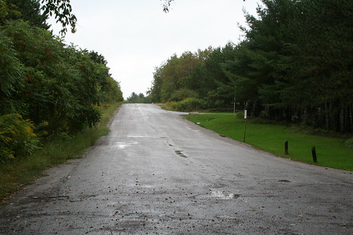
A rainy day on a forgotten road
Bassmentbeats (once again) offered a mission: a closed road with a bridge over the Humber River in northwest York Region. This time I flew solo...
At the "end" of Kirby Road, facing east, originally uploaded by Lone Primate.
At the "end" of Kirby Road, facing east, originally uploaded by Lone Primate.
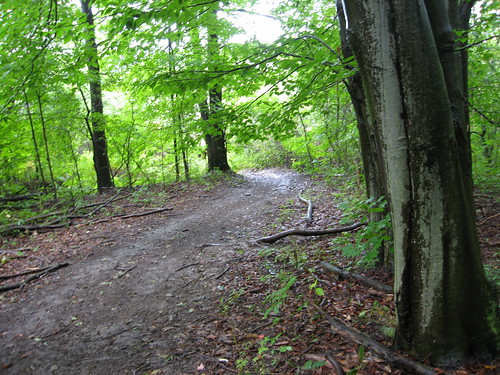
I arrived at the blocked end of Kirby Road at almost ten on the dot, and parked right at the end. This view looks back in the direction from which I'd come, eastward towards Hwy 27. The road ends at a residential driveway just off to the right, but is, coincidentally, almost exactly half way between Hwy 27 at Huntington Road, where the other blocked end is to be found, and which was my destination.

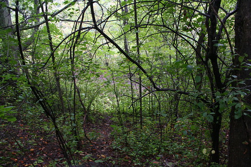
This is the westward view from about the same spot. The berm of earth closes the road. The sign has a lot of municipal warnings about dumping, but nothing of interest about when or why the road was closed. Beyond the sign, the land is Toronto Conservation Authority land. To enter it, I took the little path there at centre-left, which scoots around the berm and takes you to the old road course.
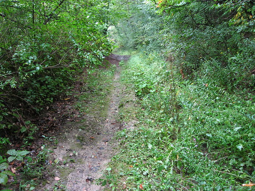
I don't know when they closed this stretch of the road, but judging from the overgrowth, it must have been at least a decade ago. I have a map from 1990 that suggests it was still open all the way to Huntington Road at that time (but who knows?).
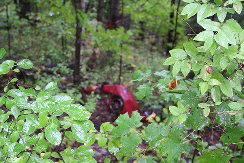
Not too far in, off the left (south) side of the road course, I happened to notice what looked like sports car parts strewn down the hillside. I can't help wondering if someone just dumped them here, or if someone had a serious crack-up here in the past and no one bothered to haul the wreck away.
Camera focused on the leaves in the foreground. I didn't notice till I got home. I was kind of pissed off when I saw that, but the more time goes by, the more I like it. Seems a little more poignant and understated this way.
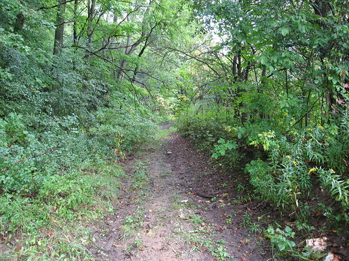
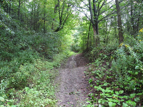
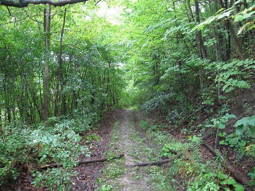
I suspect this was paved once, and deliberately desurfaced to allow nature to reclaim it. I can't really prove it and wouldn't swear to it, but that's my suspicion. You can see that some kind of vehicle still makes use of the clearance, but it's already been largely eaten up by foliage. This was a two-lane road when it was a going concern.
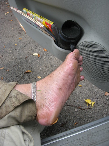
It was drizzling that morning; it didn't stop till about the point where I got to the bottom of the valley and the forest opened up into the flood plain. So, for a variety of reasons — my sandals were wet, they were slippery, and just because I like to — I took off my sandals more or less at this point and hiked the rest of the way down and back barefoot. Hey, it's September... how many more chances will I get this year? :)
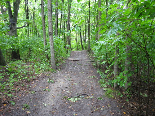
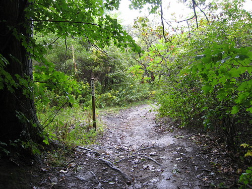
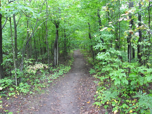
After about ten minutes I came to what looked like a fork in the road. But the way was so much clearer on the right that I decided it must have been the road course (turns out I was wrong; it's the clearing on the left). I was puzzled by the fact that it seemed to cross an old fence line, but as I say, the track was so clear it just seemed obvious to me it was the road course. In fact, it's the new trail blazed by the Humber Valley Heritage Trail folks, I think. On my way back, I followed the old road course along the left through the brush and back to this spot.
This would make a great slide in some water park. It's hard to tell from a two-dimensional view, I know, but this road slopes down somewhere between 30 and 40 degrees. On top of that, in the rain, the clay of the road was soaking and was like walking on butter. I nearly talked myself out of continuing down at about this point, but then I decided, hell, I drove an hour to get here, and for what? To walk fifteen minutes into the woods and turn back at the first sign of a hill? Okay, so I might fall in the mud. So my pants might get dirty. So I might have to put the blanket in the trunk on the driver's seat on the way home. Big deal. I wanted to see the rest. So I kept going.
This is a look back up to the turn at the top of the valley.
There was this really tortuous curve in the route on the way down that promised a twenty-yard skid down on my ass, so I abandoned the road and cut through the woods to the other side of the curve. Much safer. It was around this point that I started wondering if I'd actually lost the road altogether. The route seemed needlessly twisty for getting up and down a fairly straightforward and uncomplicated hillside, and the trees that hugged it on either side were mature enough that they couldn't have hugged any two-lane road still open to traffic within the past generation or more. But... it was a path; it had to lead somewhere, so I kept on. At this point, I could see light off to the right behind the white tree that suggested I was coming to open ground.
That's the curve I didn't risk following; you can see it glistening with slickness. Off to the left is the shortcut I made.
Here's the bottom of the trail. In the distance you can see the open ground beyond the last of the trees. Incidentally, what looks like t-junction in the middle of the picture is just that. I didn't realize it till later, but that's where the new path I followed down meets up again with the actual course of Kirby Road.
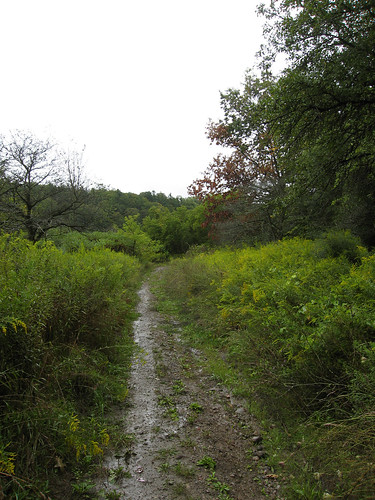
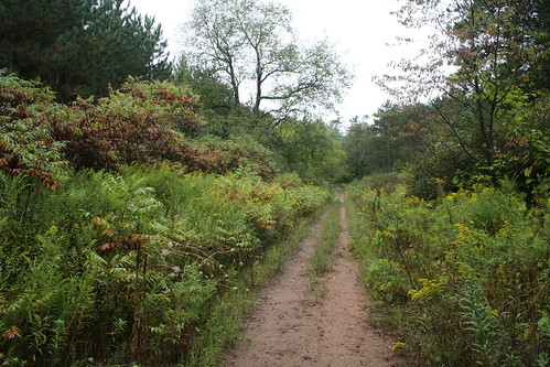
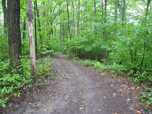
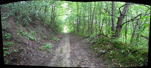
This is the course of Kirby Road again, heading westward across the flood plain. The river at this point is a few dozen yards off to the right, through the trees. On the left is a very broad, fairly deep clearance that may once have been someone's farm or at least a homestead of some kind. That's a guess, of course; but somebody cleared it for something. This shot was taken just after emerging from the forest.
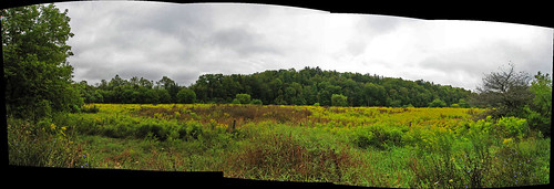
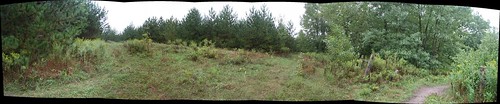
A panoramic look at the open field on the south side of Kirby Road. On the left are the trees I've just emerged from. On the right, the as-yet-unknown...
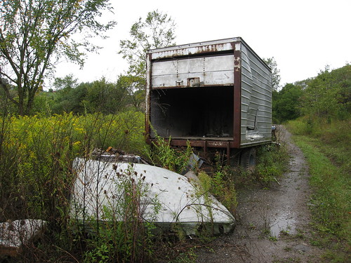
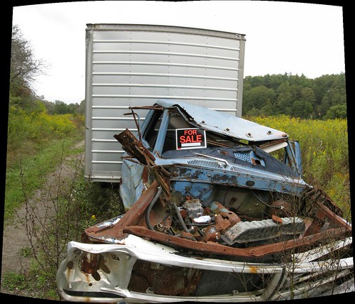
The road parallels the field for about 300 yards, and then begins to pull away to cross the river at a perpendicular angle. As I came around the gentle curve, I could spot something coming out from behind the trees. I thought, what the hell is that? My first inclination was this sinking feeling that someone was down in the valley doing some kind of work. Well... yeah. A couple of decades ago. This truck's been here for a while...
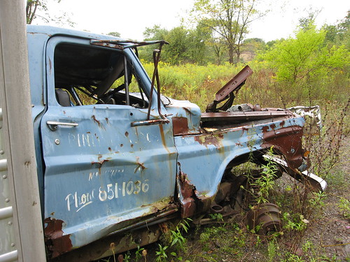
I tried and tried, but there was no making out the name or business on either door of the truck. But phone number's still clear as day. The truck's recent enough it doesn't have any of those weird two-letter prefixes, but it's ancient enough that it doesn't feature the area code, either. Back when this truck was made, and probably when it was dumped here, the whole of south-central Ontario was 416. Now, only the City of Toronto is 416... but it's also 647. Where this truck sits is now area code 905... and it's also 289. When the truck was in service, no such distinctions were necessary.
I could make out enough on the side of the truck to read that the business was in Nashville, which is a small village about two miles due south of this spot.
...I'm so tempted to try 905-851-1036 and see if anybody answers. :)
"Hello?"
"Hi, I found your truck..." :)
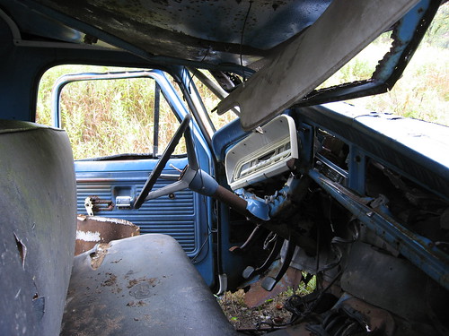
Peeking through the passenger side window, I noticed the truck was standard (there's the clutch) and there was no hint of seatbelts, not even the lap belts I remember as a kid in the early 70s.
I just had a look on Wikipedia to see if I could find out when seatbelts became standard equipment in North American-built cars (this truck is a Ford). No luck... but the article does point out that of the 50 US states, all of them now require the use of seatbelts except New Hampshire. Maybe they should change the state motto to "Live free and die." :) Although "Live free and go through the windshield" has a certain ring to it.
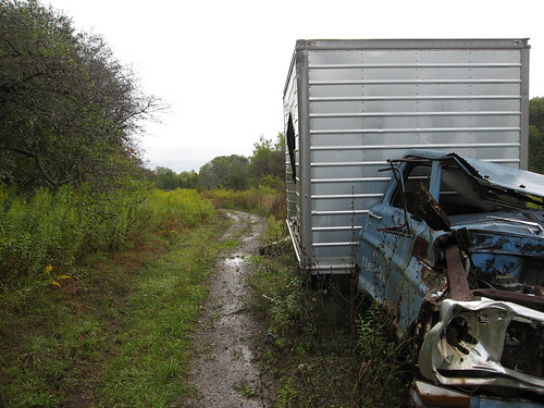
As i prepared to push on, unsure of how far ahead the bridge might be, I paused to take a few shots of the front of the truck. I thought it might be affecting to have this shot with the truck off to the side, and the view of the last few yards it ever traveled there behind it. I dunno... might have been reaching. But I think it works. Maybe. Kind of.
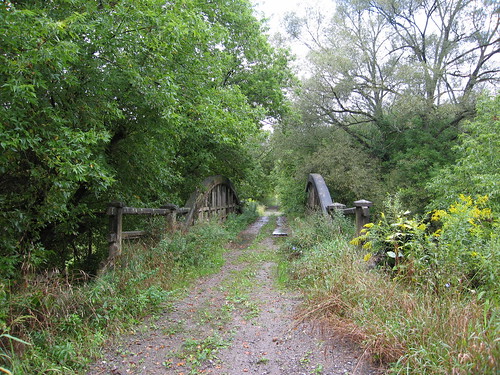
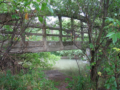
As it turns out, the bridge was about 40 yards beyond the truck. It was only just out of sight through the spreading bush.
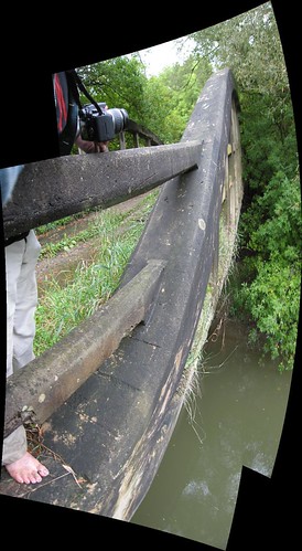
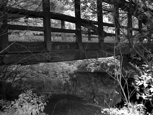
I had no idea what kind of bridge it would be. This is a bowstring arch bridge, of the same type as another favourite abandoned bridge of mine, the Middle Road bridge on (renamed) Sherway Drive over Etobicoke Creek. Closed to traffic in the 1970s, but still used daily by scores of bicyclists and pedestrians, it's been much better maintained than this one.
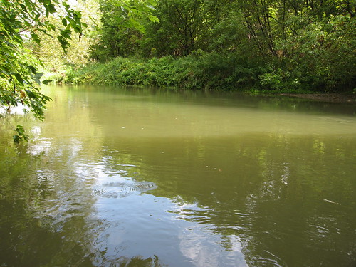
This view overlooks the Humber River, looking north, upstream.
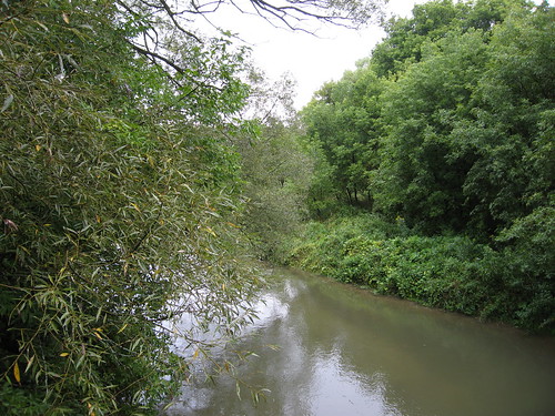
Another look northward upstream, this one from the middle of the bridge.
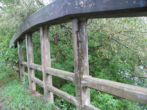
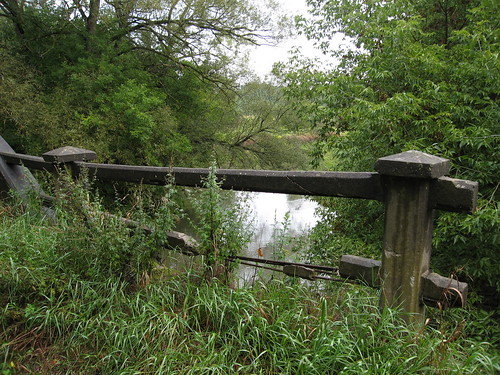
Time is stripping the concrete cladding from the steel rebar of the bridge.
For some reason, the bridge's road bed has been rather irregularly covered with several steel plates. The documentation I found online suggests to me that the bridge used to have a gravel road surface. Both are puzzling, because when I later pushed on towards the other end at Huntington Road, I did find evidence along the way of a thick asphalt road surface.
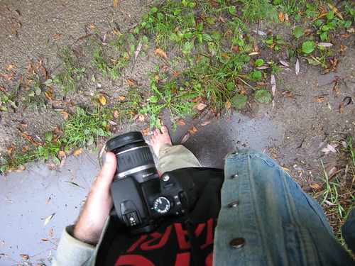
I was carrying two cameras with me at the time. When I started out, I was shooting with the Rebel XT (which you see in my left hand), but I got kind of skittish and tucked it into my jean jacket away from the drizzle and started counting on my S80, which I used for the vast majority of the shots in this set... including, obviously, this one.
You can step off Kirby Road and down into a field which leads to a very pleasant landing under the bridge, with a lovely view of the Humber. This would probably be a great place to fish, if you were so inclined.
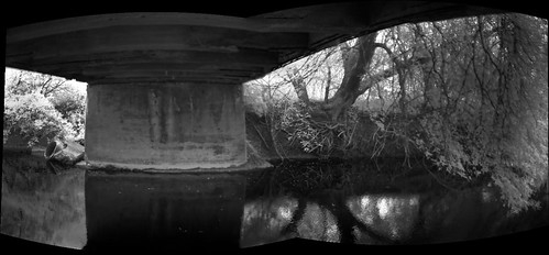
A slightly closer, panorama view of the approach to the landing under the bridge on the west side of the Humber.
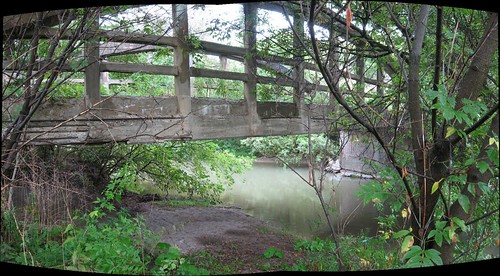
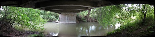
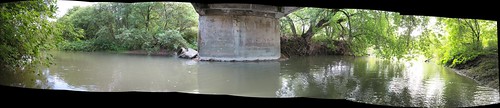
Standing just a few feet from the bridge, essentially beneath it. This is a fairly ambitious panorama made up of ten shots; two rows of five each. I really didn't expect this attempt to succeed, but AutoStitch took it on and did the magic. I think it's a beautiful spot. You can see, though, just how degraded the bridge is getting; concrete is falling away from the sides and underbelly of the span.
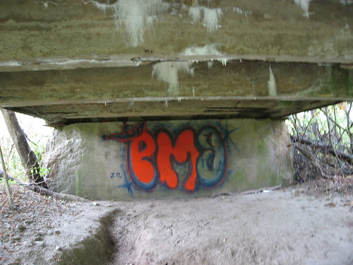
Someone started a farily elaborate, if somewhat pedestrian, attempt at tagging under the bridge on the western abutment... and ran out of dayglow orange.
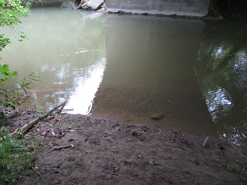
I thought the combination of reflections, shadows, and colours here was beautiful, and I'm glad the camera captured it so ably.
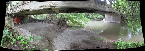
A panoramic view of the underside of the bridge and the Humber River as it flows under it, taken from the western bank.
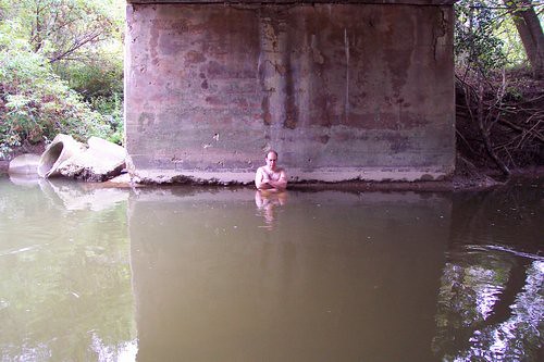
Just after I took the shots that make up this view, I decided to test the water. On Labour Day when P-Doug and I were at Duffy's Lane again, we waded in the Humber but found it too cool for swimming. Oddly enough, when I stepped in Saturday, it was noticably warmer and far more encouraging. So, I figured, what the hell...
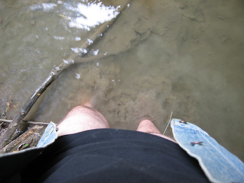
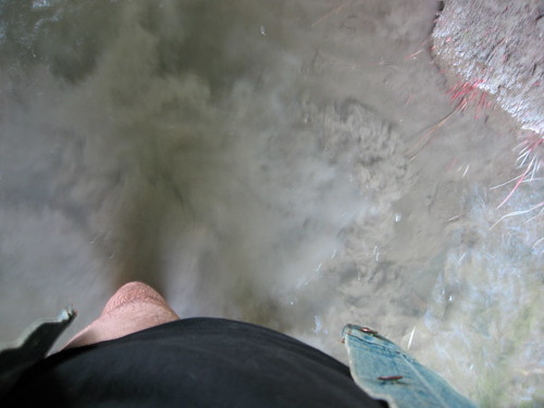
I decided to wade out to the middle of the river, or waist-deep, whichever came first, and take some shots from mid-stream. This is me, still partially clad, stepping out into the Humber.
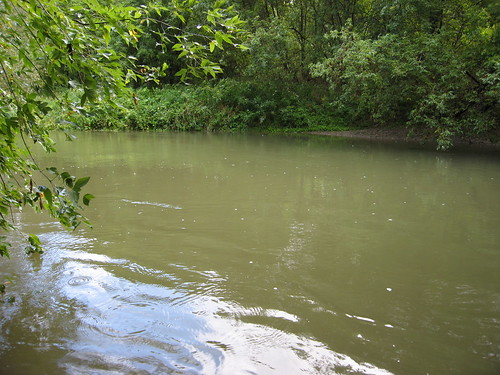
"Waist-deep" came pretty quickly. I don't think I made it to the half-way point. If I'd stripped completely, I'd probably have gone deeper. But I really only wanted to get a few shots and emerge again, not spend all day. I had no idea what the weather had up its sleeve and I still had slippery climb back up ahead of me. Knowing what I know now, I probably would have lingered longer. Even so... though it looks sunny at this point, it was overcast again only minutes later.
This view looks northward, upstream.
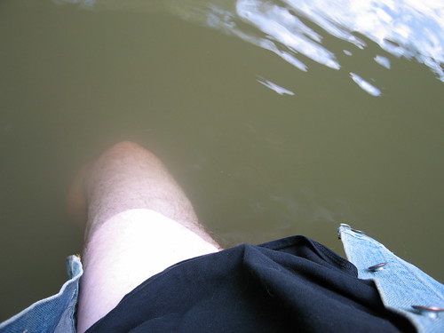
There was a weird dynamic going on. I was trying to inch out as far into the river as quasi-nakedness would allow, while trying not to get my shirt and my jacket wet. Honestly, I don't know what I was thinking.
Doesn't this look almost tropical? Well, this is about as far as I made it, and even then, I was leaning over and holding the camera out at arm's length. Odds are, the river is probably chest-deep at its deepest... and I wasn't (un)dressed for it. :) So this is as good as it gets. But look at that view... it was worth the trip and the whole effort, I think.
This is another panorama of the Humber passing under the bridge, this one taken from within the river. Like the others, it faces eastward, back in the direction I came from. This view looks through a little over 180 degrees; in fact, at the extreme right, you can see the edge of the bank behind me, which should give you some idea of how far out from the bank I actually got.
I was in the water for about five minutes. It was just fine; cool but not cold or uncomfortable. I could easily have spend a half hour relaxing in the water there. Maybe next summer.
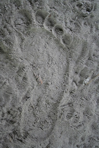
In the sand under the bridge. Something for the next visitor to ponder.
When I left the bridge, again, I wasn't sure how far I had to go to reach the other end. And, once again, I found it was just around the bend. The bridge is about equidistant between the wreck of the truck and this, the other end of the Kirby Road closure.
That's another stretch of Kirby Road beyond the fence, which marks the point where Kirby Road is met by Huntington Road, which itself ends not too far north of here, just across a still-open Humber River bridge. This view looks west, and marks the furthest point of my travels that day. From here on, it's all heading back.
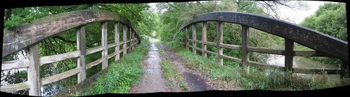
Returning to the bridge, and crossing back over it, I took this panorama of it. Oddly enough, this view again faces the same way as the previous views — west, towards Huntington around the bend in the distance. I include this shot because of the extremes of the perspective near the edges. I'm surprised this came out as well as it did. North and upstream are on the right, and I'm standing over the abutment that's visible in most of the cross-Humber shots from under the bridge.
Another weird panorama shot that really shouldn't have worked out, because I was leaning over the side and pointing back at the bridge without being able to line up the shots. But there was enough common ground for AutoStitch to make this rather warped single image. This is the north side of the bridge, with the camera facing west, taken almost precisely half an hour after I was standing down there in the water next to that tree, shooting the "lagoon" view upstream.
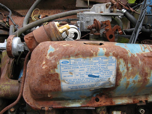
One more crack at the abandoned Ford truck. This sticker on the engine announces, among other things, that the truck is in compliance with emission standards for 1971-model vehicles. That at least ballparks when the truck was built, but doesn't really tell us how long it's been here, or hint at when the road was closed.
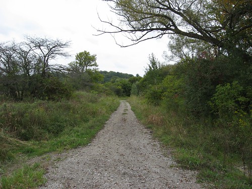
Arriving back at the point where I emerged from that long, slippery trail down through the forest, I took a closer look at what looked like an alternate trail, and all at once, it seemed clear to me that this, and not the trail I'd come down, was the course of Kirby Road (and checking the map and aerial shots later confirmed it). This is view up the road, rising from the valley floor. I decided to ascend this way instead of the mudslide!
Part way up there's this gouge so deep in the road that even I, on foot, took it easy so as not to slip. I doubt this was a feature of the road when it was open to traffic, but it only served to confirm to me how much the road's been allowed to deteriorate.

You can see it was a fairly wide road; it probably easily accommodated two cars passing each other. My feeling is that the hillside on the left has eroded somewhat since then and smothered some of the original road clearance.
You can see light from a clearing at the top. At the time I was making my way up, I was thinking, well, jeez, that was easy... why that stupid, slippery, twisty path through the forest?
This view looks back down the track of the road towards the valley floor.
Panoramic view of the approach to the clearing.
It was a little slippery on the way up, but nothing like what I would have faced following the trail I took down into the valley. I though this was a much better route and I couldn't imagine why it had been abandoned.
Then I reached the "clearing" at the "top" of the hill...
"Ohhhh yeaaaah...."
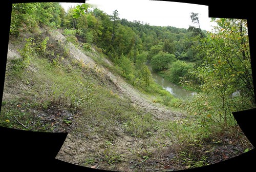
It's not easy to tell, but what you're looking at here is a landslide, running for about 50 feet clear across the road course of Kirby Road. Well, not so much across as out from under. See that little notch of sky at the upper left? That's Kirby Road. So is all that nothing, empty air between that spot and where I'm standing.
Well, this view answered a whole lot of questions, at least potentially. Like "what's that big white spot on the aerial photos?" and "why did they close Kirby Road between Huntington Road and the residences above the valley?" and "what's with that stupid alternate path through the forest anyway?" I really don't know if this landslide occurred before or after they closed the road, but it would sure explain the closure if it happend before, or re-enforce it if it happened after.
This left me with a hard choice. It was slippery and wet, and the trail linking the two discontinuous parts of Kirby Road looked iffy at the best of times. You can't really tell, but that's a hell of a drop I'm standing over. So, it was either trot back down to the valley floor and all the way up mudslide alley again, or... head up into the woods out of frame to the left. The footholds looked good and there were plenty of trees to hold onto, so I opted for the latter.
Looking back to Kirby Road from the hillside, originally uploaded by Lone Primate.
I paused part way up the hillside to shoot back at Kirby Road (it's the grey stuff between the trees at the centre of the shot). Even in two dimensions, I think this view nicely demonstrates how steep a climb this was. In fact, I took this with the XT because it was around my neck, while the S80 was tucked into my pocket out of harm's way.
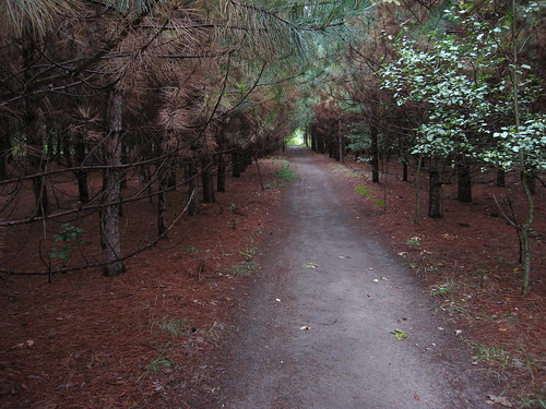
The climb up the hillside brought me out near the end of this stand of precisely-planted evergreens, with the new trail running up the middle. I had to come this heading down to the valley, but the shots on the return are superior. Now that I come to think of it, unless this road was cut through the trees, it might provide some rough idea of when the path was forged (based on the age of the trees, I'd guess a decade or two), which hints at when Kirby Road was closed. Merest speculation on my part, of course.
Heading back towards the east-end closure. This is not far from where the new trail splits off from the track of Kirby Road, just ahead around the bend. At the time I took this shot, I was about tne minutes away from where I parked.
Last time P-Doug and I were wading in the Humber, we encountered the same problem we always did: you're "clean" till that last step, when you take a pound of Humber River silt and mud out with your last step, without the river water washing it away. He said we ought to bring an old water bottle and fill it with Humber water to wash our feet off. I said, hey, I've got that beat, I keep a spray bottle and a cloth in my car. Well, this is me putting it into effect before taking off. You don't make a hobby of hiking barefoot without picking up a few practical ideas along the way. :)
So, there you go, P-Doug et al. Two hours and at least as many miles trekking barefoot through the forests, rivers, and valleys, and none the worse for wear; clean-up is a breeze. Those Hobbits might be shrimps but they've got the right idea. :)
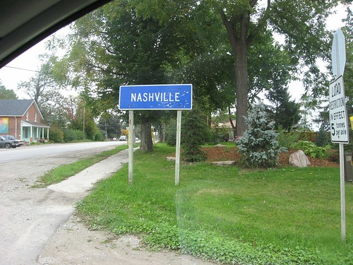
About a week after the previous shots I went back again. This sign is at the corner of Nashville Road and Huntington Road. It announces, as you might guess, the hamlet of Nashville. It's not quite as big as its more famous southern namesake, but... y'know... maybe someday. :)
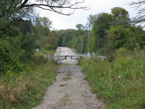
This time I parked at the Huntington Road end of Kirby. This view is from just inside the traffic barrier, looking east towards the bridge.
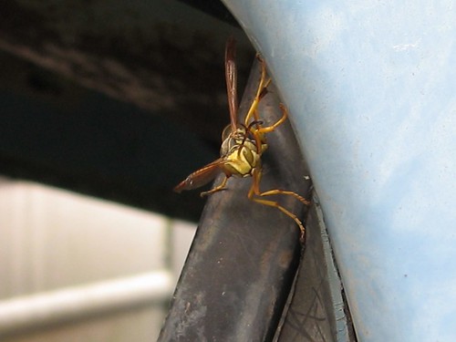
I crossed the bridge and went back to the abandoned Ford truck I found to play a joke. I noticed a lot of hornets had moved into the steelwork I hadn't noticed the week before. This one actually seemed interested in me, but in a way that didn't seem threatening or hostile. Just curious. But it does kind of look like a homeowner opening the door to a salesman. Too bad I didn't have my Fuller Brushes with me.
My bad. :)
I thought this would be funny, so I drove back out and put a "For Sale" sign on the wrecked truck on abandoned Kirby Road. Call me crazy; I think it's a smile.
Came back 90 minutes later and it was gone. I noticed another car parked by mine while I was exploring. Can you believe this? The first guy who comes along and sees the joke ruins it for everyone else. Sign could have sat their for years, slowly fading, getting funnier and funnier for passers-by, but no... some fuckheaded douchebag has to go and ruin it before a single meal passes. Fuck, that makes me mad. >:(
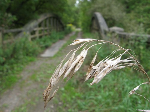
This is McEwen Bridge on Kirby Road in soft focus behind... okay, this crappy stalk was the best I could do. :)
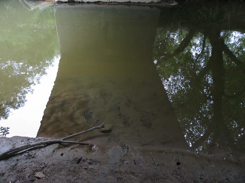
Another look at the reflections in the water under the bridge.
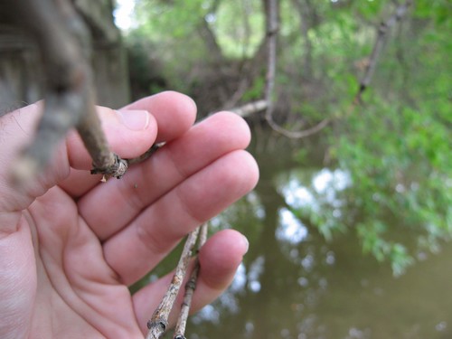
Standing on the west bank of the Humber River, holding the very end of a limb of that tree on the east bank, clear across. In a few more springs, that tree's going to drop right into the river, I think.
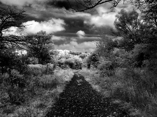
I came back again for a third time the next day, this time with P-Doug. I wanted to show him the bridge. We parked at the Huntington Road end of Kirby Road and this is an infrared HDR shot of the road heading towards the bridge.
Heading under McEwen Bridge to the Humber, this time in infrared. While I was under the bridge, I ended up speaking with a passer-by who was of either Russian or Ukranian origin. He told me that four or five years before, he'd been driving on this very road, and found a stray kitten there that he'd taken home and still had. His family had named the cat "Kirby" after the road, but the name had since been Russified into something I don't quite remember now. He told me that the washout at the top of the hill had happened subsequently, so if his memory is correct, the road has only been out of commission for well under a decade.
This is a panorama under the bridge made of two HDR shots, each composed of three infrared AEB spreads.

Someone had been sitting under the bridge recently. There are a few beer bottles under the bridge; at least one new one that hadn't been there the day before. Saturday night, musta been a party. :)
I figured, what the hell. :)
We were wondering how deep the river was here. And I'm always looking for any excuse. :) So, in I went. It took me about two minutes to make it to the far abutment, but I made it. At one point about a yard further out, the water was even deeper, but at the far side, about four feet, I'd say. This shot was actually taken by P-Doug using his Kodak DC4800, a camera that was previously mine. He's graciously agreed to let me post the shot here.
And yes, when I reached the other side, we both (again) invoked the George Armstrong Custer line, "This is how deep it is, General." :)
Subscribe to:
Posts (Atom)