

Used to be I was pretty good about blogging stuff I did. I think the project of arranging things for eventual donation to an archive takes some of the wind out of the those sails. You spend a Saturday actually doing the running around and photographing stuff, and then the evening and next day geotagging, key wording, and changing formats on the various images and videos, and about the last thing it occurs to you to do is write about it. Also, sometimes, there's really not much to tell.
But I want to be able to remember these things, and one thing the past 15 years or so has taught me is just how easy it is for a decade of your life to seem to just blur into a handful of murky summers and winters if you don't drop some breadcrumbs along the way. So...
For a while now it's been in my mind to get back to northwest Mississauga and revisit a few places interesting to me, and I finally got around to it last Saturday [N.B. "last Saturday" at this point was the one before last, Feb. 4th] because the weather was bright and dry enough that it made sense. My plan also included videoing the drive along Steeles Avenue from about Mavis to Appleby Line and back, but that didn't happen. Oddly enough, other things I hadn't planned to record did.
When I was much younger, and just had my license, I was rather familiar with the area of Meadowvale Village, but only in passing, really. Centred on the intersection of Derry Road and Second Line, it's existed since about 1820, when it was founded by, oddly enough, Irish New Yorkers. Even when I was driving through it in the early 1990s, it was still just a handful of streets off in the middle of nowhere. Traffic on both roads was two-lane. It had only just become a signaled intersection by the time I was driving there. Sleepy little place with a corner store, a church, a library, a gas station. Funny how charming that is to me now... back then, it didn't impress me much. It was just on my way places.
In the years between, there's been a lot of change there. The old village is still there but it's almost completely wrapped around by new subdivisions. Derry Road, now "Old Derry Road", and Second Line are each interrupted in both directions, and can only be accessed by using other roads. Mavis Road, which once ended miles south at Eglinton, now soars past on the east side, making Second Line superfluous, and Derry Road was diverted widely to the north in the mid-90s to bypass the village. The long, straight drives east and west on Derry and north and south on Second Line are now impossibilities consigned to my youth.
When I started driving, there was pretty much nothing on Second Line between Eglinton Avenue and Meadowvale Village (much less north of it) except the landfill at Britannia (oh, the hours I spent lined up there before anyone ever heard the word "blue box")... which is now a golf course (yeah, like I'd want to stick my hand down THOSE holes after a ball). Now, just south of the bridge is a big subdivision. It actually erases part of Second Line, splitting it into a ring, before it comes back together north of Britannia Road, where it's now called Silken Laumann way after a local Olympian, and Terry Fox Way between Britannia and Eglinton. North of Old Derry, it now dead-ends at the wall of what is new Derry Road's crossing of the Credit River. Between new Derry and Hwy 407 is a completely abandoned stretch that I've walked a few times, but in my youth, drove many. It's hard to believe they're the same stretch, but they are. I didn't shoot anything south from the bridge on Saturday, but I do have some previous shots... a couple of them 1989, I think, taken in black and white (me trying to be artsy) looking south on Second Line towards its end at Eglinton. It looks a little different these days, at least on the west side. Might even have filled up on the east side by now for all I know. I see from GoogleMaps now, though, that Second Line continues south from Eglinton for a bit... "Terry Fox Way" becomes "Wainscot Drive". Changes on changes on changes. One of the glories of growing up at the very edge of urbanity.
When I started driving, there was pretty much nothing on Second Line between Eglinton Avenue and Meadowvale Village (much less north of it) except the landfill at Britannia (oh, the hours I spent lined up there before anyone ever heard the word "blue box")... which is now a golf course (yeah, like I'd want to stick my hand down THOSE holes after a ball). Now, just south of the bridge is a big subdivision. It actually erases part of Second Line, splitting it into a ring, before it comes back together north of Britannia Road, where it's now called Silken Laumann way after a local Olympian, and Terry Fox Way between Britannia and Eglinton. North of Old Derry, it now dead-ends at the wall of what is new Derry Road's crossing of the Credit River. Between new Derry and Hwy 407 is a completely abandoned stretch that I've walked a few times, but in my youth, drove many. It's hard to believe they're the same stretch, but they are. I didn't shoot anything south from the bridge on Saturday, but I do have some previous shots... a couple of them 1989, I think, taken in black and white (me trying to be artsy) looking south on Second Line towards its end at Eglinton. It looks a little different these days, at least on the west side. Might even have filled up on the east side by now for all I know. I see from GoogleMaps now, though, that Second Line continues south from Eglinton for a bit... "Terry Fox Way" becomes "Wainscot Drive". Changes on changes on changes. One of the glories of growing up at the very edge of urbanity.
The Second Line bridge over the 401, just south of the village, is due to come down shortly, and not be replaced. It's stood since the 401 was built there, at the end of the 1950s. But the province is extending the collector system westward to Mississauga Road, and the Second Line bridge is not wide enough to accommodate it, so it's going to vanish. I wanted to record what it looked like while I still can.
I was supposed to visit my high school buddy Jay while I was there, so I gave him a call about quarter to twelve. Turned out his battery had died and he wondered if I'd give him a lift to buy a new one when I was done. I promised I would. He said not to hurry but it did kind of put a hustle in my bustle.
I was supposed to visit my high school buddy Jay while I was there, so I gave him a call about quarter to twelve. Turned out his battery had died and he wondered if I'd give him a lift to buy a new one when I was done. I promised I would. He said not to hurry but it did kind of put a hustle in my bustle.


About a mile to the west is the Creditview Road bridge over the 401. As far as I know, that bridge has a future. Well, not that bridge itself, per se; it's too narrow too. But it'll have to be rebuilt because it's now an important feeder between the residential area south and the industrial park that now fills up the fields and former road allowance of (Old) Derry Road north of the 401. So I took some shots of that too. Jay occasionally writes action fiction, and in one of his stories years ago, he had agents blow up this bridge. Looking up the 401 at Second Line, I'd say he picked the wrong one.


The "intersection" of Old Creditview Road and Old Derry Road is really now just a turn. But until the end of the 90s, it was actually a comparatively complicated intersection. What's now the Orangeville Brampton Railway (OBRY) cuts through the intersection, and so at some point in the past, the leg of Creditview on the north side was shifted to the other side of the tracks. I can remember driving down the little hill on that side of the level crossing 15, 20 years ago, heading north to Churchville. Well, that part is now closed, simply a path now, as is the stretch of "Old" Derry Road between Mississauga Road and Creditview. The quiet country drive up to Churchville is lost; Creditview Road now no longer exists between the 407 and Old Derry Road, except for a short lost stretch of abandoned pavement north of the new houses on the south side of the 407. Can hardly believe we drove there, so often.
More interesting still, and something I didn't even know until just the last few days, is that the big empty field on the southeast corner of Creditview and Derry used to house Meadowvale Station; a stop on what was then the Credit Valley Railway (now the OBRY). I would love to find a picture of that. I never gave the trestle just north of there much thought; it was just something you passed on Creditview back in the day, but it's the Howe Truss Bridge, apparently.


Same view as above, but how it looked back in 1999:

I have various shots of this intersection from over the years, and even a couple of the old road that's now gone. I think the most notable thing, though, was that I was there in a windstorm six or seven years ago that blew down the direction arrow sign just beside me, just six or seven feet away. All told, it must have weighed about a hundred pounds, and if the thing had actually struck me, it might have killed me.

Still in use is the charming Old Derry Road bridge over the Credit River.


I've often wondered, in passing, why there is a string of telephone poles in the middle of the field to the east of the river. Well, something else I didn't know: they ran alongside an interurban railway that ran between Toronto and points northeast, abandoned now for nearly a century. It continues to amaze me how long ago people put that kind of effort into so many such schemes to move workers around, and how they all seemed to bite the dust in the 1920s, just when you'd think that kind of thing would only be becoming viable.
Anyway, I did my bit in Meadowvale, and headed over to Jay's place. We went and got him a new battery, but while we were at the mall, he asked me if I'd been "under" Derry. He might as well have been asking me if I'd been "beside north" or "over yellow" or something. It made no sense. So, he directed me eastward, back to Meadowvale Village. I finally got what he meant: that closed section of Second Line that can only be accessed by taking the path "under Derry" at the Credit River bridge.
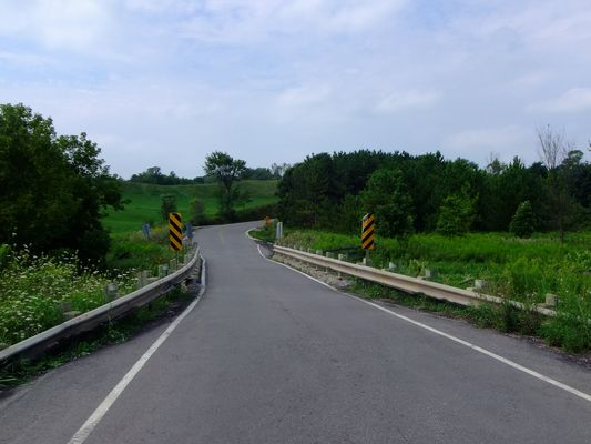
This was another road that he and I had driven many times in our younger days. It was closed in the late 90s by a combination of being pinched off in the south by the new course of Derry Road, and in the north by the construction of the 407. Six or seven years ago I came out here alone with my camera and took photos of the place. This time, with Jay, we wandered up the hill, cracking jokes and making old familiar references, feeling our age as we looked around at a lost road once so familiar to young eyes going places. I noticed that the cement was even more bitten-into by the grasses and plants than it had been the last time. In 20 years, you'll barely be able to tell it had ever been paved, I expect.


For me, it's all worth recording. It's all going to be given, one day I hope, to people younger than me who never had the chance to see these things for themselves. I really enjoy that idea and it's a big part of what gets me out there.