
Showing posts with label beer. Show all posts

Friday, November 28, 2008

Buildings, beer, budgets

I haven’t kept my blog up the way I used to… it used to be partly about recording the little things I did, mostly so I’d remember them more distinctly as time goes on – for me, they tend to blur together into a big common pot of “travel outside the city” or “had a beer downtown” or “saw a movie”. They’re of only passing interest to most people, I know, if that, but I think it’s important to keep it up.

Well, last Saturday, P-Doug and I went out to Streetsville at my prompting. I’d seen a little video of the place from about 1960, and I wanted to compare what I saw with what I remember with what’s there today. As it turned out, we didn’t really stop there; we just blew through on our way back to town.

Where we went first was a service station on the side of the 401 that was in business for about 15 years. I knew it well; the only Wendy’s for miles was there and I got gas there fairly often (yes, yes, pun intended). It closed about two years ago, at the end of September, 2006, and I can remember seeing the notice on my way back from somewhere one weekend, just before it actually closed. I’m not sure why it closed… it was always doing good business.

I was out of gas by the time we arrived and P-Doug volunteered, right out of the blue, to by me a fill-up. I was quite taken by it, since it’s not really the custom on our trips.

We got there and parked just off Argentia and crossed the street to a way through the fence I’d spotted on GoogleMaps. On one of the light poles, there was a cross in purple flowers, and a little shrine to some young driver killed at the spot (presumably). Someone who would always be their “monkey”, according to the writing on the photo. It was heavily wrapped in cellophane against the weather, though, so the sun shining on it made it very difficult to read.


We got to the station and wandered around the gas bar for a few minutes. It was strange to see it without the gas pumps or brand insignia. As is out wont these days, we took 3D paired shots of the place. Coming around to the other side, we saw a beat-up little Chev with Downsview plate frames… we took it to be abandoned, possibly stolen. Then P-Doug noticed a porta-potty. He made a sly joke about it being a cheap TARDIS that I got immediately but laughed at late because it grew increasingly funnier the more I thought about it. We didn’t put two and two together just yet. We headed toward the main building.


As we often do in these cases, we split up. He went along the north side and I went south because I wanted to see the abandoned drive-thru I’d patronized so many times. It was a weird thing to see it boarded up. Took some panos of the parking lot and the building’s main entrance, then we sort of switched sides.


When I came back to the gas bar, I noticed a guy with Sikh head gear wandering around. He’d noticed me, but he took his time coming forward. I hung back, waiting for P-Doug, who arrived pretty much at the same time as this other fellow – the security guard, as I’d imagined – came up. It was a nice enough chat, though I confess the man’s accent made following him unusually difficult. He seemed convinced the government was vastly wasteful, and of course we agreed politely. He struck me as rather starved for attention, for it must have taken us the better part of half an hour to cross the gas bar and finally say our good-byes.


After that, we blew through Streetsville without seeing anything compelling enough to stop for, and made our way down Mississauga Road to the QEW. P-Doug had mentioned visiting the Great Lakes Brewery, and while he waved it off, I felt driven to visit because we were so close, I wanted to see the place, and he’d indulged me in floating around an abandoned gas station and drifting through scenic but unengaging suburbia. It was not easy to get to the place. It’s down right north of the QEW where the street configurations are discontinuous. We did finally get there, sampled a couple of beers, ate a few shortbread cookies, and looked over their visitors’ book. They had people visiting from the States, and even from Britain – one from a brewery over there, which impressed me above all.

Off to Bryden’s. Again, not easy, because the Kingsway North was closed. But we did get there. Had a few pints, decimated a plate of what we mutually agree are the city’s best nachos (the ground beef is done in a jerk sauce whose recipe was given to the bar by the Jamaican aunt of one of the staff, and it’s incredible), took home a glass, entered a contest we didn’t win, and simply enjoyed the place for a few hours. The idea of going to a movie came up and we looked in a handy copy of NOW and P-Doug suggested seeing I.O.U.S.A. at the Carlton, so off we went.

Now that was in an interesting movie. There’s not much point in going into it, except to say it’s about the debt burden of the United States, with a historical perspective, and some ideas about how it can be turned around – and why it must be. They’re showing a condensed, 30-minute version online for free that focuses a bit more closely on the stats – brilliantly communicated using compelling animation sequences – and you really ought to take that in at least. Hey, it’s free, and it’s right here.

Monday, April 21, 2008

Here we go a-wandering

Spring's made it here at last, but I have to say it came on pretty quickly. Three weeks ago, P-Doug and I were walking along the Humber in temperatures just under freezing, videoing the fluid ballet of air bubbles shifting under the ice along the trail. Just three weeks later it was warm enough to lie back in the sun. "Footprint-making weather", I joked to P-Doug in email a few days ago, since if the weather permitted, I'd decided to make our planned wander my first barefoot hike of 2008. And so it was.

I'd suggested some abandoned roads I'd noticed on GoogleMaps, but he wrote back saying he was intrigued by a trail I'd explored alone last year: a closed stretch of Kennedy Road not quite a mile long. I hadn't gotten too far myself that year, really not going much beyond the bottom of the first hill, concentrating on exploring the forest. He was keen to see if we could make it to the far end, where Kennedy resumes north of another side road.

The big piss-off of the day came right out of the gate as P-Doug arrived to pick me up. I went to turn on my PhotoTrackr, only to realize the battery was dead. It had just enough juice left to tell me so in its toffee-nosed I-couldn't-give-a-shit English accent (which I find really annoying... does it show?). When I bought the thing last fall, the main purpose I had in mind was eventually being able to look on a map after I'd gone off-trail into the woods and put the shots I took in geographical perspective. Given that so far, the winter has seen us stick pretty closely to beaten paths, there's been no real chance to try this out. Now I was finally about to get the opportunity to really put it through its paces, and the bloody thing bails. I have no idea how the battery ran down. It hasn't been used in weeks. I hope to God it was just incidental and not systemic.

When we got where we were going, there were cars all over the place at the end of Kennedy. Half a dozen of them, at least. I never like to see that because it tends to mean people are swarming the place with their dogs and their kids. You might as well go to a waterfront park! The idea of getting out of town is to get away from all the noise and contemplate the differences of nature. That's how it is for me, anyway.

And, in fact, just as we set out, a family and their couple of dogs preceded us. One dog, looked like a big Afghan mix, was kind of stupid, hung back, got in our way, wouldn't come when they called... Okay, yeah, it's their place too, but still. Another family and their dogs came back the other way, and I thought for a minute some of the dogs were going to fight. It was all a little discouraging. I resigned myself to the prospect we'd likely see people all up and down the trail. Then, thankfully, the family we were behind broke off near the edge of the heights onto the trail that leads into the forest. We kept following the old road course.

We started down a very steep hill... we kept marveling what a bear it must have been to drivers in the wintertime back when it was still open to traffic (N.B.: we typically do this on such occasions; it's a guy thing, I think). Even on foot it was a little tricky. It's typically the demands of dealing with steep hills in sandals that instigates my taking them off and leaving them off; it always seems like a good excuse. In this case, flat-soled sandals on last autumn's slippery leaves definitely necessitated it. They went in the side pocket of my shorts and stayed there till we got back to the car about four hours later.

Part way down the hill, we could see a long tongue of ice, right in the middle of the road. The shade had preserved it, at least for another day or two. Since we were moving in the direction of gravity, we decided to avoid stepping on it.

Once we got to the bottom... the total drop must have been 80 or 90 feet, somewhere between 30 and 45 degrees (pretty steep by my book)... we started seeing things I hadn't gotten to in my previous solitary expedition. The one that especially charmed me was the tired, crumbling planking of a rough little footbridge that had been built across this tiny stream. It was very picturesque. The wood was dry and nicely sun-warmed, a pleasant counterpoint to the cool, wet, clammy sensation of the earth at the lowest points of the course... though even those sensations have their own recommendations. I was surprised, though, just how warm and dry most of the trail actually was; the elevation only had to rise a foot or two to make the difference. The area must have good drainage.

One of the things P-Doug remarked as surprising was just how empty the golf course adjacent to the trail was. We only glimpsed a couple of carts through the trees; really, on a day like that, and after the winter we just endured, both of us were just amazed the place wasn’t crawling with duffers. It's a mystery, Charlie Brown. In fact, the lack of people generally. In spite of my misgivings at the start of the trek, we didn't see anyone else the whole time we were on the lower trail. I suppose they'd confined themselves to the upper trails.

Something else surprising was the number of hills along the way. I'd only ever been down the first one, and so my uninformed mental map of the area was: big hill at the south end, flood plain, gentle slope up to side road in the north. Generally that's true, but the landscape is more textured than that. There are a couple of hills between both ends, and one nearly as challenging as the first. One rise immediately gives way to the next drop; it was just a narrow ridge in the valley. Good exercise, though, I suppose.

We did achieve our goal of reaching the next side road. There's virtually no hint that Kennedy had ever been a through street on the south side, other than the clearing itself. The thing that amazed us both was that the intersection, in defiance of all typical convention, had stop signs on the through course (the east-west side road), but no stop sign at all on the concession road that T-junctions with it! You just come down a big hill, decide if you want to go right or left, and keep going. Madness. While we were there, we did see a guy in a jeep who seemed to agree; stop sign or no, he stopped, made sure he wasn't going to smash into someone else, and then proceeded. We got a couple of nice shots there of the scenery, and then started back south.

On our way back, we came to the pond that marks the creek whose course I was interested in following into the forest. So we left the road and just wandered the leaf litter for a while. Inside was anything but a flood plain. It was all up and down, carved over thousands of years of floods and recession. Eventually I spotted a little hollow where I sat down to get some sun. P-Doug sat on a branch, which collapsed out from under him; suddenly we were in a Charlie Chaplin movie. No harm done, but it disenchanted him with the location, I think. He wandered a bit, found a better spot on top of a rise (out of the sun, flat, little bumps to sit on) and persuaded me to change locales.

I'd brought a 1L bottle of generic diet cola with six ounces of it replaced with navy rum and lime juice. As we sat there, we passed it back and forth, enjoying the Cuba Libre as we just took in nature. Of all the places we've taken the time to kick back, I think it was the closest to pristine. There was no garbage strewn around, no sign it was being constantly visited, and there was almost no hint of human activity to be heard. Traffic on the side road could be heard only once in a while; a few trains snaked through the valley a mile or two away, and a couple of small planes passed overhead in the time we were there. Every other sound was natural... the breeze, the birds, the creak of the swaying trees that were constantly raining some kind of finger-length, pussywillow-like things on us.
Eventually we had to push on because one of P-Doug's stated intentions for the day was to get to a used book store in the area before it closed. So we headed back to the road and resumed the trek south to the car. On the way, I tested the temperature of the water by the footbridge by stepping into it, ankle-deep. It was chilly, but not frigid; it could easily have been waded in to at least knee depth. But that was it. We're not, of course, in sit-back-and-soak country just yet and won't be for a couple of months, I expect. But it does raise the possibility of fording the Rouge soon to access an intriguing bridge I couldn't get to last March.

We also re-encountered that tongue of ice we'd seen on the way down the hill. This time, since we were going up, I decided to see what it would be like to walk on it. It had so much detritus frozen into it that it actually provided a pretty good surface; it wasn't slippery at all. And, also as a result of that, I was surprised how relatively comfortable it was to walk on in terms of temperature. It was cold, of course, but not so cold I had to step off of it. I climbed the ice rather ably, enjoying the experience of it. It was a good barefoot hike, full of tactile delights. A good start to the year.

We got back to the car and made it to the book store in good time. But the real mission was still ahead: trying out a pub P-Doug had found recommended online called The Crow's Nest. We found it fairly handily; I had assumed it was to be found on Davis Drive, but it's actually on Prospect Street, the name of Bayview Avenue where it becomes briefly discontinuous. The Crow's Nest sits literally astride Bogart Creek, a tributary of the Holland River, with the pub hugging one bank and its parking lot the other. Ducks and geese feed there courtesy of the kindly kitchen staff.

The place is a delight to look at inside; all wood with Old World knick-knacks placed around in a tasteful, uncluttered manner. As we stepped in the door, I noticed in passing a number of old-time articles about the community, including a flood that I think included a shot of the location. To me, this is a hallmark of a place with real soul. Someone cares about this place, the specifics of where it is in the world, and the zeitgeist in which it is embedded, partly in denial of the world around it. It's not a business out of a box. It's something that has grown nearly organically, and could only be in this place, just like a tree.

We sat in a window overlooking the creek, and a waitress arrived right away. The menu was simple but varied. There were something like a dozen different draughts on hand, at least one of which neither of us had heard of. As we debated giving it a try, the waitress offered to bring over samples of it. This is something new to me... it has never, ever happened before in any establishment I've been in. Small glasses holding a couple of ounces of Wellington Dark arrived, found favour with us, and quickly became a pitcher. We ordered the nachos. This is another test... if you order nachos and the toppings vanish with the first layer of corn chips, never go back. Save your money and buy yourself a bag of Tostitos. But The Crow's Nest's nachos were layered, and it was good. Diced raw onions, which was a nice touch P-Doug noticed. Even with the tip, between us, we got in and out of there well under $40.

Downstairs, in the facilities where all beer drinkers sooner or later have to go, the walls were decorated with postcards of ribald British cartoons. Outside the washroom, there were prints of Highland regiments and clan-based maps of Scotland showing tartans and crests. I was really impressed by the quality and placement, and had to smile at the vast resonant dissonance between the effects inside and outside the facilities: it instantly dispelled any notion of pretension about the place, leaving behind only the thought that went into the items on every wall.

We noticed that what looked like locals seemed to drift in, spend a little while, then wander off, which gave it a wonderful, honest-to-God neighbourhood gathering spot sensibility. Families and neighbours, not big noisy parties of drinking buddies shouting at one another to be heard over the latest game blaring on TV. The place was nicely busy, but not crowded. It was pretty much exactly the right balance, at least during the time we were there. No doubt it's far busier some evenings.
I think The Crow's Nest is a tiny, perfect gem, both for and in what it is, and I look forward to going back. Though I should be careful... as the song goes, "call someplace paradise, kiss it good-bye". So don't you all rush to the place. :)
Monday, June 12, 2006

Just the recent wanderings

About a week and a half ago I went with a couple of friends down to the nude beach on an overcast, drizzly Friday. It was a nice trip. The water was a little cool, but a good opening to the summer season.
It ain't exactly the Mayflower...
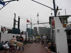
Taking the ferry over, first to Ward's Island, and then to Hanlan's point.

Blockhouse Bay
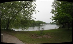
This is Blockhouse Bay, where the marina is. It's often full of the most pleasant sailboats.

The Road to Nudity
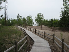
The boardwalk leading from the grassy area of the park through the screen of trees to the beach...

Entering Hanlan's Point beach
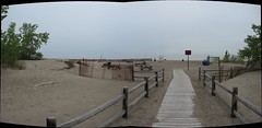
This is the end of the boardwalk onto the beach. It enters just the clothing side of the fence. Cross the fence and you can really frolic in puris naturalibus al fresco. :)

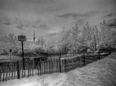
HDR IR The right side of freedom
This is a high dynamic range image compsed of three infrared images of varying exposures (pardon the pun); what I call "HDR IR". This was taken just inside the fence that separated the clothing optional side of the beach (where I'm standing) from the fabric side. The sign warns that you must be dressed on the other side of the fence.

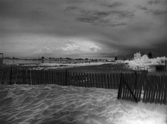
HDR IR Rainy beach due
Another HDR IR image. This looks north over the fence towards the Humber Bay.

Hanlan's Point Nude Beach
This is a panorama of the beach, looking south (hi, Rochester!) from about where you enter the nudist side of the divider.

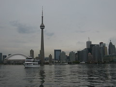
The obligatory cliche shot of the Toronto skyline
On the way back to the city from the islands. A stereotypical, but I think still lovely, shot of the skyline with a ferryboat in the foreground.

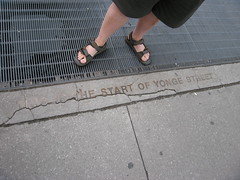
This is the start of Yonge Street
This is where Yonge Street, "the longest street in the world" according to Guinness, actually begins... a couple of yards behind the person standing on the sidewalk are the waters of Lake Ontario.

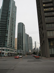
Looking up Yonge Street from its very start
Looking up Yonge Street from its very beginning. From here, you can drive all the way to the Dakotas, as memory serves. Along this stretch of sidewalk are mileage markers that tell how many kilometres to various Ontarian cities and towns along Yonge Street.

-------------------------
Last weekend I went down to the Distillery District with a couple of the guys to listen to blues music and drink organic beer. Yeah, it's that kinda town, what can I say. :)

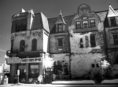
HDR IR Canary Restaurant
HDR IR image of the Canary Restaurant to be found at Cherry Street (along which we're standing) and Front Street. As I understand it, this corner has been featured in any number of TV shows and movies for its rather authentic 1940s aspect. This restaurant is, amazingly, still a going concern.

An incidental note: I took the photo about five minutes after we were witness to a minor accident at Cherry Street and Eastern Avenue in which an SUV rear-ended a van at the intersection. No real harm done, other than that the van shed about 10 pounds of rust, I nearly shed 5 pounds of brown stuff in my jeans (I was standing less than ten feet from the vehicles at the time), and the guy riding shotgun in the van bailed clutching his neck and yelling "Whiplash!" That at least got a chuckle out of the guy in the SUV. They all seemed to take it pretty well. :)

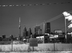
HDR IR Toronto skyline
This is how the downtown looks from Cherry Street, but didn't not that long ago and won't, again, soon. The block was, till lately, an industrial site. It's been torn down to make way for condos. That's the fate of pretty much all the industrial lands downtown over the past 15 years or so. I suppose there are worse fates for a downtown than replacing over-carbonating heavy industry with over-oxygenated Yuppie hothouse flowers...

Famous gates
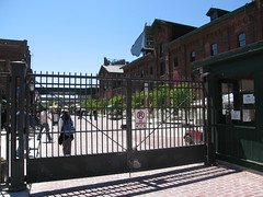
This is the entrance to the Distillery District on Mill Street (for which a still-resident brewery is named). I'm reliably informed that these gates appeared in the movies Cinderella Man (the looking-for-work scenes) and X-Men (the scene in which Magneto, as a boy in Poland, bends the steel with his mind).

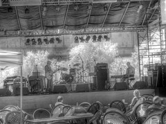
HDR IR Blues
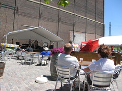
As we entered and made our way down the central drag, we passed the main band shell, where some blues musicians were tuning up. This is an HDR IR image.

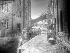
HDR IR Distillery District alleyway
This is an HDR IR shot of an alleyway inside the District. It takes three shots to make an image like this; a woman entered the scene in the final shot. She comes out as a ghost in the left foreground. Kinda cool, actually. I still consider it rather ignorant to deliberately enter the field when someone is obviously compositing a photograph, however.

Ameri-- ahhh, Canadian Bandstand :)
From where we were seated, this was the view of the first live band, who were the self-proclaimed Lester McLean Band. They were just the thing to accompany a warm late spring afternoon and quality brew. :)

Yar, here be men!
Speaking of quality brew, here it is biting the dust.

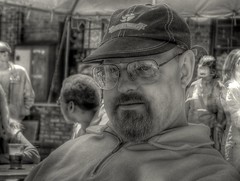
HDR IR Paul
My friend P-Doug consented to hold still long enough for my infrared camera to collect the requisite three images to compose this HDR IR portrait, which I believe is actually my first.