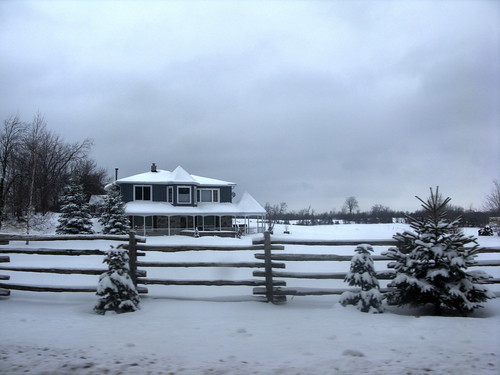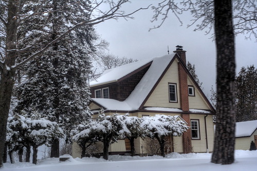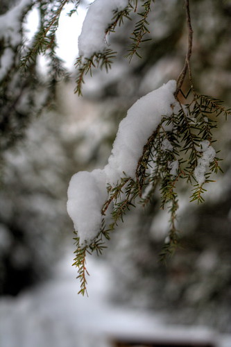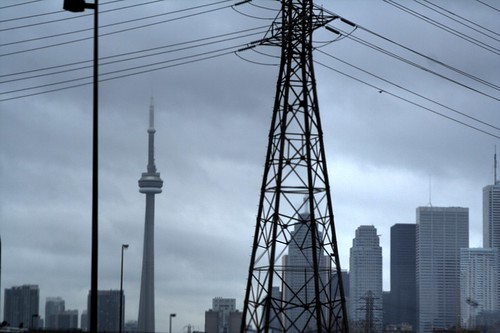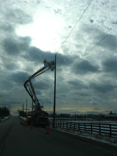


Saturday amounted to my first real opportunity to go on a geotagged hike. Now that P-Doug has the S-80, I thought he might be interested in putting it through its paces. I suggested the closed part of Humberline Drive in Rexdale, but he was anxious to go further afield, and suggested hiking Dominion Road (the closed part of what's now Dominion Street in the little hamlet of Brimstone) up into the Forks of the Credit Provincial Park.
It snowed quite a bit on Friday and it was touch-and-go as to whether or not we'd actually go. In fact, it was well after 11 when I heard from him. I thought about phoning but given that he was one doing the driving this time, I decided that was undue pressure. I was within minutes of taking off on my own to wander Humberline when P-Doug did phone me, and about half an hour later we were on the road.
We were well up Winston Churchill Boulevard before I remembered to turn the PhotoTrackr on. Luckily I did this before I started taking photos. It did a really admirable job of keeping the trail we drove and walked for hours, with only a couple of gaps, mostly due to our being stationary indoors.
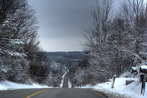
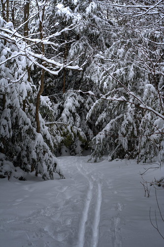
First thing, we drove to Erin to go to the bakery there that he and G favour. I didn't buy anything myself, though of course the temptation was thick in the air. After that, we drove up into Brimstone and parked at the end of the road. We set off up the trail, immediately noticing tracks laid down by skis. P-Doug eventually realized that they were actually two sets of skis, one wider and one narrower. We never did see the people who laid down the tracks, but they sure did make the going easier for us.
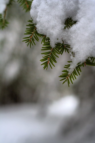
The trees were hung heavy with wet snow. It was really beautiful. The air was around freezing and almost absolutely still. My feet were a little bit cold (no, I was wearing shoes, honest; just not particularly wintery ones), but we did wander up the trail for more than half an hour. I had meant to keep an eye out for the chimney we saw standing alone last autumn, but we never did catch sight of it. What we did see was a couple of bugs on the snow who'd come out tragically too early; a midge and a spider.
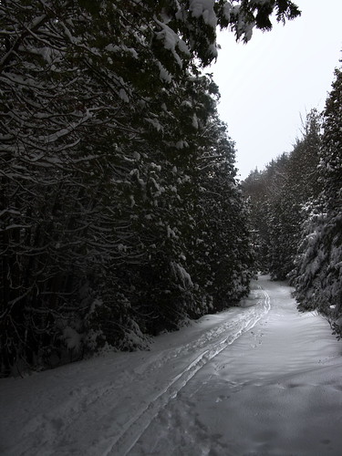
I was shooting mostly RAW in anticipation of 'finishing' the shots using Photomatix to bring out the details. My results were uneven and not wholly satisfying, though some were pleasing enough. If I had the chance to do it again, I'd shoot AEB spreads and see if they were superior in bleak, low-contrast situations. But I have the feeling there's the rub: if there's not much light and not much contrast, you're probably never going to get good HDR results anyway. P-Doug was shooting mostly AEB spreads, so it will be informative to see what kind of results he eventually gets.
I think it had been his intention to get as far into the park as we were when we came down from the rise at the east the first time we were there, about a year and a half ago, when I remember we encountered a Russian fellow trying to get his bearings and met a young couple coming in from the route we ourselves were walking Saturday. I remember testing the waters of the Credit and pronouncing them too cold for our indulgence, even if there had been sufficient cover. Well, we never got that far on Saturday. It was starting to get uncomfortably cold for me, in street shoes, and to be honest, after half an hour or so, one bend after another of snow-laden trees was starting to lose its charms, especially when the only reward was to see a big plain of snow at the risk of frostbite, or at least doubling the duration of my discomfort. I gently wet-blanketed the trek and suggested a retreat to warmer and more interesting digs, and with some small reluctance, P-Doug indulged me. But it seemed to me all our mission objectives had been met, even if we didn't land on the plain and plant the flag... I'd geotracked a hike matched to many photos, and P-Doug had had ample opportunities to both shoot AEB spreads and videotape (is there a better word for that, now that there's no tape involved?) this, that, and the other thing (mostly me, playing with tree limbs and relieving them of snow burdens). More-ambitious treks call for better weather conditions, I think. Either that or I have to go buy real winter boots!
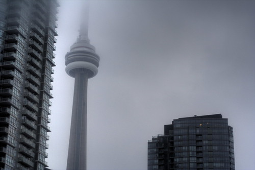
Similarly, I had plans to do a lot of time lapse photography downtown. Those plans didn't pan out, either. When we arrived downtown, it was surprisingly foggy. Not absolutely socked-in by any means, but enough that the top of the CN Tower wasn't visible. Given that filming the light going up the Tower was a big part of what I wanted to accomplish, it seemed like I'd be better off just waiting for another weekend. We ended up passing through the downtown core and heading east to a bar we'd been to once before, in warmer weather in the summer of 2006, I think. The bar was named for the Keating Channel, alongside which it resides (apparently it used to belong to the Irish Rovers). We had a thoroughly pleasant couple of hours there. It wasn't loud or very busy; we shared a pitcher of Keith's Red, and P-Doug had potato skins while I indulged in broccoli and cheese soup in a bread bowl. Very nice! Our waitress was an attractive and attentive African-Canadian woman who chatted us up about photography, in a matter that was never intrusive. I formed a very favourable impression of the place, re-enforcing the one set previously.
Towards the end of our stay, P-Doug asked me if I'd be staying downtown or returning with him to go out with G. I opted for the latter. Conditions had improved but by then, I was less ambitious about photography. We all ended up at Boston Pizza in Scarborough.
Skip forward a day. I'd put P-Doug onto Google Earth because of its facilities to geotag photos, but mostly because its pseudo-3D imagery gives a real sense of what we're facing in our plans to explore a particular river valley this spring or summer. It wouldn't work for him because it barfed on his video card. Combined with the fact he has only USB 1.1 in his computer and the card reader I lent him isn't recognized by his system, it was enough to have him looking for some hardware. He called me out of the blue early Sunday afternoon with plans to go to Tiger Direct. A USB 2.0 card quickly morphed into a potential computer purchase once he saw how low the prices were. Problem was, nearly every "good" computer sported Windows Vista, and it just wasn't worth the hassle. Oh, sure, the guy told us, all you have to do is look up the serial number of your motherboard and then download the XP drivers and put them on a pen memory and scrub the new computer's hard drive and (buy and) install XP on it and install the drivers from the pen memory, oh, sure... not a problem.
Fuck that.
It wasn't my call, but that's what I was thinking. As it turned out, so was P-Doug. We got out of there and went to Factory Direct, where P-Doug snagged a sweet machine, high speed, 2 GB DDR2, 200 GB HDD, for $399. And it had XP on it! He wandered for a minute or two, talking himself into it, and then grabbed it. Even there, it was the only one we saw with the useful OS on it.
It'll be interesting to me to see what happens from here. P-Doug has the S-80, and a computer that can work much more serious mojo than his old one. I'm not sure yet what it will mean for his creative output, but it does open the door to a lot of potential. Once the warm weather's back and hiking becomes more of a joy rather than an ordeal, opportunities will really expand.
Eight weeks till April. :)
Showing posts with label geotagging. Show all posts
Monday, February 04, 2008
Friday, February 01, 2008
Retroactive geotagging with Picasa and Google Earth
I've discovered... wait, discovered? That makes it sound like it was my idea. Let me rephrase that. I've learned, to my utter delight, how to use Picasa and Google Earth to geotag my older photographs... that is, the vast, vast majority of the ones I took before getting my Phototrakr a few months ago.
It didn't work for me right off the bat. Google Earth didn't like something in my setup and when opening in its default setting, it gave me a blank screen where the map was supposed to be. I did a little reading the other day and realized there are three settings for how it opens by default. One is to open in DirectX mode. I tried that and it worked. When Google Earth opens, you're greeted with a globe of the Earth, as if you are approaching it from space. It rotates beneath you to a default position over North America. When you select a location... Toronto, say... it gracefully zooms you in, and from there you can start navigating.
Picasa is great at cataloguing your images. If any of them have EXIF information, which would be pretty much everything I have since I bought the Kodak DC4800 in early 2001, you can select them and then choose Tools > Geotag > Geotag with Google Earth. The pictures are then transferred to a little slider in Google Earth. You select a photo (or possibly more than one; I haven't actually tried that yet) and, dragging the map (yes, the map, not the photo!) to position the specific location under the crosshairs, you click the Geotag button and the location is recorded. When you're done, the geotag information is appended to each tagged photo's EXIF information. Any program or service that can mine that tag, like Flickr, can use it to represent the location on the map where your photo was taken.
To me, this is an important advance. For several years now, cameras have been able to tell you a lot about the circumstances of a photo's creation... the exact time and date it was taken (regardless of what the file info says of creation or modification date), what make and model of camera took it, the aperture, ISO, exposure duration, EV settings, flash, special settings, on and on and on. But there was no way to communicate (or even remember, necessarily) where in the world, the country, the city the photo was taken. Now there is, even for photos not explicitly married to tracking utilities.
I think in a few years it will be common for cameras to have geotracking facilities built right into them. In a way, I'm surprised it hasn't happened already; cell phones are everywhere, as are GPS systems and devices. But until then, we have some effective work-arounds.
My first photo geotagged this way and placed on Flickr (which picked up the geotag)...
It didn't work for me right off the bat. Google Earth didn't like something in my setup and when opening in its default setting, it gave me a blank screen where the map was supposed to be. I did a little reading the other day and realized there are three settings for how it opens by default. One is to open in DirectX mode. I tried that and it worked. When Google Earth opens, you're greeted with a globe of the Earth, as if you are approaching it from space. It rotates beneath you to a default position over North America. When you select a location... Toronto, say... it gracefully zooms you in, and from there you can start navigating.
Picasa is great at cataloguing your images. If any of them have EXIF information, which would be pretty much everything I have since I bought the Kodak DC4800 in early 2001, you can select them and then choose Tools > Geotag > Geotag with Google Earth. The pictures are then transferred to a little slider in Google Earth. You select a photo (or possibly more than one; I haven't actually tried that yet) and, dragging the map (yes, the map, not the photo!) to position the specific location under the crosshairs, you click the Geotag button and the location is recorded. When you're done, the geotag information is appended to each tagged photo's EXIF information. Any program or service that can mine that tag, like Flickr, can use it to represent the location on the map where your photo was taken.
To me, this is an important advance. For several years now, cameras have been able to tell you a lot about the circumstances of a photo's creation... the exact time and date it was taken (regardless of what the file info says of creation or modification date), what make and model of camera took it, the aperture, ISO, exposure duration, EV settings, flash, special settings, on and on and on. But there was no way to communicate (or even remember, necessarily) where in the world, the country, the city the photo was taken. Now there is, even for photos not explicitly married to tracking utilities.
I think in a few years it will be common for cameras to have geotracking facilities built right into them. In a way, I'm surprised it hasn't happened already; cell phones are everywhere, as are GPS systems and devices. But until then, we have some effective work-arounds.
My first photo geotagged this way and placed on Flickr (which picked up the geotag)...
Labels:
downtown Toronto,
geotagging,
Google Earth,
HDR,
PhotoTrackr,
Picasa,
RAW
Thursday, November 29, 2007
GiSTEQ PhotoTrackr: second impressions
Well, the software's kind of buggy. Once you've created a photo group, that's it. Clicking delete does fuck-all. It's bolted in like an iron plate. So I'm stuck with two demo ones that it defaults to and come up every time I try to do something.
Also, trying to apply geotags to older photos doesn't really work. I mean, I think technically it does it. But one photo at a time. And even when you've placed it on the map, the thumbnail of the photo doesn't appear. So it's extremely impractical and simply doesn't work properly.
But, for what I really bought it for — geotagging my trips and archival shots moving forward — it seems to do just fine. So really, I got what I paid for. But I still thing I'll write to them and let them know what doesn't work for me. Then when the next release comes out, who knows?
Geotagged photo from Tuesday:
Also, trying to apply geotags to older photos doesn't really work. I mean, I think technically it does it. But one photo at a time. And even when you've placed it on the map, the thumbnail of the photo doesn't appear. So it's extremely impractical and simply doesn't work properly.
But, for what I really bought it for — geotagging my trips and archival shots moving forward — it seems to do just fine. So really, I got what I paid for. But I still thing I'll write to them and let them know what doesn't work for me. Then when the next release comes out, who knows?
Geotagged photo from Tuesday:
| Latitude: | N 43° 53' 59.5" |
| Longitude: | W 79° 20' 42.8" |
| Altitude: | 206 |
Wednesday, November 28, 2007
GiSTEQ PhotoTrackr: first impressions
Overall, my impressions are positive, and in cases, very much so. It wasn't easy to set the whole thing up, and I wouldn't call the driver installation seamless, but eventually it it was all go.
As I emailed P-Doug this morning:
You should see the thing in action. Something it does that I didn't anticipate, but I got a big charge out of, is play back the trip. When I downloaded the log file, I was first amazed when it suddenly jumped up with a map and there was my whole route on it. Then I noticed there was this play button, so I clicked it and it ran through my drive, including a stop for gas, stops at lights, a more rapid pace along straight-aways... I was just delighted. Then I corralled the photos from that trip and added them. It processed them, showed them on the map, and then offered to embed the GPS data in the EXIF – which is what I was really after, after all. All the rest was cream.
Sadly, while it's possible to embed location data in older photos, it's a hassle. I was hoping it would just be a matter of opening the map, finding the location, and dragging photos onto it and telling it "embed the data". It's not so easy. You pretty much have to re-open the map every time and tell it the approximate location (like "Toronto"), and then keep zooming in and moving the pin to tighter and tighter approximations. So while it's possible, it's such a pain that I can't imagine doing it en masse for trips I took. Hopefully they'll add such functionality in upgrades.
(Hmmm... I didn't try selecting a GROUP of photos and doing this... if I can at least get them all on the map in one shot, then it's just a matter of moving them around. That might make it practical. I'll have to try that this evening.)
Last summer I was considering that little Sony one, but it's only guaranteed to work with their cameras, it was more expensive (this thing was barely a hundred bucks), and it has nowhere near the utility. I'm going to take it for a photowalk at lunchtime and see what I come up with.
Which I did. I'll see how it performs walking instead of driving.
As I emailed P-Doug this morning:
You should see the thing in action. Something it does that I didn't anticipate, but I got a big charge out of, is play back the trip. When I downloaded the log file, I was first amazed when it suddenly jumped up with a map and there was my whole route on it. Then I noticed there was this play button, so I clicked it and it ran through my drive, including a stop for gas, stops at lights, a more rapid pace along straight-aways... I was just delighted. Then I corralled the photos from that trip and added them. It processed them, showed them on the map, and then offered to embed the GPS data in the EXIF – which is what I was really after, after all. All the rest was cream.
Sadly, while it's possible to embed location data in older photos, it's a hassle. I was hoping it would just be a matter of opening the map, finding the location, and dragging photos onto it and telling it "embed the data". It's not so easy. You pretty much have to re-open the map every time and tell it the approximate location (like "Toronto"), and then keep zooming in and moving the pin to tighter and tighter approximations. So while it's possible, it's such a pain that I can't imagine doing it en masse for trips I took. Hopefully they'll add such functionality in upgrades.
(Hmmm... I didn't try selecting a GROUP of photos and doing this... if I can at least get them all on the map in one shot, then it's just a matter of moving them around. That might make it practical. I'll have to try that this evening.)
Last summer I was considering that little Sony one, but it's only guaranteed to work with their cameras, it was more expensive (this thing was barely a hundred bucks), and it has nowhere near the utility. I'm going to take it for a photowalk at lunchtime and see what I come up with.
Which I did. I'll see how it performs walking instead of driving.
Labels:
geotagging,
GiSTEQ,
photography,
PhotoTrackr
Monday, November 26, 2007
Hit the road, Jack, ...something something photo track...
My GiSTEQ PhotoTrackr has arrived! It's a neat, inexpensive little device that corresponds frequently with the GPS and logs your position as you move. When you get home, its software matches up the log and the timestamps of your photos and then embeds the geographical location in the metadata of the image. This is called "geotagging".
I got the unit at a bargain price on eBay… a bargain because at the time I ordered it, the Canadian dollar was worth $1.08 US. I wanted it for a couple of reasons. Firstly, I wanted to be able to look back in the future a know just where I was, to within a few yards, when I took a particular image. Second, since I'm hoping to start recording the city (especially in 3D) for people in the future, it's important they be able to tell exactly where a photo was taken, especially if the location changes a great deal.
Labels:
Canadian dollar,
geotagging,
GiSTEQ,
photography,
PhotoTrackr,
US dollar
Subscribe to:
Posts (Atom)