


the taste of hazelnut coffee is
---the ribbon wrapped around the rain
---the autumn echoes
------its first footsteps peel the leaves
softly it settles upon her shoulders
---a Persian cat curled 'round her soul
---the cup gives her the taste,
------she returns lipstick
---------plum red on alabaster
------------porcelain and skin
and she is waiting
---thinking hard on something
---cup clutched in her hands like
------a bird that might fly
------or fall like leaves that
------rain and gravity might fell;
---------death their only voyage in life,
---------sidelong in the wind
---fly or fall,
------she is waiting
Thursday, September 29, 2005
Sunday, September 25, 2005
The ups and downs of the Niagara Escarpment
This weekend I visited my folks, who live in Hamilton, and who are about to go to Myrtle Beach for the next month. I brought my Rebel XT with me in case I decided to stop and take some pictures along the way. There's nothing to spectacular in all this, I guess, but if you're not from around here, it might give you an interesting idea of what the backroads of Greater Toronto are like in late summer or early autumn. Notice that at this point, the trees have not yet begun to change colour in a big way... but will, within the next couple of weeks.
My parents live in a part of town called "the Mountain" by the locals. It's the part of the city up on the Niagara Escarpment. Though it wasn't my intention, as it turns out, the Escarpment provided most of the show for the trip home.
The picture below is Rymal Road... or it might be called Garner Road now, I'm not sure. It's also known as Highway 53. This is picture I took not too long after setting out for home, about two in the afternoon.

Looking west on Hwy 53
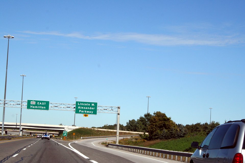
Ordinarily, I would get on the 403 off Hwy 53, and take it to the QEW to cross Burlington and Oakville, reconnect with the 403 in Mississauga, and take that to the 401 home. But this time, I decided to go a more pleasant backroads route for part of the trip. Below is a shot of the 403 just after merging off Hwy 53. I'm about to cross under the Link, named for Lincoln M. Alexander, local resident, and Ontario's first black Lt.-Governor (for our non-Canadian readers: this is the Queen's representative in a province, the person with royal signing authority).

Heading northward on the "eastbound" 403
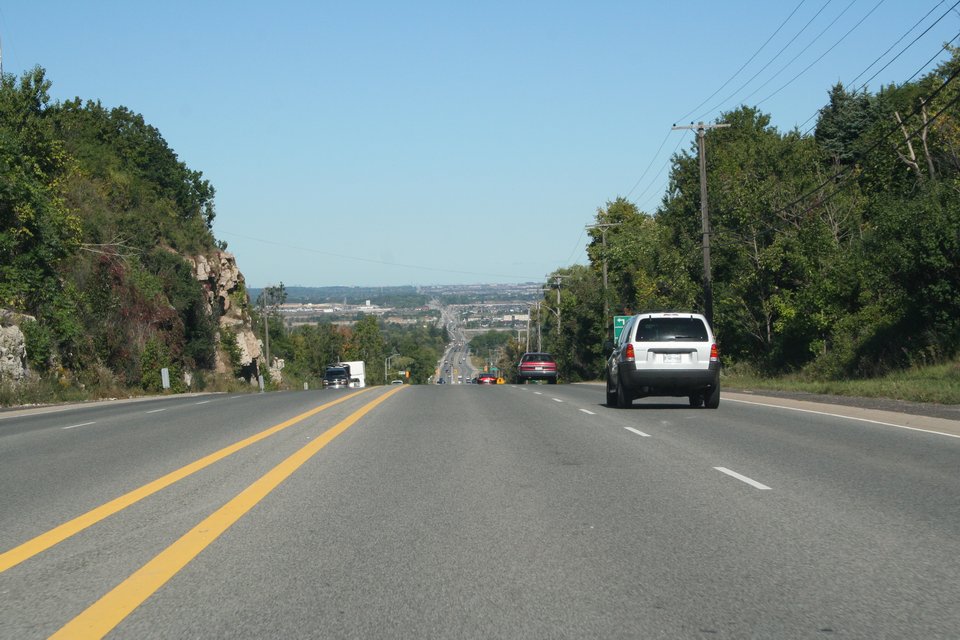
The Chedoke Expressway part of the 403 leads down the face of the Mountain and snakes through the west end of the downtown. So here I am, down off the Escarpment, heading past Main Street.

On the 403 passing Main Street in Hamilton
As I indicated, the most direct and (usually) fastest route is to stay with the superhighways. But I was in no hurry, so after I got around the tip of the lake, I decided to take a more leisurely path. I left the 403 and headed back up the Escparment via Hwy 6 northbound.

Exiting the 403 at Hwy 6, climbing the Escarpment to Hwy 5
At the lip of the Escarpment, Hwy 6 intersects with Hwy 5, also known as Dundas Street. I headed east on Dundas through Flamborough and into Burlington, where, once again, I descended the Escarpment...

Hwy 5 (Dundas Street) eastbound -- about to descend the Escarpment again
Guelph Line is the distance of the view above. In the view below, I've turned up onto Guelph Line and climbed back up onto the Escarpment again (!)... what's that now... down... up, down... up. Okay. Now in the shot below, the view faces south (looking back the way I'd just come from). This looks down into the urban part of Burlington, out into the lake, and out across to the south side of Lake Ontario, which is the Niagara Peninsula itself. My parents live at the very edge of the peninsula where it joins the rest of Ontario, on the right in this shot. Off to the left would be where Niagara Falls would be found. That finger of land represents the only significant stretch of Canada on the south side of any Great Lake; it's on the same side of Lake Ontario as Rochester, New York.

Looking south down Guelph Line towards Hwy 5 and Lake Ontario
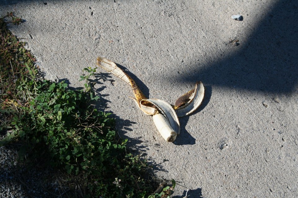
On my way back to the car from taking the shot above, I noticed this abandoned, half-eaten banana. Honest, it isn't mine! There are nearly six million primates in the GTA... and you know how fond primates are of their bananas. :)

This isn't mine
I headed up Guelph Line northward. Generally, I'd head east again when I got to Britannia Road, but I missed the turn and decided to head east on Derry Road instead. I remembered that Rattlesnake Point, with its excellent vistas of the floor of ancient Lake Iroquois, was along Derry. So I headed for that. Getting to the Point required me to turn off Derry and head -- you guessed it -- but up the Escarpment again. I got to the park, realized I was a quarter shy of the $4.25 admission, but the woman in the booth said it was no big deal and waved me in anyway. I got some nice shots of the forest paths in there, as well as some really pleasing ones of the Milton farmland below.

The view of Derry Road from Rattlesnake Point, looking west
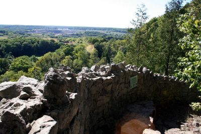
Looking north from Rattlesnake Point

Rattlesnake rocks, I guess
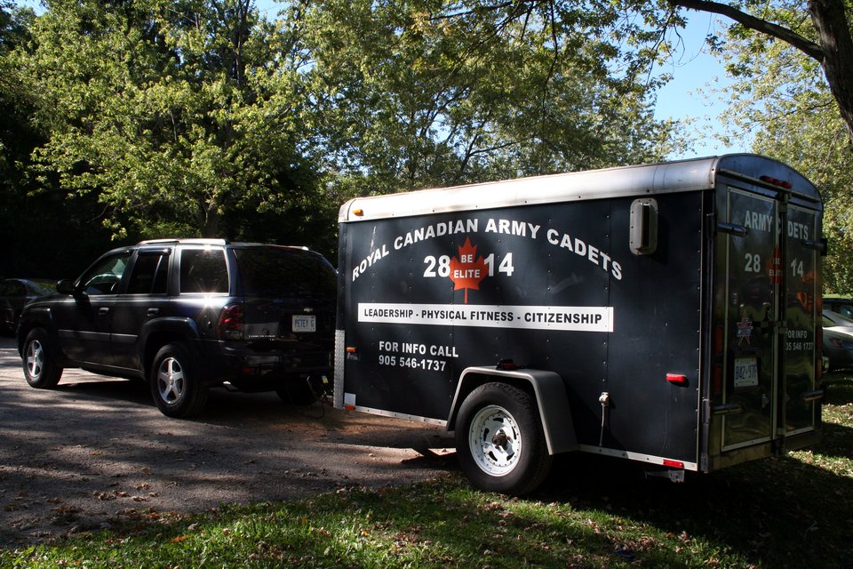
On my way back to the car, I happened to notice this trailer, apparently belonging to the Royal Canadian Army Cadets. I wondered what in the world army cadets would be doing here... then it occurred to me that Rattlesnake Point is prized by rock climbers. No doubt our future soldiers preparing for the next assault on Normandy. :)

Your tax dollars atwork play
When I left the park, I followed the access road north till I got to Steeles Avenue, which actually ends at the road I was on (or begins, depending on your perspect, I suppose). Steeles eventually forms the north boundary of the City of Toronto, but I was still most of an hour west of that. Steeles also took me back down the Escarpment, one last time. I took this shot just after the descent.

This posting's obligatory artsy shot
As a closing shot: this is the intersection of Steeles Avenue and Trafalgar Road. At the moment, it's still a rural intersection, but, as you can see, already reworked for the large volume of traffic already using it. I expect that this same intersection, photographed in 2015, will be under construction, and by 2020 will be highly suburbanized, and completely unrecognizable.

Steeles Avenue at Trafalgar Road, September 2005
A point of fun: see the license plate on the truck? "JKES RD", it says. I assume that means "Jake's ride"... though I had fun as I drove away wondering what else it could stand for... "Jacky's hard"? "Juke's Road"? "Joke's rude"? Damn, I should have asked him.
My parents live in a part of town called "the Mountain" by the locals. It's the part of the city up on the Niagara Escarpment. Though it wasn't my intention, as it turns out, the Escarpment provided most of the show for the trip home.
The picture below is Rymal Road... or it might be called Garner Road now, I'm not sure. It's also known as Highway 53. This is picture I took not too long after setting out for home, about two in the afternoon.

Looking west on Hwy 53
Ordinarily, I would get on the 403 off Hwy 53, and take it to the QEW to cross Burlington and Oakville, reconnect with the 403 in Mississauga, and take that to the 401 home. But this time, I decided to go a more pleasant backroads route for part of the trip. Below is a shot of the 403 just after merging off Hwy 53. I'm about to cross under the Link, named for Lincoln M. Alexander, local resident, and Ontario's first black Lt.-Governor (for our non-Canadian readers: this is the Queen's representative in a province, the person with royal signing authority).
Heading northward on the "eastbound" 403
The Chedoke Expressway part of the 403 leads down the face of the Mountain and snakes through the west end of the downtown. So here I am, down off the Escarpment, heading past Main Street.

On the 403 passing Main Street in Hamilton
As I indicated, the most direct and (usually) fastest route is to stay with the superhighways. But I was in no hurry, so after I got around the tip of the lake, I decided to take a more leisurely path. I left the 403 and headed back up the Escparment via Hwy 6 northbound.
Exiting the 403 at Hwy 6, climbing the Escarpment to Hwy 5
At the lip of the Escarpment, Hwy 6 intersects with Hwy 5, also known as Dundas Street. I headed east on Dundas through Flamborough and into Burlington, where, once again, I descended the Escarpment...
Hwy 5 (Dundas Street) eastbound -- about to descend the Escarpment again
Guelph Line is the distance of the view above. In the view below, I've turned up onto Guelph Line and climbed back up onto the Escarpment again (!)... what's that now... down... up, down... up. Okay. Now in the shot below, the view faces south (looking back the way I'd just come from). This looks down into the urban part of Burlington, out into the lake, and out across to the south side of Lake Ontario, which is the Niagara Peninsula itself. My parents live at the very edge of the peninsula where it joins the rest of Ontario, on the right in this shot. Off to the left would be where Niagara Falls would be found. That finger of land represents the only significant stretch of Canada on the south side of any Great Lake; it's on the same side of Lake Ontario as Rochester, New York.

Looking south down Guelph Line towards Hwy 5 and Lake Ontario
On my way back to the car from taking the shot above, I noticed this abandoned, half-eaten banana. Honest, it isn't mine! There are nearly six million primates in the GTA... and you know how fond primates are of their bananas. :)
This isn't mine
I headed up Guelph Line northward. Generally, I'd head east again when I got to Britannia Road, but I missed the turn and decided to head east on Derry Road instead. I remembered that Rattlesnake Point, with its excellent vistas of the floor of ancient Lake Iroquois, was along Derry. So I headed for that. Getting to the Point required me to turn off Derry and head -- you guessed it -- but up the Escarpment again. I got to the park, realized I was a quarter shy of the $4.25 admission, but the woman in the booth said it was no big deal and waved me in anyway. I got some nice shots of the forest paths in there, as well as some really pleasing ones of the Milton farmland below.

The view of Derry Road from Rattlesnake Point, looking west

Looking north from Rattlesnake Point

Rattlesnake rocks, I guess
On my way back to the car, I happened to notice this trailer, apparently belonging to the Royal Canadian Army Cadets. I wondered what in the world army cadets would be doing here... then it occurred to me that Rattlesnake Point is prized by rock climbers. No doubt our future soldiers preparing for the next assault on Normandy. :)
Your tax dollars at
When I left the park, I followed the access road north till I got to Steeles Avenue, which actually ends at the road I was on (or begins, depending on your perspect, I suppose). Steeles eventually forms the north boundary of the City of Toronto, but I was still most of an hour west of that. Steeles also took me back down the Escarpment, one last time. I took this shot just after the descent.
This posting's obligatory artsy shot
As a closing shot: this is the intersection of Steeles Avenue and Trafalgar Road. At the moment, it's still a rural intersection, but, as you can see, already reworked for the large volume of traffic already using it. I expect that this same intersection, photographed in 2015, will be under construction, and by 2020 will be highly suburbanized, and completely unrecognizable.

Steeles Avenue at Trafalgar Road, September 2005
A point of fun: see the license plate on the truck? "JKES RD", it says. I assume that means "Jake's ride"... though I had fun as I drove away wondering what else it could stand for... "Jacky's hard"? "Juke's Road"? "Joke's rude"? Damn, I should have asked him.
Wednesday, September 21, 2005

Sunday, September 18, 2005
Hurricane Hazel (1954) and Raymore Drive
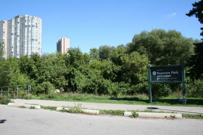
I happened to mention Hurricane Hazel and Raymore Drive in a comment having to do with an earlier post. I've been down there before and seen the park and the relatively new monument to the victims there. What with what's going on with New Orleans at the moment, it seems entirely timely to blog about Raymore Drive.

Map of Raymore Park -- MapArt

Raymore Drive before and after Hurricane Hazel -- Details of plates from the City of Toronto Archives
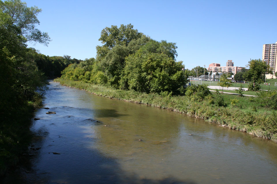
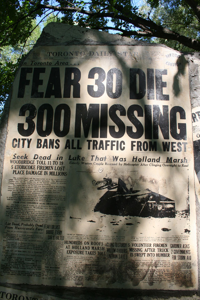
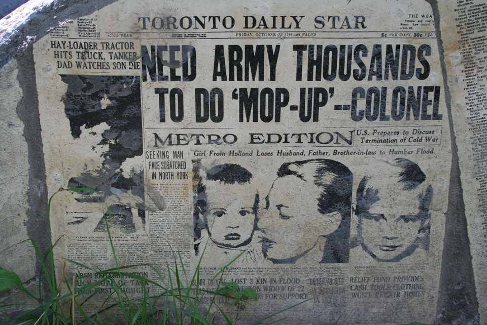
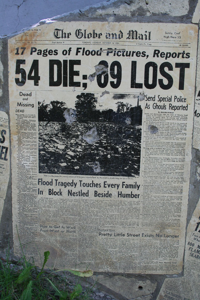
In October of 1954, a hurricane, named Hazel by the (U.S.) National Hurricane Center (which only began naming hurricanes the year before), hit Toronto full force. It's very rare for official hurricanes to hit Toronto (although, oddly enough, one did in 2003 --Hurricane Isebel -- but with nowhere near the results of Hazel). Hurricane Hazel taught Torontonians a lot of lessons about building in our valleys and flood plains... we learned them well. A small blessing of the hurricane is that we still have several nearly pristine river valley systems in a city of five million... the Credit, the Humber, Etobicoke Creek, the Don (and its various branches), the Rouge...
But it's not without price. Hundreds of people lost their lives in the waters of Hurricane Hazel. Major parts of our road system were washed out. A bridge on Highway 401, still being constructed across the city at the time, was washed out and had to be rebuilt. But remembered most of all, above all else, was the tragedy of the houses washed away on Raymore Drive in Etobicoke (the -ke is silent; "eh-TOE-b'co").
That night, the waters rose. In her wonderful book, Hurricane Hazel, Betty Kennedy interviewed survivors and the people who tried to help. They told stories of whole families who waited too long, huddled on their rooftops, calling for help that couldn't reach them. Their homes were swept away before the eyes of would-be rescuers. The story goes, as I understand it, that a footbridge that crossed the Humber in the vicinity of the intersection of Raymore Drive and Tilden Crescent (about 50 yards upstream of the current bridge) blocked the wreckage of homes from the Holland Marsh upstream, which backed up the river until it finally tore the bridge loose; the floodwaters roaring across the flood plain to the southwest, where the homes stood.

Raymore Drive and Tilden Crescent
The last surviving house

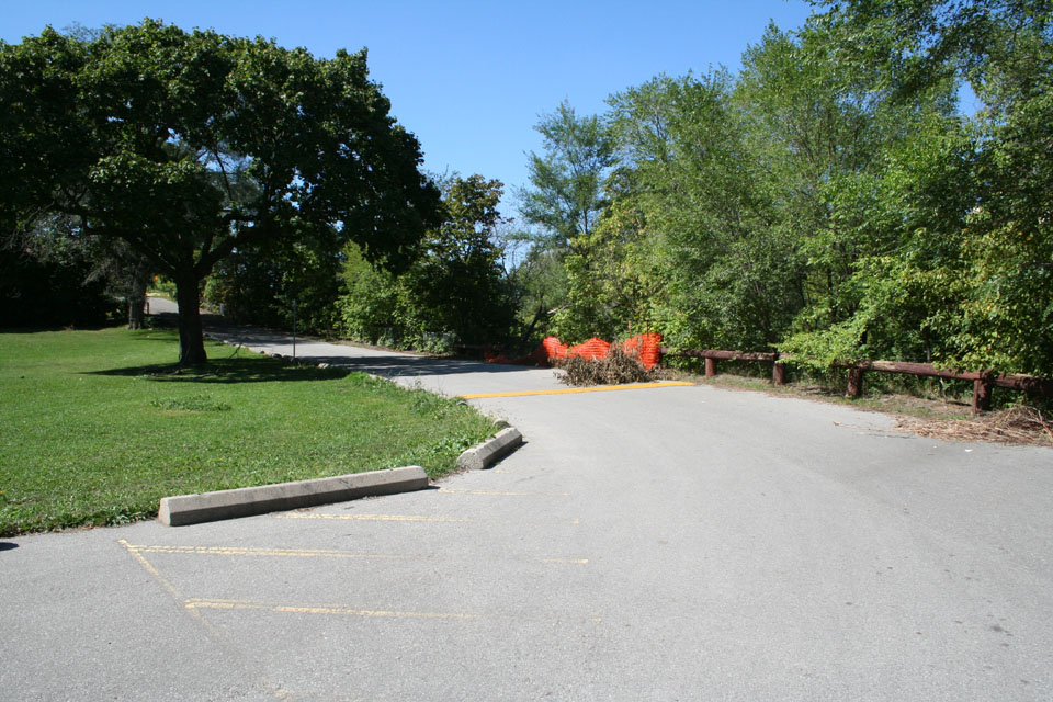
Approximate location of the fatal swing bridge

Local non-primate citizen taking the air in the park -- I happened to notice he was sporting a full set... rare in dogs these days. Good for him! :)

Storm damage from the August flooding evident here as well
The base of the park, facing east

Where the houses once stood

Looking north up Raymore Drive
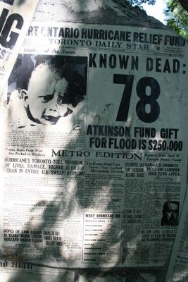
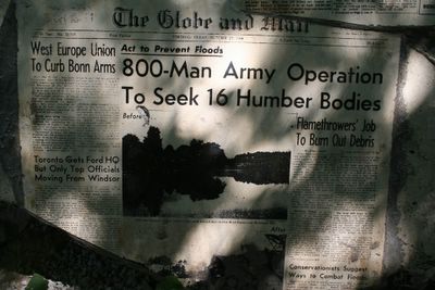
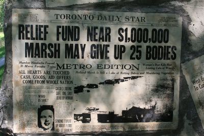
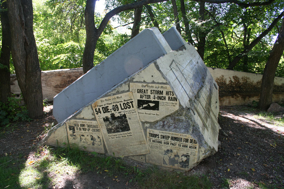
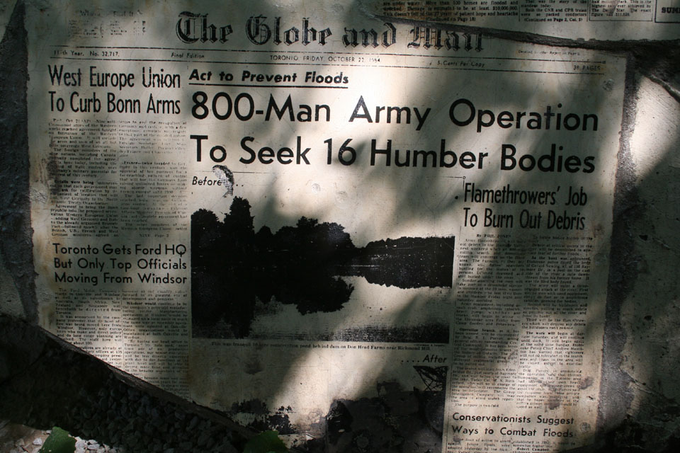
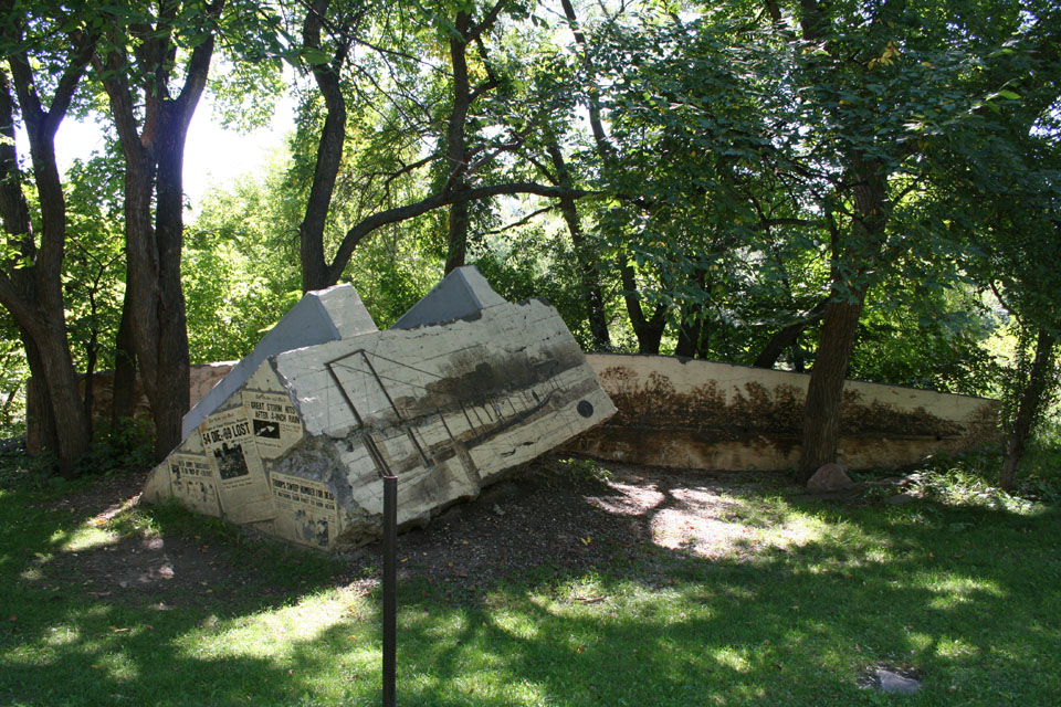
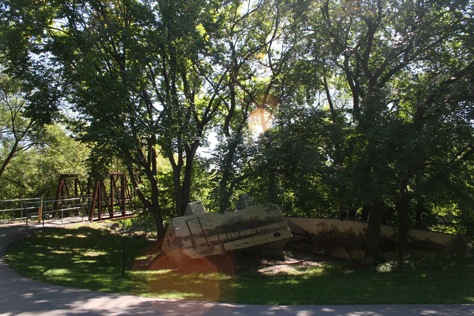
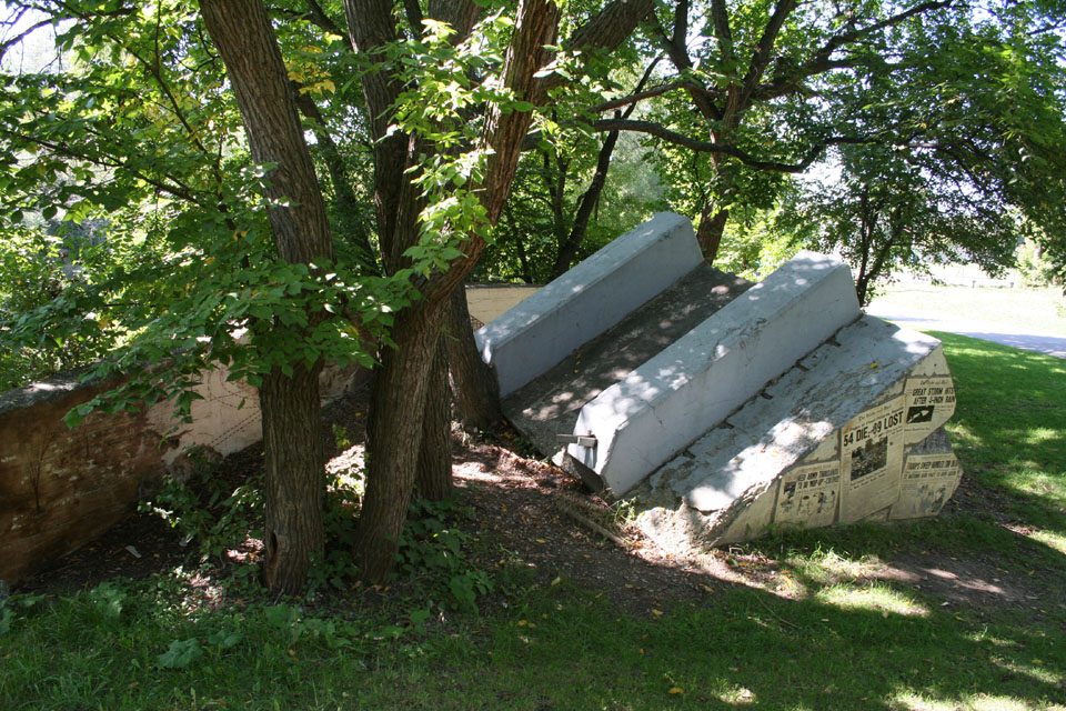
Today, the place where those homes stood is a park. Across the new bridge, huge chunks of the old one, torn away and deposited in the dirt, still rest where they were dropped by the flood. An amazing tribute to the victims was conceived the residents of the Weston area, and in 2002, artist Mario Noviello realized that vision, transferring murals of contemporary newspaper headlines and graphics to the bridge base and retaining wall.

The new bridge

The plaque

The plaque in context
The plaque at the park reads as follows...
"As dawn broke on Thursday October 14, 1954, Hurricane Hazel reached Southern Ontario after lashing the eastern United States. By midnight Friday, October 15, an estimated 8 1/4 inches of rain had fallen, creating massive floods throughout Metro.
The resulting damage was severe. Just upstream, flood waters tore loose a footbridge that crossed the Humber River. The river rose 20 feet, sweeping away 14 homes on Raymore Drive and killing 32 residents in one hour.
After Hurricane Hazel, the Metropolitan Toronto and Region Conservation Authority was established to promote watershed management and public ownership of the floodplain. Raymore Park was then dedicated in memory of Hurricane Hazel's many victims and survivors.
In 1995, a new footbridge was constructed by Metro Toronto with support from the Province of Ontario, representing a substantial step towards the completion of the Humber Trail and greenway system."

Approaching the bridge

Eagle's tag
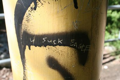
...but apparently not everyone is a fan

Looking towards the disaster

The monument: first blush

The parties responsible

A view of the old bridge

Towering sorrow

Pulled from their moorings...

Where once the houses stood


The whole assembly

With the bridge

Leaving it all behind

Looking southward

Map of Raymore Park -- MapArt

Raymore Drive before and after Hurricane Hazel -- Details of plates from the City of Toronto Archives
In October of 1954, a hurricane, named Hazel by the (U.S.) National Hurricane Center (which only began naming hurricanes the year before), hit Toronto full force. It's very rare for official hurricanes to hit Toronto (although, oddly enough, one did in 2003 --Hurricane Isebel -- but with nowhere near the results of Hazel). Hurricane Hazel taught Torontonians a lot of lessons about building in our valleys and flood plains... we learned them well. A small blessing of the hurricane is that we still have several nearly pristine river valley systems in a city of five million... the Credit, the Humber, Etobicoke Creek, the Don (and its various branches), the Rouge...
But it's not without price. Hundreds of people lost their lives in the waters of Hurricane Hazel. Major parts of our road system were washed out. A bridge on Highway 401, still being constructed across the city at the time, was washed out and had to be rebuilt. But remembered most of all, above all else, was the tragedy of the houses washed away on Raymore Drive in Etobicoke (the -ke is silent; "eh-TOE-b'co").
That night, the waters rose. In her wonderful book, Hurricane Hazel, Betty Kennedy interviewed survivors and the people who tried to help. They told stories of whole families who waited too long, huddled on their rooftops, calling for help that couldn't reach them. Their homes were swept away before the eyes of would-be rescuers. The story goes, as I understand it, that a footbridge that crossed the Humber in the vicinity of the intersection of Raymore Drive and Tilden Crescent (about 50 yards upstream of the current bridge) blocked the wreckage of homes from the Holland Marsh upstream, which backed up the river until it finally tore the bridge loose; the floodwaters roaring across the flood plain to the southwest, where the homes stood.
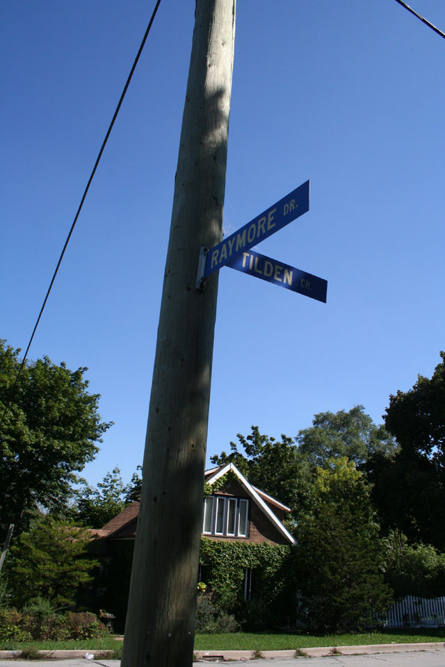
Raymore Drive and Tilden Crescent
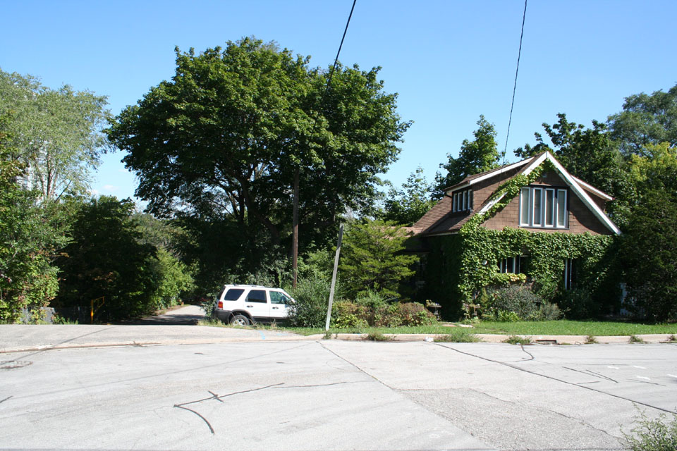
The last surviving house

Approximate location of the fatal swing bridge
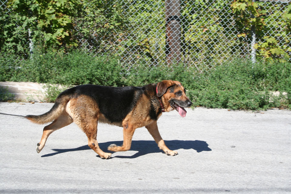
Local non-primate citizen taking the air in the park -- I happened to notice he was sporting a full set... rare in dogs these days. Good for him! :)

Storm damage from the August flooding evident here as well

The base of the park, facing east

Where the houses once stood
Looking north up Raymore Drive
Today, the place where those homes stood is a park. Across the new bridge, huge chunks of the old one, torn away and deposited in the dirt, still rest where they were dropped by the flood. An amazing tribute to the victims was conceived the residents of the Weston area, and in 2002, artist Mario Noviello realized that vision, transferring murals of contemporary newspaper headlines and graphics to the bridge base and retaining wall.

The new bridge
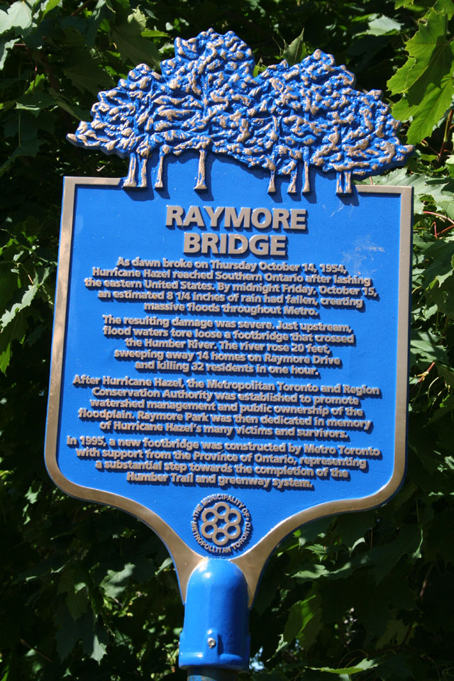
The plaque
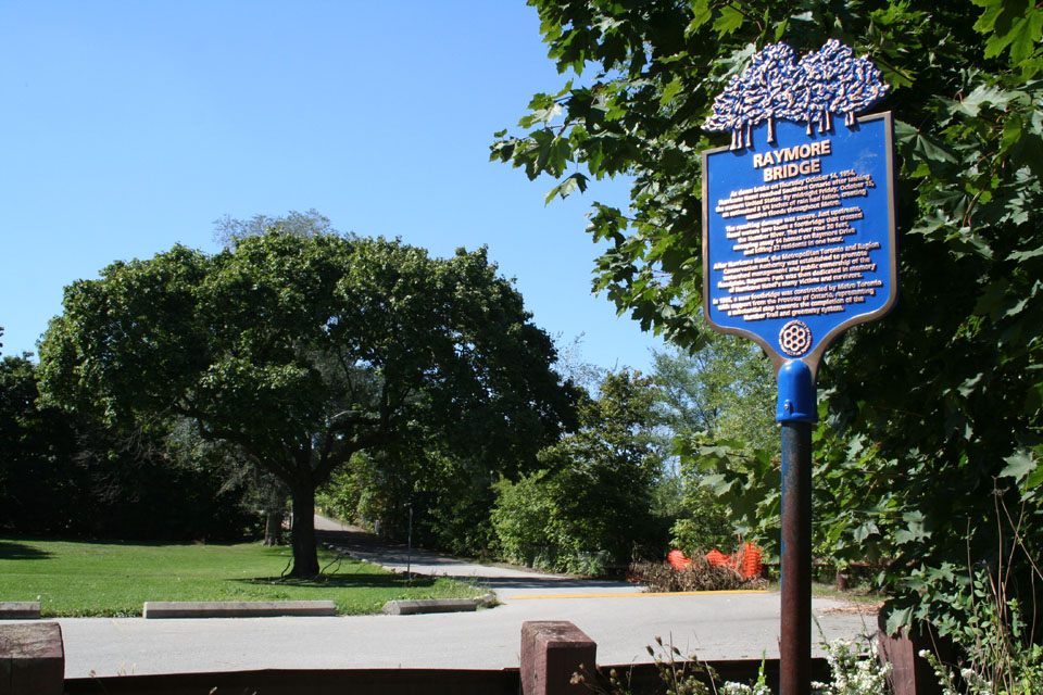
The plaque in context
The plaque at the park reads as follows...
"As dawn broke on Thursday October 14, 1954, Hurricane Hazel reached Southern Ontario after lashing the eastern United States. By midnight Friday, October 15, an estimated 8 1/4 inches of rain had fallen, creating massive floods throughout Metro.
The resulting damage was severe. Just upstream, flood waters tore loose a footbridge that crossed the Humber River. The river rose 20 feet, sweeping away 14 homes on Raymore Drive and killing 32 residents in one hour.
After Hurricane Hazel, the Metropolitan Toronto and Region Conservation Authority was established to promote watershed management and public ownership of the floodplain. Raymore Park was then dedicated in memory of Hurricane Hazel's many victims and survivors.
In 1995, a new footbridge was constructed by Metro Toronto with support from the Province of Ontario, representing a substantial step towards the completion of the Humber Trail and greenway system."
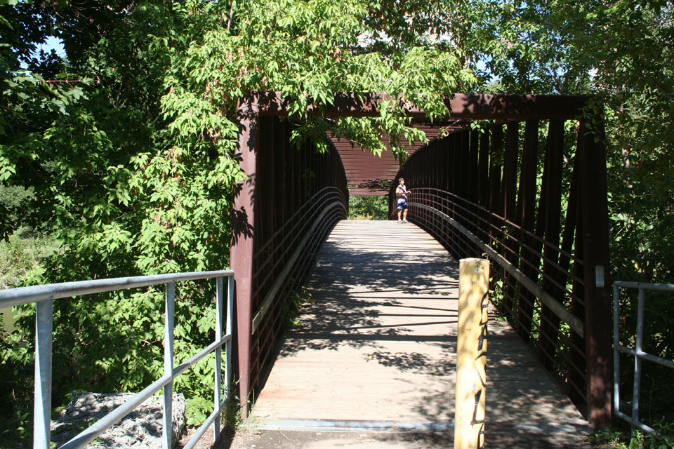
Approaching the bridge

Eagle's tag

...but apparently not everyone is a fan
Looking towards the disaster
The monument: first blush

The parties responsible

A view of the old bridge

Towering sorrow

Pulled from their moorings...
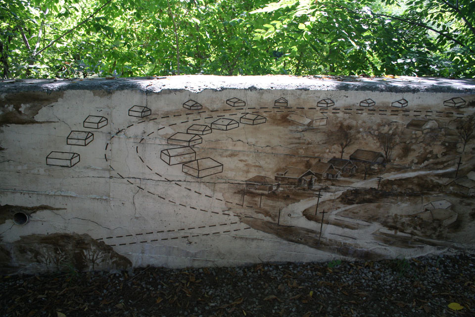
Where once the houses stood


The whole assembly
With the bridge
Leaving it all behind

Looking southward
Subscribe to:
Posts (Atom)