
Map of Raymore Park -- MapArt

Raymore Drive before and after Hurricane Hazel -- Details of plates from the City of Toronto Archives
In October of 1954, a hurricane, named Hazel by the (U.S.) National Hurricane Center (which only began naming hurricanes the year before), hit Toronto full force. It's very rare for official hurricanes to hit Toronto (although, oddly enough, one did in 2003 --Hurricane Isebel -- but with nowhere near the results of Hazel). Hurricane Hazel taught Torontonians a lot of lessons about building in our valleys and flood plains... we learned them well. A small blessing of the hurricane is that we still have several nearly pristine river valley systems in a city of five million... the Credit, the Humber, Etobicoke Creek, the Don (and its various branches), the Rouge...
But it's not without price. Hundreds of people lost their lives in the waters of Hurricane Hazel. Major parts of our road system were washed out. A bridge on Highway 401, still being constructed across the city at the time, was washed out and had to be rebuilt. But remembered most of all, above all else, was the tragedy of the houses washed away on Raymore Drive in Etobicoke (the -ke is silent; "eh-TOE-b'co").
That night, the waters rose. In her wonderful book, Hurricane Hazel, Betty Kennedy interviewed survivors and the people who tried to help. They told stories of whole families who waited too long, huddled on their rooftops, calling for help that couldn't reach them. Their homes were swept away before the eyes of would-be rescuers. The story goes, as I understand it, that a footbridge that crossed the Humber in the vicinity of the intersection of Raymore Drive and Tilden Crescent (about 50 yards upstream of the current bridge) blocked the wreckage of homes from the Holland Marsh upstream, which backed up the river until it finally tore the bridge loose; the floodwaters roaring across the flood plain to the southwest, where the homes stood.

Raymore Drive and Tilden Crescent
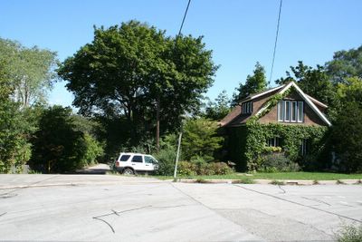
The last surviving house

Approximate location of the fatal swing bridge

Local non-primate citizen taking the air in the park -- I happened to notice he was sporting a full set... rare in dogs these days. Good for him! :)

Storm damage from the August flooding evident here as well
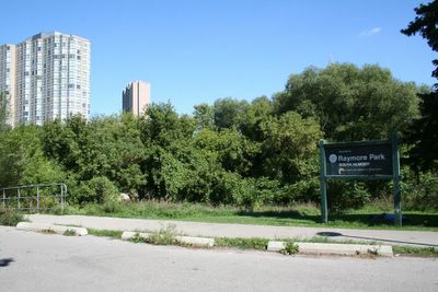
The base of the park, facing east

Where the houses once stood
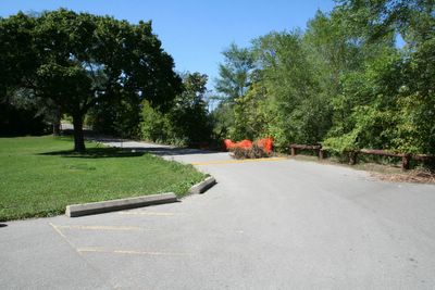
Looking north up Raymore Drive
Today, the place where those homes stood is a park. Across the new bridge, huge chunks of the old one, torn away and deposited in the dirt, still rest where they were dropped by the flood. An amazing tribute to the victims was conceived the residents of the Weston area, and in 2002, artist Mario Noviello realized that vision, transferring murals of contemporary newspaper headlines and graphics to the bridge base and retaining wall.

The new bridge

The plaque

The plaque in context
The plaque at the park reads as follows...
"As dawn broke on Thursday October 14, 1954, Hurricane Hazel reached Southern Ontario after lashing the eastern United States. By midnight Friday, October 15, an estimated 8 1/4 inches of rain had fallen, creating massive floods throughout Metro.
The resulting damage was severe. Just upstream, flood waters tore loose a footbridge that crossed the Humber River. The river rose 20 feet, sweeping away 14 homes on Raymore Drive and killing 32 residents in one hour.
After Hurricane Hazel, the Metropolitan Toronto and Region Conservation Authority was established to promote watershed management and public ownership of the floodplain. Raymore Park was then dedicated in memory of Hurricane Hazel's many victims and survivors.
In 1995, a new footbridge was constructed by Metro Toronto with support from the Province of Ontario, representing a substantial step towards the completion of the Humber Trail and greenway system."

Approaching the bridge

Eagle's tag

...but apparently not everyone is a fan

Looking towards the disaster

The monument: first blush

The parties responsible

A view of the old bridge

Towering sorrow

Pulled from their moorings...

Where once the houses stood

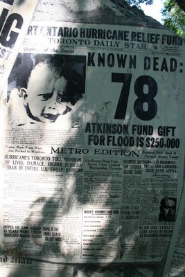
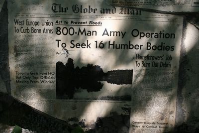
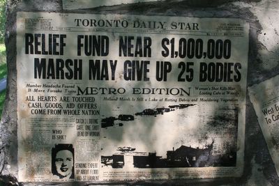
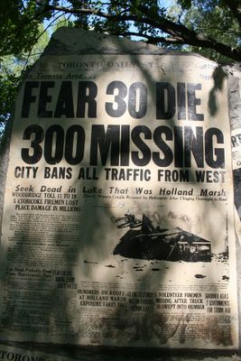


The whole assembly

With the bridge
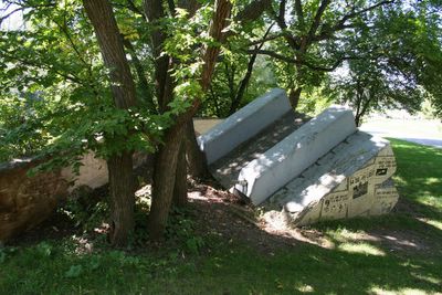
Leaving it all behind

Looking southward


5 comments:
I thought I commented on this already, but it doesn't look like it. Anyway, I like this post. Feel like I went there myself and gathered the information. Thanks!
The bridge was a suspension bridge, not a swing bridge.
Tonite I noticed my 13 yr old daughter engrossed in a book. "Safe as Houses" by Eric Walters. I quickly realized as she described the story, she was reading about Raymore Drive. I grew up on Riverlea Drive, and attended Humber Heights PS. Although Hurricane Hazel occurred 10 years before I was born, I recall our school principal telling us that our school was the temporary morgue. I remember the jerry rigged swing over the bend in the river where if our parents knew we were playing we would have been grounded. Thank-you for this website so I could show my daughter where I grew up and expand the story she was reading. I stayed up tonite to read that book, and I brings a tear to the eyes thinking of lives lost where as a child I played.
I've been here several times since this blog was posted. The bronze plaque near the bridge on the post is gone (stolen likely) and it has been replaced by a regular flat sign panel. The old bridge foundations, which were covered by the enlarged newspaper images are faded and hard to decipher anymore. Terry
Visited yesterday. Nice park but sad to see the memorial defaced and in need of repair. My grandmothers brother was Kenneth Edwards. He and his family perished that day as their house was swept down the humber. I was born years later, but it still stings to know the terror they must have felt.
Post a Comment