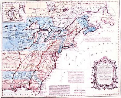
I found this map several years ago and always found it amusing. I know it's a little hard to see at this resolution, but the large blue area at mid-left on the map, clear across the lakes, is titled "PROVINCE OF NEW YORK" on this map, made on the eve of the French and Indian War. Clearly, New York was anticipating a win, and staking out an early claim to the New World's New World Order afterwards. We did win, but the Proclamation of 1763 killed the hopes of all these claimnants west of the Appalachians, and led to the Revolution. In only about a generation, it all went from being two places, down to one, and then back to two again.
I show the map here in honour of Laura and Allan, who've just moved to Toronto, New York (at least according to this map). Hope it gives them a smile. :)
 Huske map, 1755, reproduced in "The French and Indian War" by Seymour I. Schwartz


2 comments:
Thank you! I love old maps. This is terrific. Thanks for thinking of us.
Maybe we should have moved further north!
Post a Comment