Saturday I decided to undertake a sort of grand slam of photographic archiving projects I’ve been meaning to accomplish for a while. Since they were nicely arranged in a more or less straight line westward, it was actually fairly handy to manage. In order, they were Westwood Plaza in Etobicoke, the unopened stretch of Sheridan Park Drive in Mississauga, and the reconstruction of Barnstable Bridge and its environs on Lower Base Line in Milton, which has gone into heavy overtime since last winter.
Since I had to talk to someone overseas on Skype at 3 p.m., so I had a tight self-set deadline. I left around 9:30 in the morning, heading west on the 401. I took the 427 south and backtracked a bit along Dundas Street to where it meets up Bloor Street and Kipling Avenue in a complicated intersection, called, not surprisingly, Six Points, which names the neighbourhood as well.
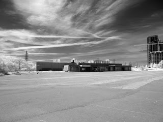
What little I know about Westwood Plaza (I’m not even sure if it actually is called “Westwood Plaza”; the theatre there is... was?... called Westwood Theatre) is that it opened in 1951 or so, when it was really on the edge of town... outside town, really; barely suburban at the time. It closed in 1998, I’m told. I can only remember being there once: in August of 1995, to see A Goofy Movie with friends. Not long afterwards, of course, it gave up the cinematic ghost. A karate dojo and a driving school remained in the plaza for a while, but even they eventually drifted away. I heard recently that the place is due to be razed this year, so I thought I’d better get going and take pictures of the place if it really was my intention to do so at all.
Six Points is an intersection where three major roads intersect, and in 1961, Metro undertook to rebuild it for serious traffic by means of ramps and bridges in a complicated jumble that, for all its ugliness and confusion, does allow traffic to get where it’s going (provided you pay attention to the signs) with a minimum of holdup. Supposedly the city now wants to untangle Six Points and recreate the at-grade intersections, with the idea of rerouting Dundas Street slightly to the south to avoid intersecting Kipling and Bloor where they intersect (in effect, ending the six “points”). If that happens... whether or not that happens... Westwood’s done for. Dundas would be routed through the land it now sits on. But even if Six Points isn’t changed, the city’s made other plans for the land.
Next stop was Sheridan Park Drive at Mississauga’s west border. It’s a strange street that’s really just two nubs of a street, connected by a big soup bowl of another street, Speakman Drive, in a relatively nice industrial park. Sheridan Park Drive is part of the road allowance of The Queensway, a street that was constructed west from Queen Street in Toronto near the Humber River in the 1950s and eventually made its way across most of Mississauga. Mississauga has a few valleys, though, and never connected all the chunks of The Queensway. Eventually one became Blythe Road, and another Sheridan Park Drive. I discovered it while getting seriously into maps in my early 20s, about half my life ago now. I used to wonder why they disconnected it. The truth, as I just discovered recently, is that they never actually built it. Sheridan Park Drive’s abandoned middle isn’t abandoned at all... it’s merely unopened. Well, again, change is in the air, and it looks like Mississauga’s intending to open that stretch at some point fairly soon. So I thought I’d record it.
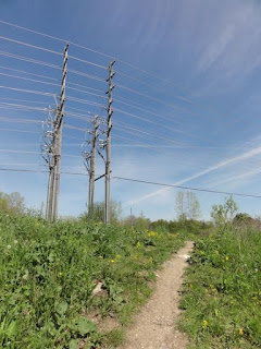
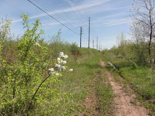
I was down there years ago... decades ago... to look it over... one of my first little “lost road” expeditions, actually. I’d forgotten just how nothing it was. An impassible tract next to a cleared hydro corridor, which now features a bike path (I honestly can’t recall if it was there the first time I was there). It had been my intention to walk its length and record it for posterity, but it was so unimpressive that even I, uncharacteristically, decided “why bother”? I took some shots at either end, and I drove the parts that are currently open, as well as recording what Speakman Drive currently looks like, and left it at that.
Finally was the follow-up of the construction of a new two-lane bridge taking Lower Base Line across East Sixteen Mile Creek. Lower Base Line is known through most of Toronto and Mississauga as Eglinton Avenue (till around 1970, it was called Base Line Road in Mississauga), but Milton is still pretty rural and apparently don’t cotton to them thar new-fangled ideas and city mouse names, so... Lower Base Line it remains. Halton Region, of which Milton is a constituent municipality, also includes such retained bucolic, if perplexing, nomenclature as Upper Middle Road, so there’s every indication this is how it’s going to stay. But anyway...
I used to do a lot of riding around Halton in the early 90s with a buddy whose hobbies included just driving around, listening to music and shooting the breeze, so I saw quite a bit of backroads Halton. The two one-lane bridges on Lower Base Line, and the little parks adjacent to them, were reasonably familiar to me; even more so to him, as he reputed them to be make-out spots par excellence. About ten years ago, Halton decided these two one-lane, wood-decked bridges couldn’t cut the mustard and the time had come to replace them. The first is the more easterly of the two, which I discovered just this weekend is called Barnstable Bridge. Its successor was built at least two or three years ago... I have photos of it about that old... but it’s down in the valley and servicing it with a road that will bear, and safely conduct, the traffic was another matter, so it’s sat unused beside it for all that time. Till now. The road was closed at the heights last winter, and the new road is currently being constructed, mostly on the west side right now. I found out about that last week, and was excited by the prospect of getting some shots of this going on. This was really the jewel in the crown of the expedition this weekend.
I got to Sixth Line, didn’t read the sign, and decided Lower Base Line was closed at that point (it isn’t). So I drove up Sixth Line to Britannia Road, over to Fifth Line, and down, for the sensible reason that the bridge is much closer to Fifth Line than Sixth.
The route down on the west side is currently really torn up, because they’re putting in the drainage infrastructure. Fantastic photographic opportunity! But a daunting hike I almost balked at. Looking it over, it was just plausible enough that I decided to take it on. It meant a lot of climbing into ditches and back out again, balancing on scraps of the road about a foot wide, and dealing with mud and gravel, but I’m proud to say I took it all on and bested it. Coming through, I had a reasonably easy trek down into the valley.
The road’s being vastly widened, and they’re putting up an impressive curving retaining wall. The road now leads straight to the new bridge instead of snaking down to the little one-laner. When I got there, I was chagrined to find a family of four camped out on the old bridge. Just my luck. I worked like a sonovabitch to get down there, and the shots are ruined by the Joad family on a $2 Saturday outing. Uncharitable, I know, but I was thinking nerd daggers at them the whole time. I also noticed that the road on the east side was still intact. They’d come down a nice, even, paved stretch from the Sixth Line side. I could have been miffed but I wasn’t. If I’d come down that way, odds are I would not have bothered with the construction at the top of the Fifth Line side and I would have missed some valuable shots I got making a virtue of necessity, so it was just as well.
I shot what I could without being intrusive and headed up to the far side. There was construction equipment blocking the way at the top... apparently Lower Base Line was open that far. I noticed the family’s beat-up sedan at the top and recognized it as a car so badly maintained that I’d noticed it passing me going the other way at some point (you tend to notice things like a hood held shut by bungee cord). While I was up there, a middle aged couple came by in a pickup truck and we exchanged some brief polite chatter on the construction going on below. As they drove away, I heard the family on their way up the road. Thank goodness! The dad jokingly remarked to me “they” were ruining “his creek” down there. Having the place to myself, I was able to finally get some shots of the old bridge before facing the reverse trek up the west side and through the obstacle maze back to my own conveyance waiting for me at the top.
I guess I’ll have to follow this up in the late summer or early autumn... it’s due to re-open in October. We’ll see. I’m anxious to see if they preserve the old bridge for the park-goers. Its pier and decking date to the 1960s, but since no one’s even sure when its supports were first laid down, I think it warrants keeping it around, so long as it’s separated from vehicle traffic.
I made it back in time to talk to my buddy overseas, by the way. :)


No comments:
Post a Comment