


In the 1950s and 60s, James Salmon and Ted Churnside photographed a number of level crossings in the north end of Metro, back when it, too, was still countryside, but on the verge of development. To me it's astonishing to see faintly familiar scenes, which are now multi-lane roads passing under railroad bridges as old as, or older than, me; represented as little country roads, often gravel-covered dirt, with signaled crossings.
I want to do the same for people in the future, whose homes may one day crowd these now rural settings. The resources available to me for doing this outstrip what was available to Salmon and Churnside all those years ago; cumbersome rigs for shooting B&W still images. I can record video on the road; if I choose, where it's safe and appropriate, I can stop, get out, and shoot dozens of photos in colour and three dimensions. So I decided to head out last weekend and get it done.
The route I took zigzags north-northeast across York and into Durham, hitting most of the major crossings of the CN line. A handful of them are already served with underpasses, but most aren't. It was my intention setting out to stop and photograph each one of them, but as time passed... time passed. I realized taking 10-15 minutes at every crossing would mean the whole thing would take six or seven hours, rather than the two or three I really wanted to put into it. Besides, I'd wind up with 500 photos of very much the same scene, with minor variations, over and over. There was also the consideration that some of these roads already carry a fair amount of traffic, making just pulling over and wandering around a little risky; also, some of them simply didn't have convenient places to stop. So in the end I decided to just photograph a few... ones that really struck me, and where it made sense to stop. There were three, which I think is a good representation.

St. John's Sideroad
This was a pretty spot on a road with not much traffic on it. While I was there, I thought I heard a train whistle in the distance, so I decided to stick around for a couple of minutes. Sure enough, down the track I saw the approaching lights. I recorded a freight passing by at the crossing... it took about four minutes for it to pass. Don't worry; the video's been abridged; shortened to about two minutes.
Even at my age, and knowing one is standing safely to the side, I have to say, watching a train bear down on one is still impressive and a matter of mastering a deep, ancient urge to dash away. :)


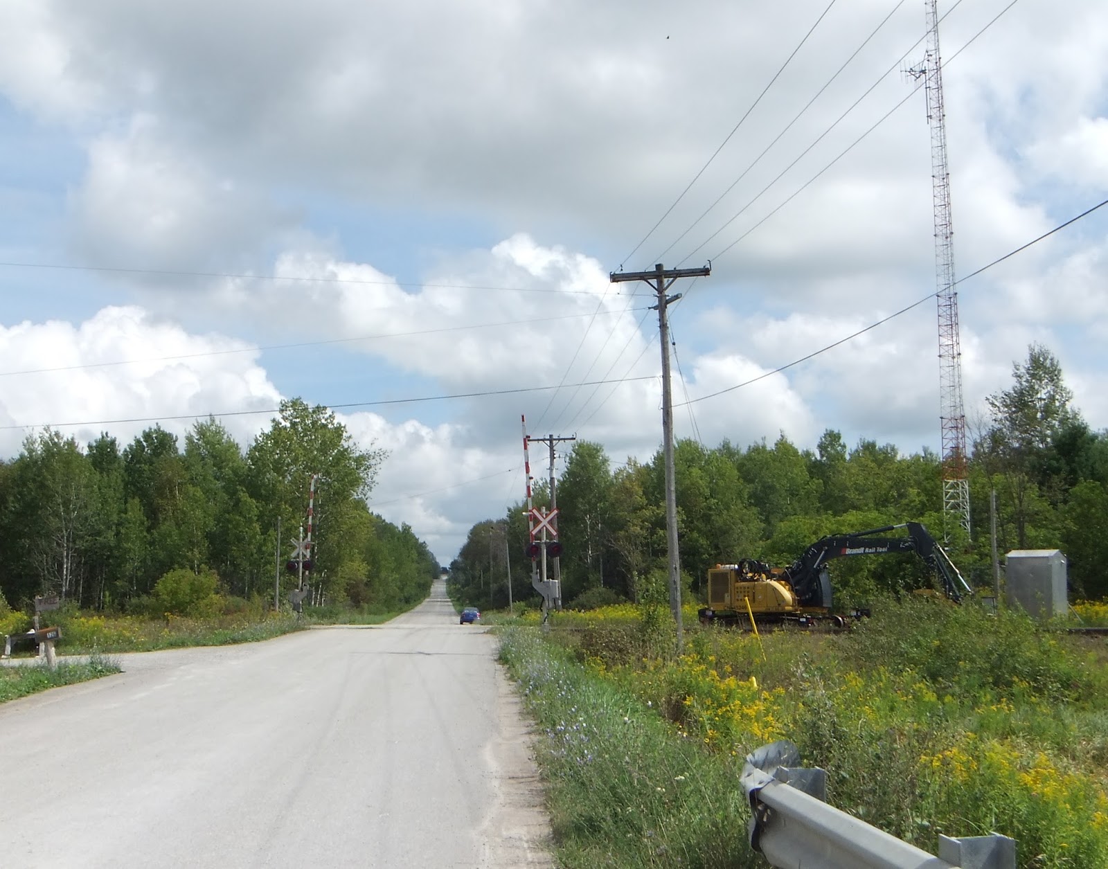
McCowan Road
McCowan's actually a fairly substantial north-south street further south of here. One thing that might limit its growth is that there's a short gap in it a few miles south of this crossing, with a village at the foot of the hill where it resumes... though they might eventually bypass it, I suppose. It's also in, or in the vicinity of, the Oak Ridges Moraine, which could also mean it won't be developed or change considerably. But, you never know; so I decided to stop and take a few shots.


Zephyr Road
This is just a bit over the border into Durham Region, where I was getting to the end of trip, and nearly the turn-around point. It was a dirt road, with a little bridge over a slow creek next to the crossing. I had to stop and get that. It's like those shots of Steeles Avenue in gravel I was talking about... it'll be hard to believe, one day.


I turned around after I got to Ravenshoe Road, which is both the upper border of Durham and as far as I'd planned to go anyway. Below is a compilation of the views of the level crossings I travelled over. Each is a pair: first either heading north or east, as the road might be; the second being the same crossing on the return trip, heading south or west again. The whole thing runs about 15 minutes, so I'm not expecting it's just everyone's cup of tea. But if you like that sort of thing, and you have fun trying to imagine how it's going to seem to someone 50 years from now, have a look. :) (Note: most of the music, which is all ambient, in-car, is by Junkhouse, with a few by Symphony of Science.)
As an aside... I think the biggest kick I got out of the whole thing was when I came over a rise and saw the view of the dogleg intersection of Queensville Sideroad with York Durham Line. It immediately evoked the image of the old intersection of Finch and Woodbine Avenues in North York... an intersection that ceased to exist about 35 years ago. Finch was widened, given to new course eastward from Woodbine to meet another section of itself at Victoria Park Avenue; and Woodbine Avenue in North York died, as such, to become the 404. I always wondered it would have been like to have driven the view seen below... and now, in a way, I feel like I have. The bottom view below is very much like what approaching Woodbine eastbound on Finch prior to the mid-70s would have looked like.

5 comments:
It's taking documentary trips like this that remind one that every scene we encounter is ultimately doomed.
Very enjoyable article and photos.
I particularly like the comparison of the Queensville-York-Durham Line dogsleg to the former one at Woodbine and Finch. With a little imagination, one can travel backwards in time.
Having lived in southern York county for a while, I can relate to a number of these level crossings.
The railway crossing at Woodbine and the Vandorf Side Road, while not a level one is particularly intriguing because of the traffic hazard posed by the supports and the unusual configuration of the Side Road running approximately east-west but not in a perfect line.
Presumably this was a level crossing at some point in the past. I don't know what in this intersection's past history caused it to be so odd.
We all need a sense of place, and our place in it. Knowing the geology, history, and geography, driving the roads and wading the waters, taking in the look of the land and recording the changes people have made to it over time, making it yours and being comfortable in it--all bespeak your love of place.
We've lived most of our married life away from our respective native places--indeed, away from our native land--but we both have a strong sense of place and return as often as we can. We make a home and friends wherever we are, taking in the essence of each new place, but we remain firmly rooted in the places where generations of our predecessors lived before us, the hills and lakes and sunsets inextricably linked with our memories of beloved family and carefree childhood.
Bridegwater,
At risk of a personal question, do you takes photos also of some of your former places and post them?
I would like to see such photos, endowed with meaning by your comments, and would value them.
I think why Lone Primate/Barefoot Hikers's blogs have struck such a responsive chord in me is that I live in an urban area of continual construction and I can never remember what the area looked like before!
Post a Comment