


It didn't work for me right off the bat. Google Earth didn't like something in my setup and when opening in its default setting, it gave me a blank screen where the map was supposed to be. I did a little reading the other day and realized there are three settings for how it opens by default. One is to open in DirectX mode. I tried that and it worked. When Google Earth opens, you're greeted with a globe of the Earth, as if you are approaching it from space. It rotates beneath you to a default position over North America. When you select a location... Toronto, say... it gracefully zooms you in, and from there you can start navigating.
Picasa is great at cataloguing your images. If any of them have EXIF information, which would be pretty much everything I have since I bought the Kodak DC4800 in early 2001, you can select them and then choose Tools > Geotag > Geotag with Google Earth. The pictures are then transferred to a little slider in Google Earth. You select a photo (or possibly more than one; I haven't actually tried that yet) and, dragging the map (yes, the map, not the photo!) to position the specific location under the crosshairs, you click the Geotag button and the location is recorded. When you're done, the geotag information is appended to each tagged photo's EXIF information. Any program or service that can mine that tag, like Flickr, can use it to represent the location on the map where your photo was taken.
To me, this is an important advance. For several years now, cameras have been able to tell you a lot about the circumstances of a photo's creation... the exact time and date it was taken (regardless of what the file info says of creation or modification date), what make and model of camera took it, the aperture, ISO, exposure duration, EV settings, flash, special settings, on and on and on. But there was no way to communicate (or even remember, necessarily) where in the world, the country, the city the photo was taken. Now there is, even for photos not explicitly married to tracking utilities.
I think in a few years it will be common for cameras to have geotracking facilities built right into them. In a way, I'm surprised it hasn't happened already; cell phones are everywhere, as are GPS systems and devices. But until then, we have some effective work-arounds.
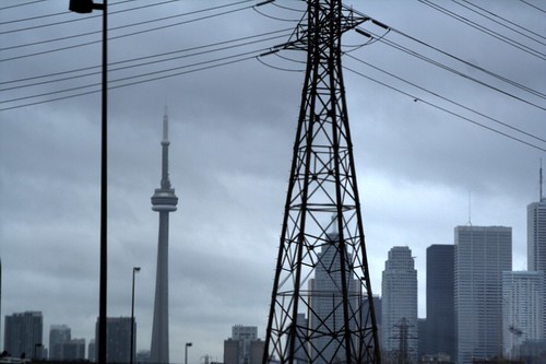
My first photo geotagged this way and placed on Flickr (which picked up the geotag)...
Latitude: N 43° 39' 11.03"
Longitude: W 79° 20' 55.93"
Longitude: W 79° 20' 55.93"
No comments:
Post a Comment