


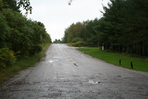
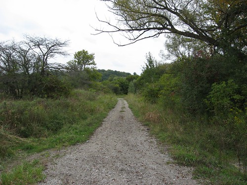
At the "end" of Kirby Road, facing east, originally uploaded by Lone Primate.
I arrived at the blocked end of Kirby Road at almost ten on the dot, and parked right at the end. This view looks back in the direction from which I'd come, eastward towards Hwy 27. The road ends at a residential driveway just off to the right, but is, coincidentally, almost exactly half way between Hwy 27 at Huntington Road, where the other blocked end is to be found, and which was my destination.

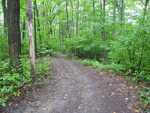
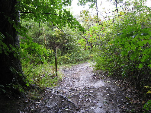
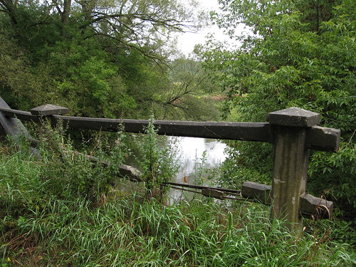
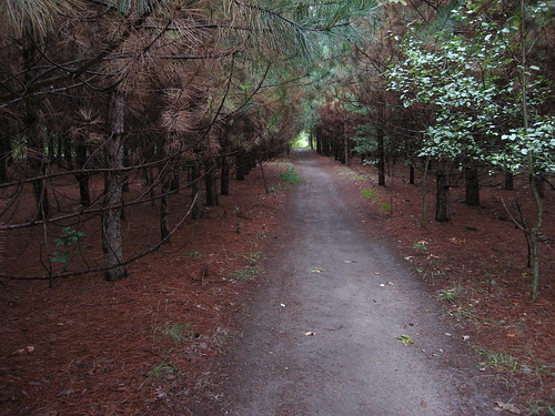
This is the westward view from about the same spot. The berm of earth closes the road. The sign has a lot of municipal warnings about dumping, but nothing of interest about when or why the road was closed. Beyond the sign, the land is Toronto Conservation Authority land. To enter it, I took the little path there at centre-left, which scoots around the berm and takes you to the old road course.
I don't know when they closed this stretch of the road, but judging from the overgrowth, it must have been at least a decade ago. I have a map from 1990 that suggests it was still open all the way to Huntington Road at that time (but who knows?).
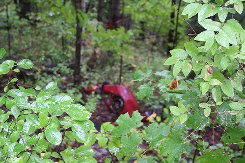
Not too far in, off the left (south) side of the road course, I happened to notice what looked like sports car parts strewn down the hillside. I can't help wondering if someone just dumped them here, or if someone had a serious crack-up here in the past and no one bothered to haul the wreck away.
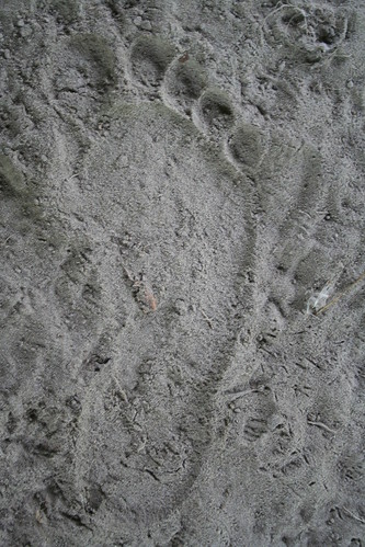
Camera focused on the leaves in the foreground. I didn't notice till I got home. I was kind of pissed off when I saw that, but the more time goes by, the more I like it. Seems a little more poignant and understated this way.
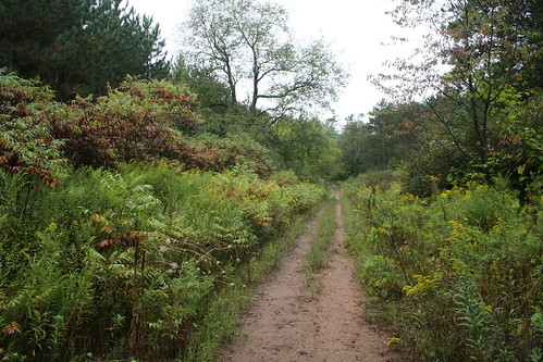
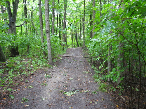
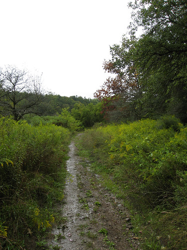
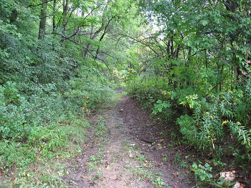
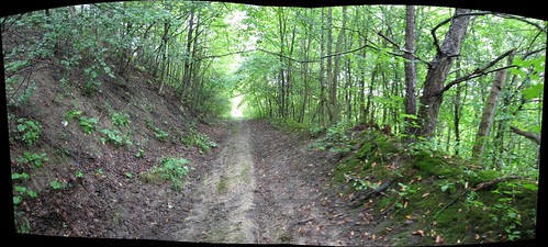
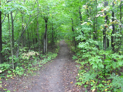
I suspect this was paved once, and deliberately desurfaced to allow nature to reclaim it. I can't really prove it and wouldn't swear to it, but that's my suspicion. You can see that some kind of vehicle still makes use of the clearance, but it's already been largely eaten up by foliage. This was a two-lane road when it was a going concern.
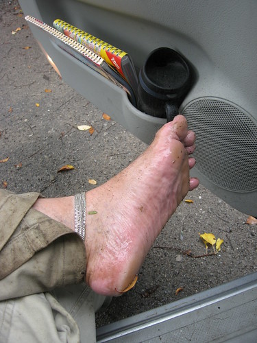
It was drizzling that morning; it didn't stop till about the point where I got to the bottom of the valley and the forest opened up into the flood plain. So, for a variety of reasons — my sandals were wet, they were slippery, and just because I like to — I took off my sandals more or less at this point and hiked the rest of the way down and back barefoot. Hey, it's September... how many more chances will I get this year? :)
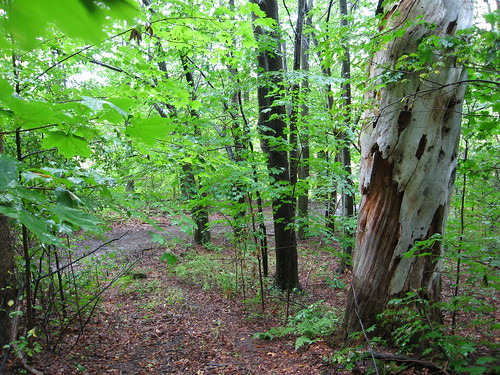
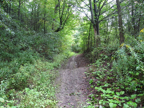
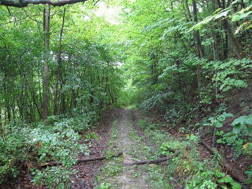
After about ten minutes I came to what looked like a fork in the road. But the way was so much clearer on the right that I decided it must have been the road course (turns out I was wrong; it's the clearing on the left). I was puzzled by the fact that it seemed to cross an old fence line, but as I say, the track was so clear it just seemed obvious to me it was the road course. In fact, it's the new trail blazed by the Humber Valley Heritage Trail folks, I think. On my way back, I followed the old road course along the left through the brush and back to this spot.
This would make a great slide in some water park. It's hard to tell from a two-dimensional view, I know, but this road slopes down somewhere between 30 and 40 degrees. On top of that, in the rain, the clay of the road was soaking and was like walking on butter. I nearly talked myself out of continuing down at about this point, but then I decided, hell, I drove an hour to get here, and for what? To walk fifteen minutes into the woods and turn back at the first sign of a hill? Okay, so I might fall in the mud. So my pants might get dirty. So I might have to put the blanket in the trunk on the driver's seat on the way home. Big deal. I wanted to see the rest. So I kept going.
This is a look back up to the turn at the top of the valley.
There was this really tortuous curve in the route on the way down that promised a twenty-yard skid down on my ass, so I abandoned the road and cut through the woods to the other side of the curve. Much safer. It was around this point that I started wondering if I'd actually lost the road altogether. The route seemed needlessly twisty for getting up and down a fairly straightforward and uncomplicated hillside, and the trees that hugged it on either side were mature enough that they couldn't have hugged any two-lane road still open to traffic within the past generation or more. But... it was a path; it had to lead somewhere, so I kept on. At this point, I could see light off to the right behind the white tree that suggested I was coming to open ground.
That's the curve I didn't risk following; you can see it glistening with slickness. Off to the left is the shortcut I made.
Here's the bottom of the trail. In the distance you can see the open ground beyond the last of the trees. Incidentally, what looks like t-junction in the middle of the picture is just that. I didn't realize it till later, but that's where the new path I followed down meets up again with the actual course of Kirby Road.
This is the course of Kirby Road again, heading westward across the flood plain. The river at this point is a few dozen yards off to the right, through the trees. On the left is a very broad, fairly deep clearance that may once have been someone's farm or at least a homestead of some kind. That's a guess, of course; but somebody cleared it for something. This shot was taken just after emerging from the forest.
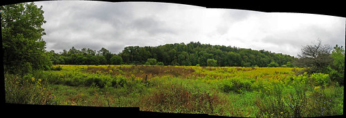
A panoramic look at the open field on the south side of Kirby Road. On the left are the trees I've just emerged from. On the right, the as-yet-unknown...
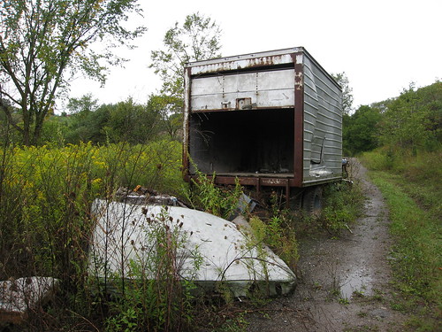
The road parallels the field for about 300 yards, and then begins to pull away to cross the river at a perpendicular angle. As I came around the gentle curve, I could spot something coming out from behind the trees. I thought, what the hell is that? My first inclination was this sinking feeling that someone was down in the valley doing some kind of work. Well... yeah. A couple of decades ago. This truck's been here for a while...
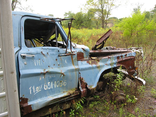
I tried and tried, but there was no making out the name or business on either door of the truck. But phone number's still clear as day. The truck's recent enough it doesn't have any of those weird two-letter prefixes, but it's ancient enough that it doesn't feature the area code, either. Back when this truck was made, and probably when it was dumped here, the whole of south-central Ontario was 416. Now, only the City of Toronto is 416... but it's also 647. Where this truck sits is now area code 905... and it's also 289. When the truck was in service, no such distinctions were necessary.
I could make out enough on the side of the truck to read that the business was in Nashville, which is a small village about two miles due south of this spot.
...I'm so tempted to try 905-851-1036 and see if anybody answers. :)
"Hello?"
"Hi, I found your truck..." :)
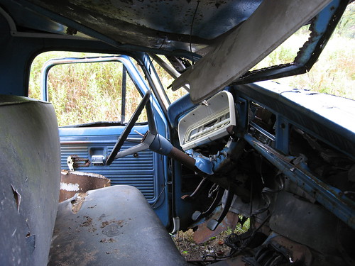
Peeking through the passenger side window, I noticed the truck was standard (there's the clutch) and there was no hint of seatbelts, not even the lap belts I remember as a kid in the early 70s.
I just had a look on Wikipedia to see if I could find out when seatbelts became standard equipment in North American-built cars (this truck is a Ford). No luck... but the article does point out that of the 50 US states, all of them now require the use of seatbelts except New Hampshire. Maybe they should change the state motto to "Live free and die." :) Although "Live free and go through the windshield" has a certain ring to it.
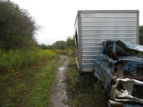
As i prepared to push on, unsure of how far ahead the bridge might be, I paused to take a few shots of the front of the truck. I thought it might be affecting to have this shot with the truck off to the side, and the view of the last few yards it ever traveled there behind it. I dunno... might have been reaching. But I think it works. Maybe. Kind of.
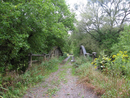
As it turns out, the bridge was about 40 yards beyond the truck. It was only just out of sight through the spreading bush.
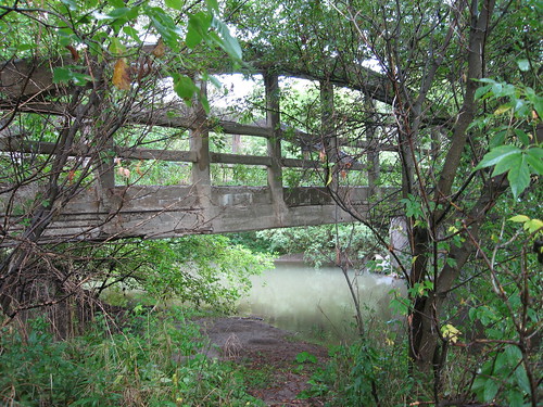
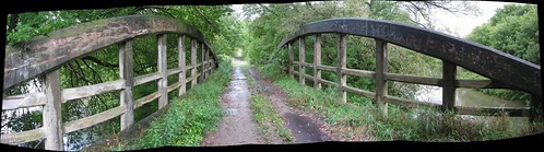
I had no idea what kind of bridge it would be. This is a bowstring arch bridge, of the same type as another favourite abandoned bridge of mine, the Middle Road bridge on (renamed) Sherway Drive over Etobicoke Creek. Closed to traffic in the 1970s, but still used daily by scores of bicyclists and pedestrians, it's been much better maintained than this one.
This view overlooks the Humber River, looking north, upstream.
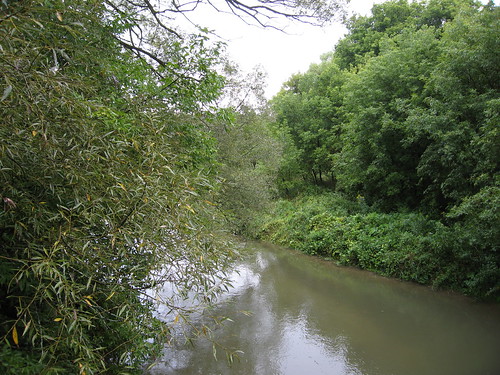
Another look northward upstream, this one from the middle of the bridge.
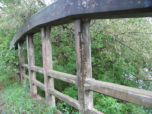
Time is stripping the concrete cladding from the steel rebar of the bridge.
For some reason, the bridge's road bed has been rather irregularly covered with several steel plates. The documentation I found online suggests to me that the bridge used to have a gravel road surface. Both are puzzling, because when I later pushed on towards the other end at Huntington Road, I did find evidence along the way of a thick asphalt road surface.
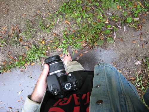
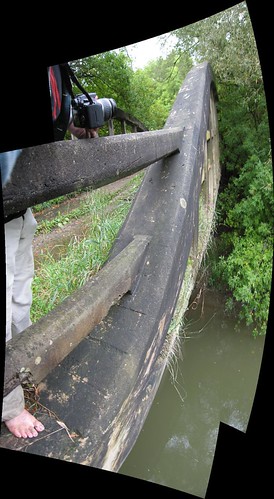
I was carrying two cameras with me at the time. When I started out, I was shooting with the Rebel XT (which you see in my left hand), but I got kind of skittish and tucked it into my jean jacket away from the drizzle and started counting on my S80, which I used for the vast majority of the shots in this set... including, obviously, this one.
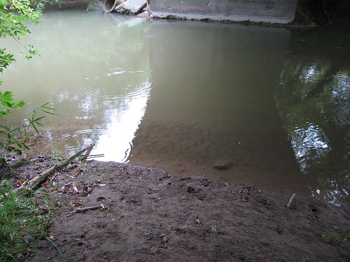
You can step off Kirby Road and down into a field which leads to a very pleasant landing under the bridge, with a lovely view of the Humber. This would probably be a great place to fish, if you were so inclined.
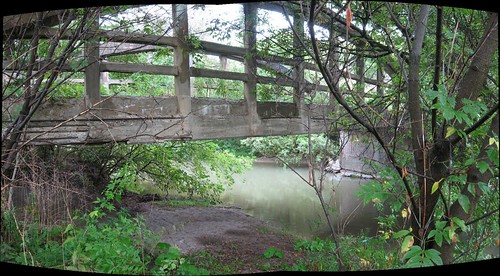
A slightly closer, panorama view of the approach to the landing under the bridge on the west side of the Humber.
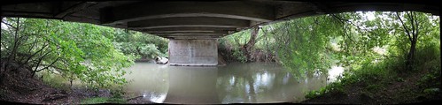
Standing just a few feet from the bridge, essentially beneath it. This is a fairly ambitious panorama made up of ten shots; two rows of five each. I really didn't expect this attempt to succeed, but AutoStitch took it on and did the magic. I think it's a beautiful spot. You can see, though, just how degraded the bridge is getting; concrete is falling away from the sides and underbelly of the span.
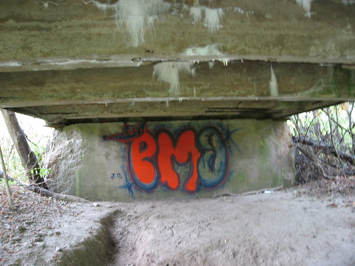
Someone started a farily elaborate, if somewhat pedestrian, attempt at tagging under the bridge on the western abutment... and ran out of dayglow orange.
I thought the combination of reflections, shadows, and colours here was beautiful, and I'm glad the camera captured it so ably.
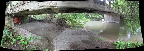
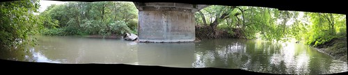
A panoramic view of the underside of the bridge and the Humber River as it flows under it, taken from the western bank.
Just after I took the shots that make up this view, I decided to test the water. On Labour Day when P-Doug and I were at Duffy's Lane again, we waded in the Humber but found it too cool for swimming. Oddly enough, when I stepped in Saturday, it was noticably warmer and far more encouraging. So, I figured, what the hell...
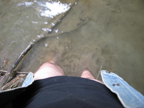
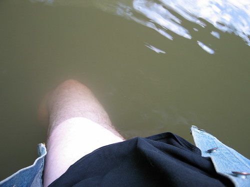
I decided to wade out to the middle of the river, or waist-deep, whichever came first, and take some shots from mid-stream. This is me, still partially clad, stepping out into the Humber.
"Waist-deep" came pretty quickly. I don't think I made it to the half-way point. If I'd stripped completely, I'd probably have gone deeper. But I really only wanted to get a few shots and emerge again, not spend all day. I had no idea what the weather had up its sleeve and I still had slippery climb back up ahead of me. Knowing what I know now, I probably would have lingered longer. Even so... though it looks sunny at this point, it was overcast again only minutes later.
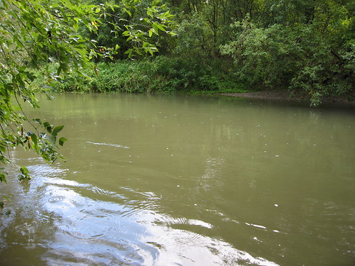
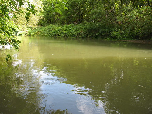
This view looks northward, upstream.
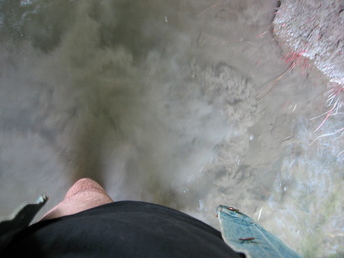
There was a weird dynamic going on. I was trying to inch out as far into the river as quasi-nakedness would allow, while trying not to get my shirt and my jacket wet. Honestly, I don't know what I was thinking.
Doesn't this look almost tropical? Well, this is about as far as I made it, and even then, I was leaning over and holding the camera out at arm's length. Odds are, the river is probably chest-deep at its deepest... and I wasn't (un)dressed for it. :) So this is as good as it gets. But look at that view... it was worth the trip and the whole effort, I think.
This is another panorama of the Humber passing under the bridge, this one taken from within the river. Like the others, it faces eastward, back in the direction I came from. This view looks through a little over 180 degrees; in fact, at the extreme right, you can see the edge of the bank behind me, which should give you some idea of how far out from the bank I actually got.
I was in the water for about five minutes. It was just fine; cool but not cold or uncomfortable. I could easily have spend a half hour relaxing in the water there. Maybe next summer.
In the sand under the bridge. Something for the next visitor to ponder.
When I left the bridge, again, I wasn't sure how far I had to go to reach the other end. And, once again, I found it was just around the bend. The bridge is about equidistant between the wreck of the truck and this, the other end of the Kirby Road closure.
That's another stretch of Kirby Road beyond the fence, which marks the point where Kirby Road is met by Huntington Road, which itself ends not too far north of here, just across a still-open Humber River bridge. This view looks west, and marks the furthest point of my travels that day. From here on, it's all heading back.
Returning to the bridge, and crossing back over it, I took this panorama of it. Oddly enough, this view again faces the same way as the previous views — west, towards Huntington around the bend in the distance. I include this shot because of the extremes of the perspective near the edges. I'm surprised this came out as well as it did. North and upstream are on the right, and I'm standing over the abutment that's visible in most of the cross-Humber shots from under the bridge.
Another weird panorama shot that really shouldn't have worked out, because I was leaning over the side and pointing back at the bridge without being able to line up the shots. But there was enough common ground for AutoStitch to make this rather warped single image. This is the north side of the bridge, with the camera facing west, taken almost precisely half an hour after I was standing down there in the water next to that tree, shooting the "lagoon" view upstream.
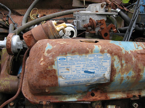
One more crack at the abandoned Ford truck. This sticker on the engine announces, among other things, that the truck is in compliance with emission standards for 1971-model vehicles. That at least ballparks when the truck was built, but doesn't really tell us how long it's been here, or hint at when the road was closed.
Arriving back at the point where I emerged from that long, slippery trail down through the forest, I took a closer look at what looked like an alternate trail, and all at once, it seemed clear to me that this, and not the trail I'd come down, was the course of Kirby Road (and checking the map and aerial shots later confirmed it). This is view up the road, rising from the valley floor. I decided to ascend this way instead of the mudslide!
Part way up there's this gouge so deep in the road that even I, on foot, took it easy so as not to slip. I doubt this was a feature of the road when it was open to traffic, but it only served to confirm to me how much the road's been allowed to deteriorate.

You can see it was a fairly wide road; it probably easily accommodated two cars passing each other. My feeling is that the hillside on the left has eroded somewhat since then and smothered some of the original road clearance.
You can see light from a clearing at the top. At the time I was making my way up, I was thinking, well, jeez, that was easy... why that stupid, slippery, twisty path through the forest?
This view looks back down the track of the road towards the valley floor.
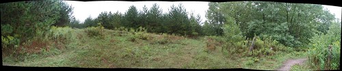
Panoramic view of the approach to the clearing.
It was a little slippery on the way up, but nothing like what I would have faced following the trail I took down into the valley. I though this was a much better route and I couldn't imagine why it had been abandoned.
Then I reached the "clearing" at the "top" of the hill...
"Ohhhh yeaaaah...."
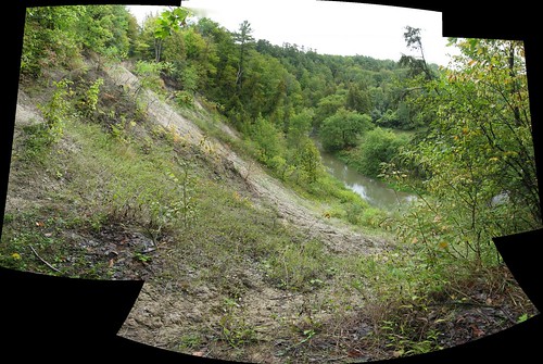
It's not easy to tell, but what you're looking at here is a landslide, running for about 50 feet clear across the road course of Kirby Road. Well, not so much across as out from under. See that little notch of sky at the upper left? That's Kirby Road. So is all that nothing, empty air between that spot and where I'm standing.
Well, this view answered a whole lot of questions, at least potentially. Like "what's that big white spot on the aerial photos?" and "why did they close Kirby Road between Huntington Road and the residences above the valley?" and "what's with that stupid alternate path through the forest anyway?" I really don't know if this landslide occurred before or after they closed the road, but it would sure explain the closure if it happend before, or re-enforce it if it happened after.
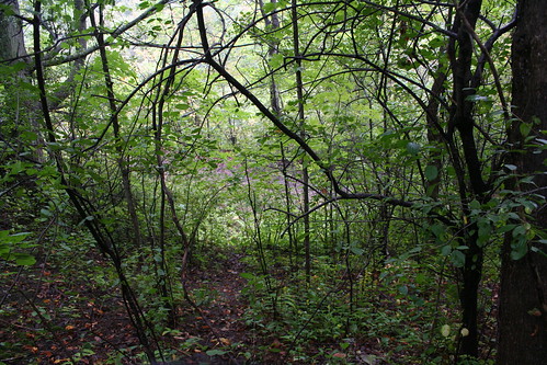
This left me with a hard choice. It was slippery and wet, and the trail linking the two discontinuous parts of Kirby Road looked iffy at the best of times. You can't really tell, but that's a hell of a drop I'm standing over. So, it was either trot back down to the valley floor and all the way up mudslide alley again, or... head up into the woods out of frame to the left. The footholds looked good and there were plenty of trees to hold onto, so I opted for the latter.
I paused part way up the hillside to shoot back at Kirby Road (it's the grey stuff between the trees at the centre of the shot). Even in two dimensions, I think this view nicely demonstrates how steep a climb this was. In fact, I took this with the XT because it was around my neck, while the S80 was tucked into my pocket out of harm's way.
The climb up the hillside brought me out near the end of this stand of precisely-planted evergreens, with the new trail running up the middle. I had to come this heading down to the valley, but the shots on the return are superior. Now that I come to think of it, unless this road was cut through the trees, it might provide some rough idea of when the path was forged (based on the age of the trees, I'd guess a decade or two), which hints at when Kirby Road was closed. Merest speculation on my part, of course.
Heading back towards the east-end closure. This is not far from where the new trail splits off from the track of Kirby Road, just ahead around the bend. At the time I took this shot, I was about tne minutes away from where I parked.
Last time P-Doug and I were wading in the Humber, we encountered the same problem we always did: you're "clean" till that last step, when you take a pound of Humber River silt and mud out with your last step, without the river water washing it away. He said we ought to bring an old water bottle and fill it with Humber water to wash our feet off. I said, hey, I've got that beat, I keep a spray bottle and a cloth in my car. Well, this is me putting it into effect before taking off. You don't make a hobby of hiking barefoot without picking up a few practical ideas along the way. :)
So, there you go, P-Doug et al. Two hours and at least as many miles trekking barefoot through the forests, rivers, and valleys, and none the worse for wear; clean-up is a breeze. Those Hobbits might be shrimps but they've got the right idea. :)
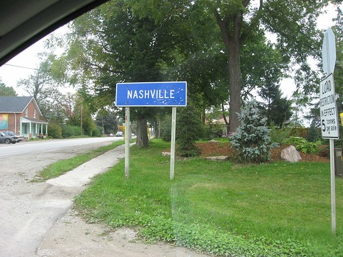
About a week after the previous shots I went back again. This sign is at the corner of Nashville Road and Huntington Road. It announces, as you might guess, the hamlet of Nashville. It's not quite as big as its more famous southern namesake, but... y'know... maybe someday. :)
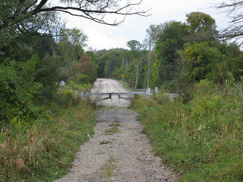
This time I parked at the Huntington Road end of Kirby. This view is from just inside the traffic barrier, looking east towards the bridge.
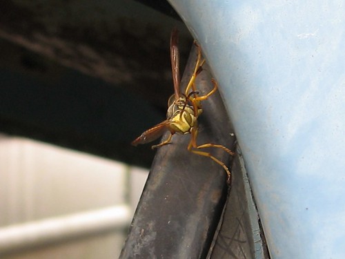
I crossed the bridge and went back to the abandoned Ford truck I found to play a joke. I noticed a lot of hornets had moved into the steelwork I hadn't noticed the week before. This one actually seemed interested in me, but in a way that didn't seem threatening or hostile. Just curious. But it does kind of look like a homeowner opening the door to a salesman. Too bad I didn't have my Fuller Brushes with me.
My bad. :)
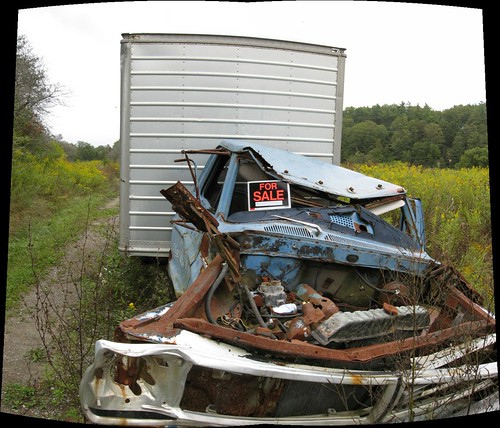
I thought this would be funny, so I drove back out and put a "For Sale" sign on the wrecked truck on abandoned Kirby Road. Call me crazy; I think it's a smile.
Came back 90 minutes later and it was gone. I noticed another car parked by mine while I was exploring. Can you believe this? The first guy who comes along and sees the joke ruins it for everyone else. Sign could have sat their for years, slowly fading, getting funnier and funnier for passers-by, but no... some fuckheaded douchebag has to go and ruin it before a single meal passes. Fuck, that makes me mad. >:(
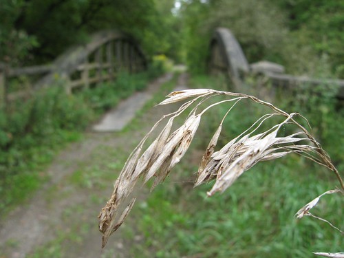
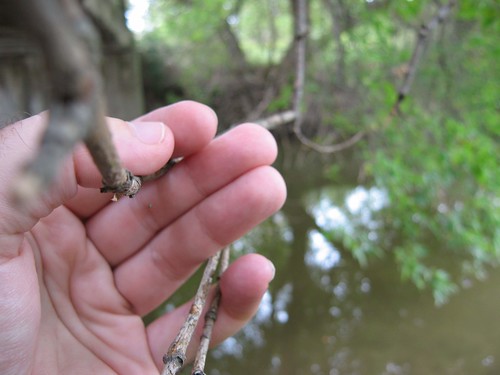
This is McEwen Bridge on Kirby Road in soft focus behind... okay, this crappy stalk was the best I could do. :)
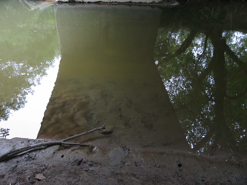
Another look at the reflections in the water under the bridge.
Standing on the west bank of the Humber River, holding the very end of a limb of that tree on the east bank, clear across. In a few more springs, that tree's going to drop right into the river, I think.
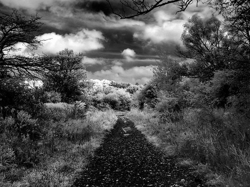
I came back again for a third time the next day, this time with P-Doug. I wanted to show him the bridge. We parked at the Huntington Road end of Kirby Road and this is an infrared HDR shot of the road heading towards the bridge.
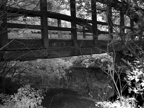
Heading under McEwen Bridge to the Humber, this time in infrared. While I was under the bridge, I ended up speaking with a passer-by who was of either Russian or Ukranian origin. He told me that four or five years before, he'd been driving on this very road, and found a stray kitten there that he'd taken home and still had. His family had named the cat "Kirby" after the road, but the name had since been Russified into something I don't quite remember now. He told me that the washout at the top of the hill had happened subsequently, so if his memory is correct, the road has only been out of commission for well under a decade.
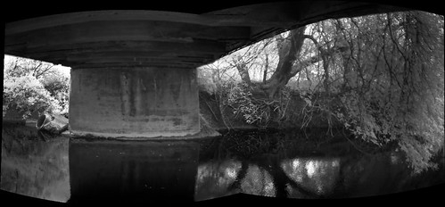
This is a panorama under the bridge made of two HDR shots, each composed of three infrared AEB spreads.

Someone had been sitting under the bridge recently. There are a few beer bottles under the bridge; at least one new one that hadn't been there the day before. Saturday night, musta been a party. :)
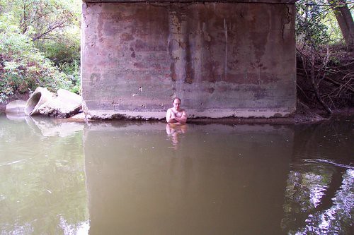
I figured, what the hell. :)
We were wondering how deep the river was here. And I'm always looking for any excuse. :) So, in I went. It took me about two minutes to make it to the far abutment, but I made it. At one point about a yard further out, the water was even deeper, but at the far side, about four feet, I'd say. This shot was actually taken by P-Doug using his Kodak DC4800, a camera that was previously mine. He's graciously agreed to let me post the shot here.
And yes, when I reached the other side, we both (again) invoked the George Armstrong Custer line, "This is how deep it is, General." :)
No comments:
Post a Comment