


Well, this summer I’ve done more than my usual share of lost bridge exploration. This is the kind of thing I love, but I didn’t really know why. I’ve long been an aficionado of closed roads for the romance of what were once well-travelled public places, surrendered back to the nature out of which they were once cut; there’s something humbling about that. But bridges are different. They tend to persist much longer than mere lines of asphalt between fields and trees. They’re a much more tenable symbol of human intent and ability. A chunk of asphalt in a clearing can be evocative of a former human presence. But coming across a span of stone, or better yet of iron, across a river, is a thrilling and even eerie sensation. There’s a power to a bridge that transcends simple engineering and utility. A bridge is not just an artifact, it’s a presence. To observe one alone in nature is almost to feel as though you are being observed in return; something like with the Monolith in the movies 2001 and 2010.
And so this summer was so often about seeking them out; the lost, or soon to be lost, examples of what we’ve wrought. Unfortunately, for all my ground work, I’ve done little enough about recording my impressions and putting them up here for my own memory, and for the interests of others. Aside from the Gorewood Road bridge, I’ve completely neglected this chore. So now, in one fell swoop, I’d like to correct that.
I don’t know much about his bridge except that it predates the 1950s, because I discovered it in a photograph taken by James Salmon in the 50s. At that time it was still a going concern and you can see a building at the far end of the bridge in the shot. From what I’ve seen in contemporary aerial photos, this bridge didn’t really go anywhere except to what appears to have been a quarry on the far side of the river. In the field on the near side was an elaborate set of outbuildings that were probably for processing whatever it was that came from the quarry. That’s just a guess, of course. I had assumed the road must have connected to Pottery Road at one time, the only major road to come down into the valley on the west side back then, but there’s no evidence I’ve found that it ever did.
The road still leads to the bridge and amazingly, you can still drive down into the valley on it, although not much further than that. The rest of the way to the bridge has to be undertaken on foot; a very pleasant walk of about a half a mile. The area is still well-used by strollers and bicyclists, and crisscrossed by rail lines, some still in daily use, others forgotten to the point of having been removed.
The bridge itself is fairly modern design; built entirely of steel and formerly road-surfaced in cement (I think). I’ve been under the bridge, which was a little tricky but manageable, and it’s holding up extremely well, for all the years and floods it’s seen. The aerial photo I have shows a bridge in this spot in 1953; if it is indeed the same bridge, then it’s one of the few hardy enough to have survived Hurricane Hazel in 1954 intact and undamaged enough to stay in business to the present day.
These shots date from on and around Canada Day, 2010.


Sneath Road is a little suburban street in Bolton that crosses the Humber River. The bridge is one of the vanishing breed of one-lane pony truss bridges that once proliferated in the rural fringe around Ontario’s cities, but began vanishing in favour of more ambitious replacements in the late 1950s and wholesale by the 1960s. There aren’t many left in existence and far fewer still in operation. Sneath Road bridge was an exception to both rules until very recently; it was closed to vehicular and pedestrian traffic at the beginning of October, 2007. Our visit there made it self-evident that pedestrians have, willy-nilly, reassumed the use of the bridge, but it remains closed to cars. Even more recently, local residents have fought off a proposal to remove the bridge and/or replace it. So it looks like this rare pony truss will persist for some time to come, and motorists will simply have to find another way. :)


This find was accidental. I was enjoying a park on Bronte Creek with a friend several weeks ago and we noticed the bridge. I waded out into the creek and down to the bridge. We noticed old abutments there and I assumed these were from a former bridge there that had recently been replaced. But when I went looking for the story of it all, I discovered that this had long been a gap in the road system and that the Rebecca Street bridge was only built just after the start of the current century. There’s no mention I can find of a previous span, even one torn out by Hurricane Hazel. So this is a mystery I haven’t solved yet... what, then, are these paired abutments on either side of the river?


Sept. 20, 2010 – I've actually stumbled across the answer in the meantime. It turns out that the abutments were part of a bridge built for the Hamilton Radial Electric Railway. It was built in 1905, went into service in 1906, and was taken out of service in 1925. The site I found the information on showed the route, and it did indeed follow what is now Rebecca Street. I don't know when the bridge was torn down, but while it stood, it looked like this (photo from the Milton Historical Society):

This one-lane, wooden-plank bridge carries 16th Avenue traffic back and forth over the Little Rouge between Reesor Road and York-Durham Line, and I know for a fact it’s for the chop. At some time in the next 10-15 years, if not sooner, this bridge will be removed, and the course of 16th Avenue changed to eliminate the dogleg at Reesor Road. The road will be widened at the same time, and in all likelihood, suburbia, which already exists walking distance to the west, will overflow the fields shortly thereafter. For the moment, it’s a strange, noisy little bridge in the field that cars already cross with surprising frequency. It took some doing to get down there to get the under shots, including being bitten on the neck by a big spider whose web I busted up crossing the field.


Sept. 20, 2010 — Also, I'm wrong: I found a document that points out that while they will be rerouting 16th Avenue, possibly saving this bridge on request of Rouge Park's administration, they won't be widening 16th Avenue. It's going to remain two lanes east of Donald Cousens Parkway.
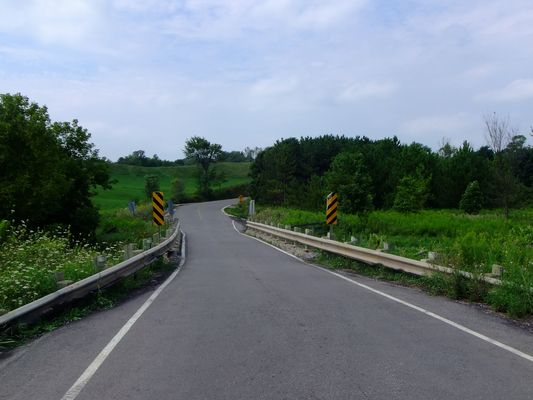
This little one-laner over the East Humber might be around for a while yet. It’s still pretty isolated from suburbia, and it’s in a river valley that might wind up slated for conservation purposes, which would limit the access to it. It’s also on a weird diversion from King-Vaughan Road’s natural right-of-way that, if the road is ever improved, might see this bridge survive by being totally bypassed. It’s hard to say. Oddly enough, all the wear on this bridge seems to be on the side away from the flow of the river, which is contra-intuitive to me.


At one time, Kirkham’s Road was the name for what’s now Meadowvale Road, skirting the east side of the Toronto Zoo since circa 1975. Now only a little bit of the road still has its original name. In the area where it crosses the Rouge River, it’s had a wild history of course changes since the 1950s. In order aerial shots, it’s clear that an even older bridge was once there, a bit to the west of where the current one, built in the mid-to-late 50s, exists today. The bridge, along with its southern connection to Meadowvale Road, was closed as structurally unsound in 2005. Its fate is still undecided but it looks to me like, before too long, it will be torn down, and the water main it carries will be put under the Rouge. So, I thought I’d get down there and photograph the bridge and the closed part of the road while it was still possible. It’s surprising how quickly and aggressively nature has begun to reclaim that stretch after just five years of disuse.


6 comments:
I am totally digging the Beechwood Drive bridge. That's a narrow one even for a one-laner. Clearly it continues to get some love, evidenced by the fresh deck.
The latticework on the Sneath Road bridge is unusually tall, at least in my experience. Too bad some of it appears to be missing.
I'm puzzled over the Rebecca Street abutments, too. That would have been one seriously low bridge. Does that creek flood? Is it navigable/does it carry any ship/boat traffic? If the answer to both is no, then maybe I can understand these little abutments.
It will be a shame to lose the 16th Ave. bridge. That's such an unusual pony truss design. I've never seen anything like it. I wonder if it can be dismantled and reassembled elsewhere, such as for pedestrian use. I wonder if it's possible to find out something about its design and whether others like it still exist -- if not, I wonder if it's possible for it to be spared as a civil engineering landmark or something like that. We do that in Indiana from time to time, save the last or near-last example of a particular design of a thing.
Could the King-Vaughan Road bridge originally have had concrete railings rather than the current steel guardrails?
The Kirkham's Road photos are my favorite of them all. Abandoned road, abandoned bridge, does it get any better than that?
Hi, Jim. :) Yeah, Beechwood Drive's bridge is now used by pedestrians in the Don Valley to get back and forth between parking lots at either end. I suppose that's why it's been kept up so well. It's a sturdy thing; there's no decay on it at all that I could see. I'm wondering if it's cast iron instead of steel.
I'm not sure if Twelve Mile Creek counts as navigable... I have my doubts, since I was able to walk in it and Rebecca Street is probably less than a mile from Lake Ontario. I know that Sixteen Mile Creek (four miles east, as you might guess) is definitely navigable for some distance and is under federal jurisdiction as such.
I think they might save the 16th Avenue bridge. That bridge is actually a Bailey bridge; I'm surprised how many of them there are in the Toronto area and how many are actually in use (one I know well is the one that carries Finch Avenue vehicular traffic over the Rouge River). Being one of several might not save it, but apparently there are a few interesting features about it (they didn't say what, exactly, in what I read) that might make York Region keep it around for pedestrians, especially since subdivisions are now a fifteen minute walk from that spot.
I don't know much about the King-Vaughan Road bridge except that I like little rural one-laners. :) Never seen a photo of it I didn't take. It wouldn't surprise me, though, if it's been reworked at some point, because it's pretty clear it hasn't been replaced; at least not very recently!
Kirkham's Road is great. The aerial shots at got at the City Archives tell a story of remarkable change to that road since the 50s. I hope to write something about that, with illustrations, soon. :)
As far as I can find, the bridge at Beechwood is a replacement. It seems that the original was lost during the floods that accompanied the coming of Hurricane Hazel.
Dan
Toronto, Ont.
Hi, Dan,
No, I don't think so; I'm virtually certain this is the same bridge, and James Salmon took the upper picture in 1953, most of a year before Hurricane Hazel...
http://www.flickr.com/photos/loneprimate/4756970883/
I believe Beechwood Drive was the road to the Don Valley Paper Mill - later Domtar - not a quarry. I don't think it ever connected to Pottery Road.
http://maps.library.utoronto.ca/dvhmp/don-valley-paper.html
Wow seeing the pics of the old Beechwood bridge bring back memories. The new structure doesn't compare. Shame they replaced it.
Post a Comment