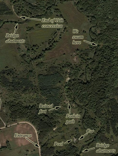
We parked up on Cold Creek Road and trekked down the the narrow gravel road into the valley. The gravel was rounded and at one point P-Doug slipped on it and scraped his left knee and shin. But it didn't seem to hold him back any as we started our explorations...
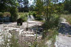
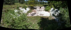
The first thing we encounted was a large swimming pool. You can see from the trees growing out of it that it's been abandoned now for decades. The side weren't straight; they sloped inwards. P-Doug noticed the pool had no liner, so must have been an early, leaky model inground pool. He also noticed it was trimmed in a colour of sea green popular in the late 50s and early 60s. There was a lifeguard tower dumped into the pool, as well as, of all things, an oven.
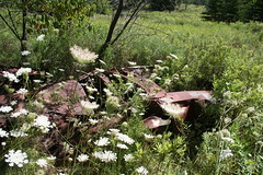
We came across a badly ruined car. P-Doug guessed it to be an AMC model of some kind, probably from the 1970s. It was a hideous metallic green — the parts of it that were still painted, that is.
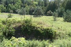
A bridge once crossed the Humber here. It was probably a farmer's bridge, continued in use by the campgrounds (assuming that's what this place was). In this shot, I'm standing on one abutment, looking across at the other.

This is an infrared panorama of the Humber River. The bridge abutments are at centre-right.
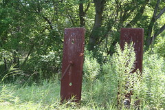
We're not quite sure what these are. They're firmly cemented into the ground. P-Doug took a guess that they were the anchors for some sort of cable suspension bridge on the Humber. Given how close it is to the other bridge, I have my doubts, but I'm hard-pressed to guess, just based on this, what they might have been for if not that.
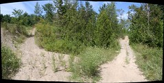
Following along the path, we came to fork. We headed up the left branch. As it turns out, we came back via the right.
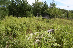
At the top of the hill, we found this large wooden structure that had utterly collapsed. It even had pointed palisades. What was this? It reminded us both of The Forest Rangers, a popular show on Canadian TV in the 60s and 70s. As a matter of fact, the show was filmed somewhere quite nearby, just north of Kleinburg, in the Humber River valley.

To the north was a large open field. P-Doug felt pretty sure it had once been a farmer's field, and he felt for the farm family that had to clear it; he remarked that he was glad they weren't around to see nature reclaiming all their hard work.
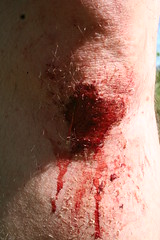
By the time we were at the farmer's field, we'd been at it about an hour and a half. P-Doug's knee was beginning to scab over, and he indulged me in this sensationalist shot.
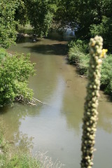
Heading back, we found ourselves at the top of a rise. Looking down, we saw this beautiful vision of the Humber below us. That was pretty much we we decided most of the balance of the afternoon would be devoted to soaking in the river. So, we doubled back and crept along the bank, which on our side was cut sharp and deep, till we found a managable approach.
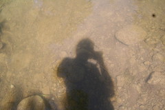
This is a shot of my shadow as I stand in the Humber. Actually, this is well over an hour after we started swimming. I suddenly got the urge to take some shots of the location, though it was risky to the cameras involved. But I'm glad I did!
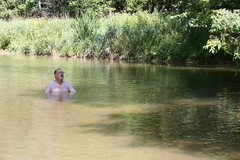
P-Doug in the distance, sat in the Humber near the bend where we just sat back in the beautiful water, chatting across the river from opposite banks.
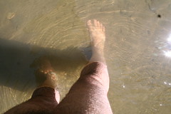
Me, standing in the shallows.
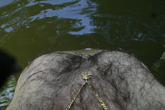
Me, standing in the deepest part; came right up to my nipples. P-Doug was wondering how deep it was, so in spite of the fact I was carrying my Rebel XT, I waded in to show him. I quoted George Armstrong Custer, who once rode his horse into a river to answer the same question: "This is how deep it is, general."
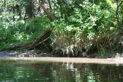
The sunbeam marks the spot where I sat chest-deep in the water on smooth rocks for over an hour, feeling the cool water rush by and the warm summer sun on my back.
P-Doug suggested I take a 360-degree panorama and put it together with AutoStitch when I got home. I did, and here it is. I suggest you click on this one to actually see it.
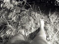
After a bit, I took my XT back to where we'd stripped; I asked P-Doug if he wanted his DC4800. He did, so I brought that back to him. Then I realized I should have brought my G1 too, to take infrared shots. So, back I went for a third time. This is an infrared shot of me about to step back into the Humber from the landing where we left our clothes.
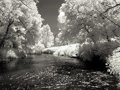
Looking downstream from the landing, taken from a few yards out in the river.
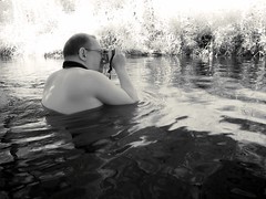
Who will watch the watcher? Well, me. Here's P-Doug in infrared, shooting the north bank in colour.
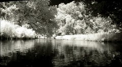
Looking upstream to the bend; a huge heron came out of the trees and glided along the river earlier, when, unfortunately, I was not armed with my camera. Oddly enough, I believe I accidentally filmed the same bird upstream a couple of hours later with my S80.
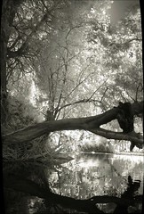
Overhanging tree. Looks like a great place to dive from. I didn't try. :)
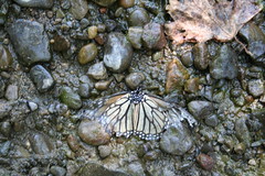
On our way back, we crossed a little stream where this poor butterfly was upside down. Its wings were damaged. P-Doug lifted it from the water and put it on a tall blade of grass. I don't know what became of it, but hopefully it was better than slowly drowning.
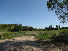
We got in the car and drove a five minutes into Bolton, where we bought something to drink and tried to use what seemed to be the on payphone in town... which was inside the locked door of a closed donut shop. After that, we decided to investigate one more location — a missing bridge at the end of the 11th Concession, which is in a straight line with Cold Creek Road, where we parked earlier and where the trail we took begins. This view looks south where the traffic-accessible part of the 11th Concession ends.
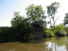
A bit further down and around a curve, you find yourself back at the Humber. Off to our right, we spotted the abutments of an old, now demolished, bridge. I stepped into the river and left P-Doug on the north bank, wading in to get a better look. This is the abutment on the south side.
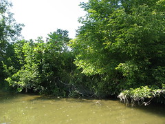
This is the abutment on the north side, the side from which we'd come. The water here was fairly deep; it was dampening the cuffs of my shorts.

I forded the river and climbed the hill on the south side to the south abutment, where I made this panorama of the view over the south abutment, looking north across the Humber.
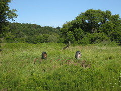
Just downstream, east from the abutment, was this abandoned piece of farm equipment.
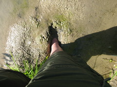
Crossing back, I stepped into the river and immediately sank about 6" into the mud. I was glad I was barefoot; sneakers would never have come clean, and even my sandals have deep grooves in them that would have drank the silt and been a bugger to clean. As it was, the mud was completely off my skin before I was done fording to the north side.

A 180-degree panorama of the Humber, north at centre, with P-Doug waiting for me on the far side. I was standing a couple of yards out int ot the river when I took this. At this part of the river, the water's only about a foot deep, but it's strewn with rocks.
There are other things I still want to see, and I wouldn't mind setting back in the Humber again here. I hope we'll return.


4 comments:
That knee looks pretty bad, and walking through the mud there, ewwww! But everything else, wow, looks great! What a blast!
Oh gosh, that looked like the perfect summer adventure! How cool!
It was great; I'd like to reprise it. :)
As for walking in the mud... consider it a form of sex, with the yielding flesh of the world. ;)
Hi, I've seen your interesting comments at Laura's blog, and today I decided to go further, so this is my first time visiting your blog page. I have to say I like how descriptive you are in your stories and I also like the photos! Nice.
Post a Comment