


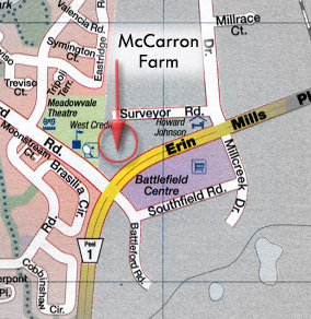
McCarron farm location on (closed) Fifth Line, MapArt
This is the other end of the closed section of Fifth Line, about a mile south of the section above that’s now vanished into a parking lot. It’s just north of spot where Erin Mills Parkway (once Fifth Line) suddenly heads northeast to link up with Mississauga Road. The old road surface is closed, and the clearance east and west of the centre line has been sold off the adjacent properties: to the west, a high school built in the 80s, and to the east, a small, 10-acre section of property that was once a little farm. Last time I checked, in the mid-90s, it was actually still zoned agricultural. People lived here until 1974. The road was closed, and the house was torn down.

City of Toronto Archives, 1967, plate 157 detail
In the image above, taken in 1967, the McCarron farm property (then inhabited by a couple named Shortell) is the treelined square just to the upper left of centre. North is at the top. To the west (left) is the Nixon farm. Between them is Fifth Line West, a section closed since the 1980s. To the east is the Canadian Pacific Railway. The fence in the views following is smack in the middle of the road allowance, and end at the upper left of the property. Surveyor Road runs along the north side of the property, from Millcreek Drive, which runs today roughly northwest about half way between the property and the CPR line.
In 1877, a map of Peel County (today Peel Region) shows this property. It belonged to a certain Owen McCarron. I discovered the place in 1990, when the whole story of the road closure was just coming to my attention.
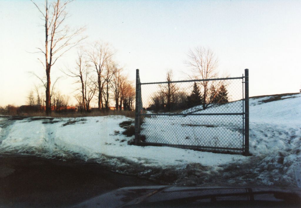
Fence, circa 1990
Fence, Feb. 1999

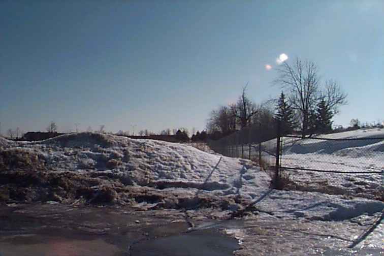
Fence, Feb. 2002

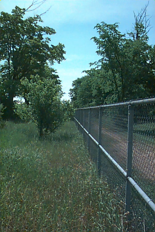
Fence, June 2005
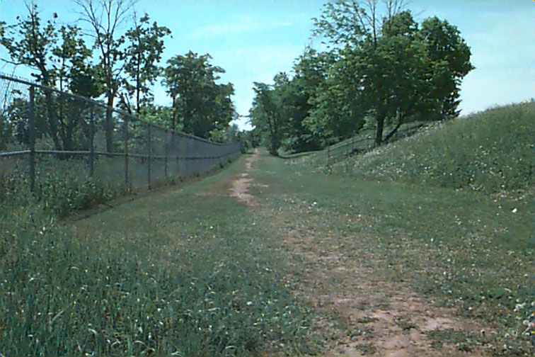
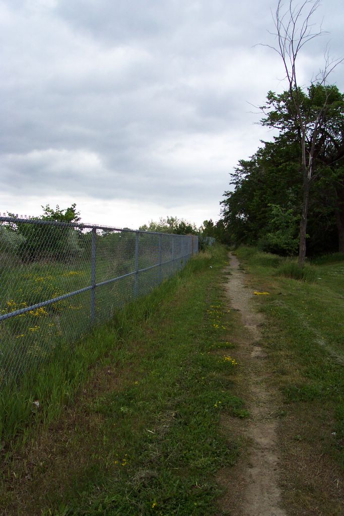
Back then, there was a new fence that had only recently been put up between the properties, down what had once been the middle of the road. One either side, tall trees stood in long, wind-shielding lines. The whole 10-acre property, in fact, was lined with trees on all sides. You can see the trees that lined both side in the earlier shots. The ones on the McCarron property were cut down in the late 90s. Back then, the property was not so wild. It was easy to move around in it, and I found the foundations of the house that once stood there. There was something like a root cellar, and it was clearly used by teenagers as a hangout to drink. I made a panorama of shots I took there in the mid-90s, and you can see the place was attractive.
More recently, the fence has suffered from repeated snow loads (it’s at the of Surveyor Drive, so snowplows dump tons of snow there every winter). There are posted plans to build a warehouse on the property, but so far, nothing’s been done. The property is increasingly overgrown; I found it far too much trouble when I was there on the weekend to make my way to the house foundations, even if I could have remembered exactly where they were.
Interestingly, in the late 90s, I was briefly in touch with a young woman who was the grandchild of the people who owned the farm and home just the other side of the road from here (on what’s now the land of the high school). The family name was Nixon, and they inhabited their home there till the 1970s as well, when the city closed off this section of Fifth Line.
Looking south, 1997 or 1998
Looking south again, 1997 or 1998

Looking south, 2005
Looking further south, 2005

Panorama, 1997 or 1998

Panorama, 2005

Property foundations, 2002
No comments:
Post a Comment